
After a great week in Vancouver we were ready to make some distance towards our northern goal of Ketchikan.
Skipper’s Diatribe
Our first stop off the dock from Fisherman’s Wharf was the fuel dock at the Burrard Bridge Civic Marina. The dock was short, and could really only accommodate one large cruising boat at a time. We held station under the bridge for a while waiting for a power yacht to move off after fueling up. We replaced 35 gallons of diesel in the tanks after the first leg of our trip from Bellingham.

As we were starting our journey on a Tuesday, I was doing more laptop driving than helming Perception. Grace took her out of False Creek and picked a path through the labyrinth of tankers waiting in English Bay to unload. We hit relatively uncomfortable swell with wind on our nose, and had to cut speed down to 5 kts to keep from pounding.
Over the course of the day our comfort increased as the wind and swell eased. We ran on a single engine to save fuel – we can do about 80% speed with 50% fuel consumption in this mode. This is perfect when we are wanting to go slow due to wave state anyways. We have plenty of time to be efficient – no real commitments other than our reservation in Haida Gwaii at the start of July.
The trip that day was relatively uneventful other than spotting a humpback near Popham Island. We arrived outside Smuggler Cove in the late afternoon after a sunny day on the water.
The entrance to the cove felt tight with shoals keeping us close to the sheer side of Isle Capri. Not much to worry about with light winds, and we were soon rewarded with the cove opening ahead of us.
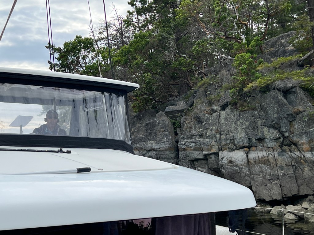

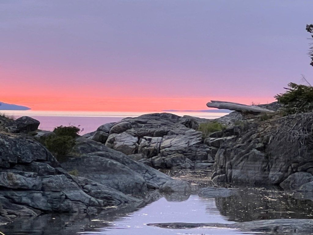
There were several other boats already in the cove, including a sailboat that had entered just ahead of us. This boat was maneuvering where I had hoped to drop anchor, so I settled for a spot nearer the entrance. In hindsight it was happy circumstance as the view of the sunset out into Welcome Passage was superior from our serendipitous location.
Smuggler Cove was rife with stern tie loops and chains installed by the Canadian Park Service. This is a very nice convenience for boaters like us as we can pull ourselves back from our anchors toward the shore, snugly held in place for the night without worrying about swinging into shore or another boat. The cove felt sparsely populated at our stay, but can apparently fill to capacity in the summer months.
After dinner the three of us piled into Ghost for an oar-driven dinghy ride around the cove. We laughed at the harbor seal following us with his heavy breathing, or “snorffeling” as we like to call it.
Wednesday dawned with more of the same (MOTS) – sunny skies and light winds on our nose. Finding the conditions so, we continued motoring northwards.
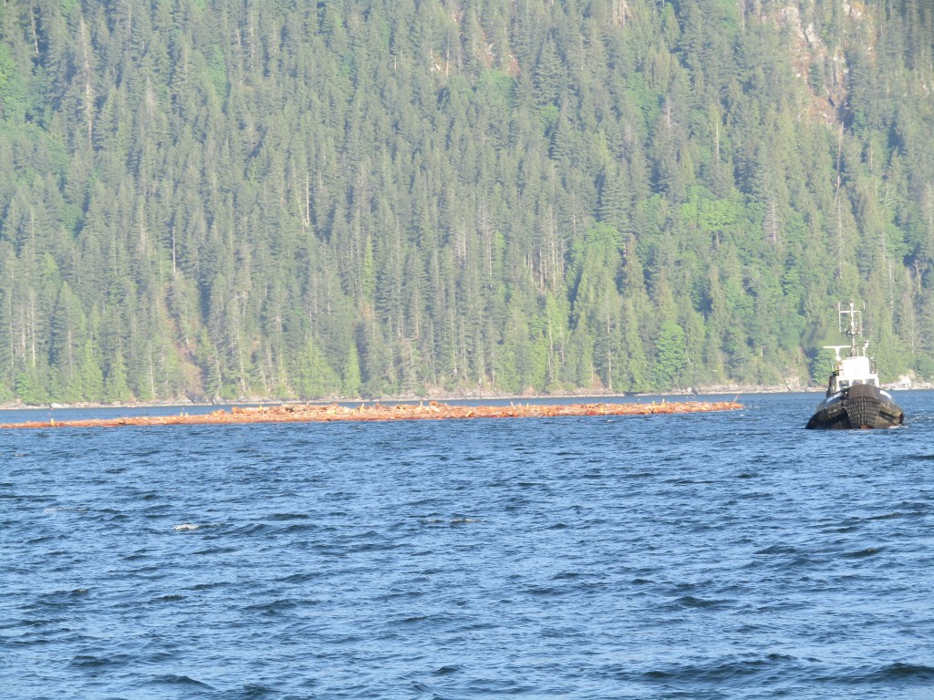
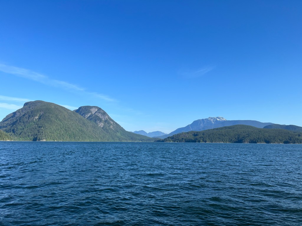
It was a long day of motoring up the Malaspina Strait passing between Texada Island and the mainland. We passed by an industrial-looking Powell River on the coast. I had originally planned to stop for the night at the Copeland Islands, hoping to find an unoccupied anchorage within the group. We had more daylight ahead of us so pushed up Thulin Passage past the Copelands, going another 8 nm to Squirrel Cove on Cortes Island. The last few miles the wind turned to the southwest as we passed into Desolation Sound, so we put up the jib to catch a bit of a boost as we motored along on one engine.
Thursday would offer a set of challenges for us in the form of passing through several rapids as we made our way from Desolation Sound to Johnstone Strait. We had made such good time up the Sunshine Coast that I was getting behind on my reading about our next steps. I had originally loosely planned on going through the Yuculta Rapids at the transition from ebb to flood in the early afternoon of that day. We would hopefully do this early enough in the cycle that we could also pass through Gillard Passage and Dent Rapids during the same tidal transition. Late Wednesday evening I changed my mind and decided we should pass through on the prior transition from flood to ebb, as our copy of the Douglass guidebook described this as the optimal way to make it through all three rapids in one go.
As a result we pulled up anchor at about 5:15 AM the next morning, and motored up Lewis Channel against the current. We had about 20 nm to go, and about three hours to do it in to arrive ahead of slack in Yuculta.

We saw few other boats out that morning – certainly not the conga line of pleasure boats heading to transit a narrows like we saw in Dodd’s Narrows a few weeks prior. Mostly we saw fishing boats, tugs, and others going about the maritime business of the area.
We were all alone when we arrived about 35 minutes before slack on the Yuculta, predicted to be 8:57AM that morning. It’s always a bit disconcerting to encounter no other fools going through something like Yuculta Rapids – makes me wonder if we are doing something wrong! We picked up speed in the back-eddy along Stuart Island before hitting the flood current coming out of the Yuculta. We fought about 1.5kts of current to get through, with no signs of significant eddies or ripples. We hit Gillard Passage right about at slack, and our wake was the only real disturbance on the surface.
After Gillard Passage we motored on up through Dent Rapids a bit after the turn to ebb, picking up speed through Devil’s Hole. We still saw no significant signs of eddies or ripples at that point in the cycle. All-in-all, an uneventful transit beyond a few float planes buzzing us above Yuculta Rapids. I’d definitely recommend timing things like this for a south-to-north transit.
We continued on to Shoal Bay, and dropped our hook there in about 40 feet of water north of the pier after struggling to find a spot in the east side of the bay. We put down about 130′ of rode, and drug for a bit as a result. We eventually bit in well enough to stay for a few hours.
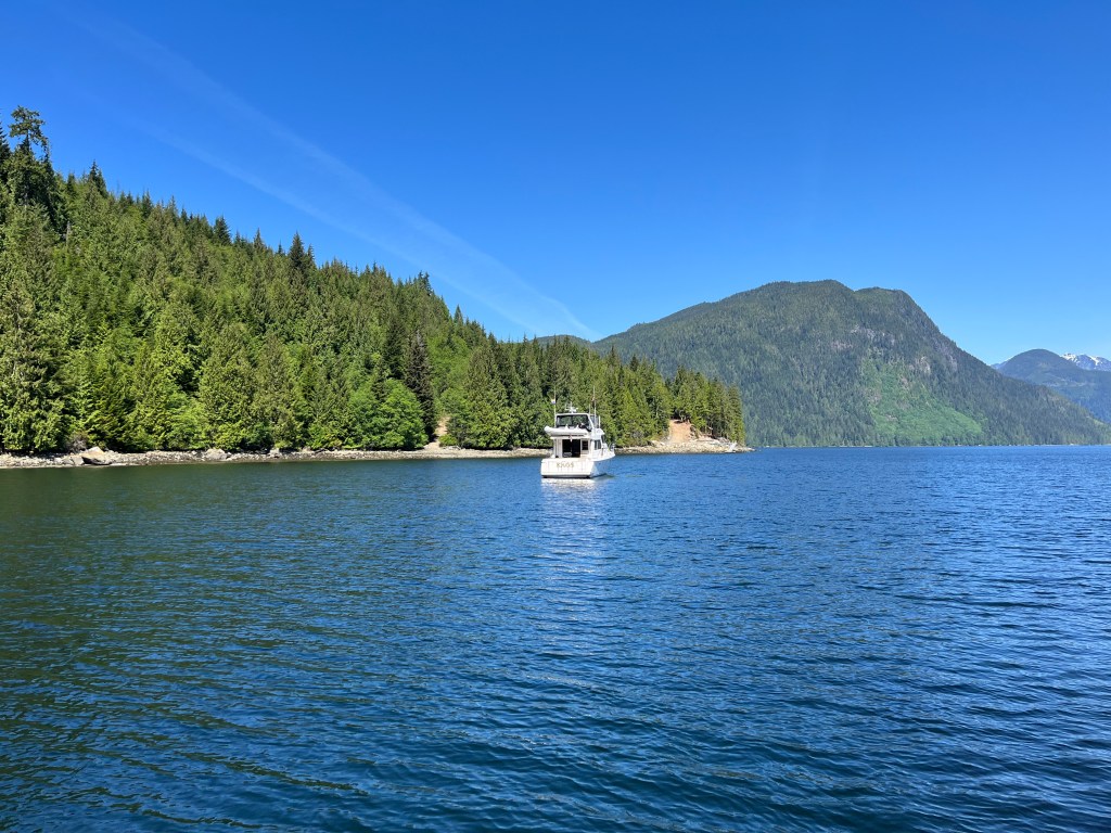
Interestingly we entered the bay just behind Kaos, the boat owned by the writer of the Seabits blog. I’d been an avid reader when deciding to go with Starlink on Perception, a big enabler for us to live this way and keep me employed – not to mention being able to stream “The Mandalorian” while there’s a 25 knot blow pushing the boat around at anchor somewhere north of Vancouver Island.
We pulled anchor about an hour before slack tide at Greene Point Rapids, and shot our fourth set that day. We continued on through Chancellor Channel to Johnstone Strait, reaching Helmcken Island in the late afternoon.
I’d been a bit nervous about finding an open anchorage in Johnstone Strait, and my gamble paid off this time. There was one sailboat in Billygoat Bay, but North Cove was empty. We dropped anchor in North Cove and had the place to ourselves. Grace and I later explored the possibility of a stern tie on shore, finding a derelict boat ashore there. We gave up on the stern tie, but later re-anchored away from the westerly that had come up later in the evening.
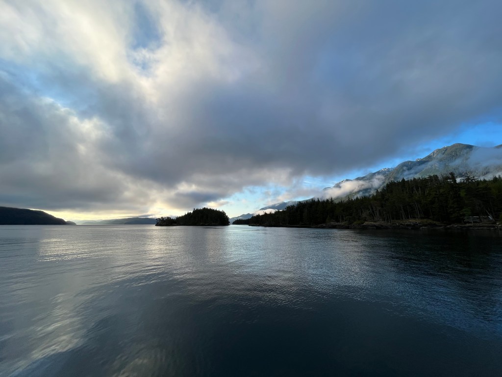
Friday morning presented us with the challenge of heading west up Johnstone Strait. I wanted to wait until my morning meeting ended as well as letting the tide turn to ebb to see if the strait looked bad in that condition. It looked just fine, so we left the snug North Cove for the open strait. Things went just fine in Current Passage, but when we rejoined Race Passage on the west side of Helmcken things got interesting. We hit the nasty ebb current against a westerly wind, generating those steep, choppy waves that everyone warns about. We slowed to a crawl and pushed on up the strait.
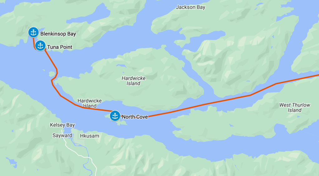
Conditions continued to deteriorate, and we cut our losses by turning into the channel between Yorke Island and Hardwicke Point. This brought immediate relief from the waves, and later from the wind as well. We poked our noses out into Sunderland Channel, and finding conditions much better on that side went on across to Tuna Point Cove.
Tuna Point Cove offered us respite for much of the day, but was relatively rolly with swell coming in off of the strait. Later that afternoon we decided we’d poke our nose out into the strait to test conditions, and either make a bit more progress to the west or just round the corner into Blenkinsop Bay. The tide had shifted to a flood, so if the ebb current had also relaxed a bit to flood, then perhaps the waves would be a bit less rough on us. The winds had come up some during the afternoon, and the station at Fanny Island was now reading winds from the WNW in the 20-25 knot range.
Needless to say, it was still pretty nasty in the strait and we immediately tucked into Blenkinsop Bay. Our new location didn’t seem much of an upgrade. I’d hoped for some protection from the 20+ knot winds now whistling down the Johnstone, but they carried right across Point George and into the harbor. I suspect it may have been an acceleration zone for wind rushing around White Bluff. Regardless the bay was not a good shield for the winds. On the plus side, the swell was reduced and we had a large area in which to anchor and swing. We put out a large scope and settled in for the night with the wind howling through the rigging.
A note on our anchoring that evening. With the winds so high – perhaps 25 knots while anchoring – we actually pulled some rode through the windlass for the first time when we settled back before attaching the bridle. I am normally pulling back with the engines in reverse idle for the initial set, but this time the wind alone was enough to make the chain slip through the gypsy. I had to apply the engines in forward to ease the pressure so Melinda could get the bridle attached safely.
I did monitor the winds during the evening while we were up, and saw a peak of 36.1 knots. This is definitely our personal record for wind speeds at anchor. Thankfully our trusty Rocna held us tight in the mud, drawing a very solid but short arc on my anchor alarm app.
