
The Skipper’s Lesson
After a long night anchored in high winds were anxious to escape the Johnstone Strait and make some headway over the long Memorial Day weekend. We pulled anchor Saturday morning with ambition, but soon found ourselves in a near-disaster situation that taught us a hard lesson about complacency.
Our lesson really started the night before. The wind was high in Blenkinsop Bay, even though it was a westerly wind and we had tucked into the west side of the bay behind the tree-lined shore. The wind whistled around the side of the hill in front of us – we may have been in some kind of natural acceleration zone. The wind was in the 20-30 knot range most of the night, peaking at 36 knots early in the evening. Our anchor held well, but we were sailing around quite a bit on our bridle as our catamaran is wont to do.
The next morning it took a bit of effort to unstick the anchor from the mud after the wind pulled us hard against it all night. We headed south out into the strait and I made the turn west to round Jesse Island outside the entrance.
Shortly after making my first big turn I heard a “whump”, and noticed that the port engine had stalled. I took the engine out of gear, held down the starter, and was relieved that she started up immediately. I tentatively shifted back into forward and the engine stalled once again.
My first thought was that we had wrapped something around the propellor – maybe a crab pot that I hadn’t seen in the early light. As the situation wouldn’t fix itself, I started to turn back into Blenkinsop Bay. I then noticed that my steering was compromised as well. I could turn to starboard, just fine, but was limited to just a few clicks over when turning to port.
As I began my turn back into the bay I picked up the VHF and called a “pan pan” on channel 16. The Canadian Coast Guard replied and asked about our situation and whether or not we needed assistance. My adrenaline came down a bit as I realized we’d be able to limp back into the bay on the starboard engine, so I asked them to stand by. We made it into the relatively sheltered entrance to the bay and were able to set our anchor. It was a huge relief to be safely on the hook once more.
As soon as we were settled the three of us began to investigate our predicament. Standing on the starboard sugar scoop, I could see a line hanging down from the port propellor. I was able to fish it up with our boathook to find…. It was one of our mooring lines! At that point it became clear that the mooring line we leave tied to the pulpit at the port bow was no longer there. None of us had noticed that morning as we weighed anchor. The wind the prior night must have worked it loose over time, and it dropped into the water waiting for a turn to starboard to get pulled under the port hull and wrap into the prop.
The mooring line was now tightly stretched between the bow cleat and the saildrive. I had to cut the line at the cleat to get it off as there was zero wiggle room to play with the bowline under that load. We walked the new bitter end of the line back to the rear of the port hull and considered our options.
The easiest way to get at the line would be to get into the water. Of course none of us was keen on the idea given the low temperature and the ongoing jostling of the boat by the wind and swell wrapping around into the bay. Thankfully my crew is very creative at extracting me from the corners I tend to work myself into, and I didn’t have to risk life and limb under the boat.
We first got out our trusty endoscopic camera. This is a Wi-Fi camera on the end of a 10 meter cable that we pushed down into the water to get video of our saildrive streamed to my phone. We could see the line wrapped around the saildrive, but it was difficult to work the lines free from the sugar scoop. We ended up sticking me in the bow of the dingy, and I surfed behind the port hull with one end of the wrapped line in each hand. In that position I was able to unwrap the line from the saildrive relatively quickly, especially since we have a folding prop that presented minimal resistance to pulling in that direction.
With a shout of joy from all three of us, the line came off and the saildrive was clear. We spend a while longer inspecting the saildrive with the endoscopic camera, making sure the prop looked true and that it easily turned in both directions in gear. We then weighed anchor and took a test run around the bay to make sure there were no ill effects from the wrapping.

Afterwards I also began regularly inspecting the saildrive oil, as it can turn milky if water is intruding past the seals which may happen given the stress the wrapping put on it. Happily I’ve seen no ill effects as yet.
We were extremely lucky that we didn’t damage the saildrive and/or engine. The line also clearly impeded the rudder’s movement as it would have stretched alongside it between the bow cleat and saildrive. Things could have been much worse for us.
In retrospect, I recall our early sailing days of stowing all fenders and lines as soon as we left dock, regardless of whether or not we would dock again in a few hours time. Over the last two years we’ve become complacent about this, tying the mooring lines to the pulpit or lifelines with a larks head to hold them until the next time we hit the dock. We’d also been leaving our fenders alongside the lifelines rather than spending the time to take them down and retie them later – a tripping hazard for sure.
Our friend and sailing mentor Marty O’Toole would kid us about the “toilet paper on our shoe” if we left one of our fenders dragging after leaving the dock. Not much better to leave the mess up on deck. No more for this crew – we’ve learned a lesson about keeping things ship-shape, and we will no longer avoid a little work to keep things safe.
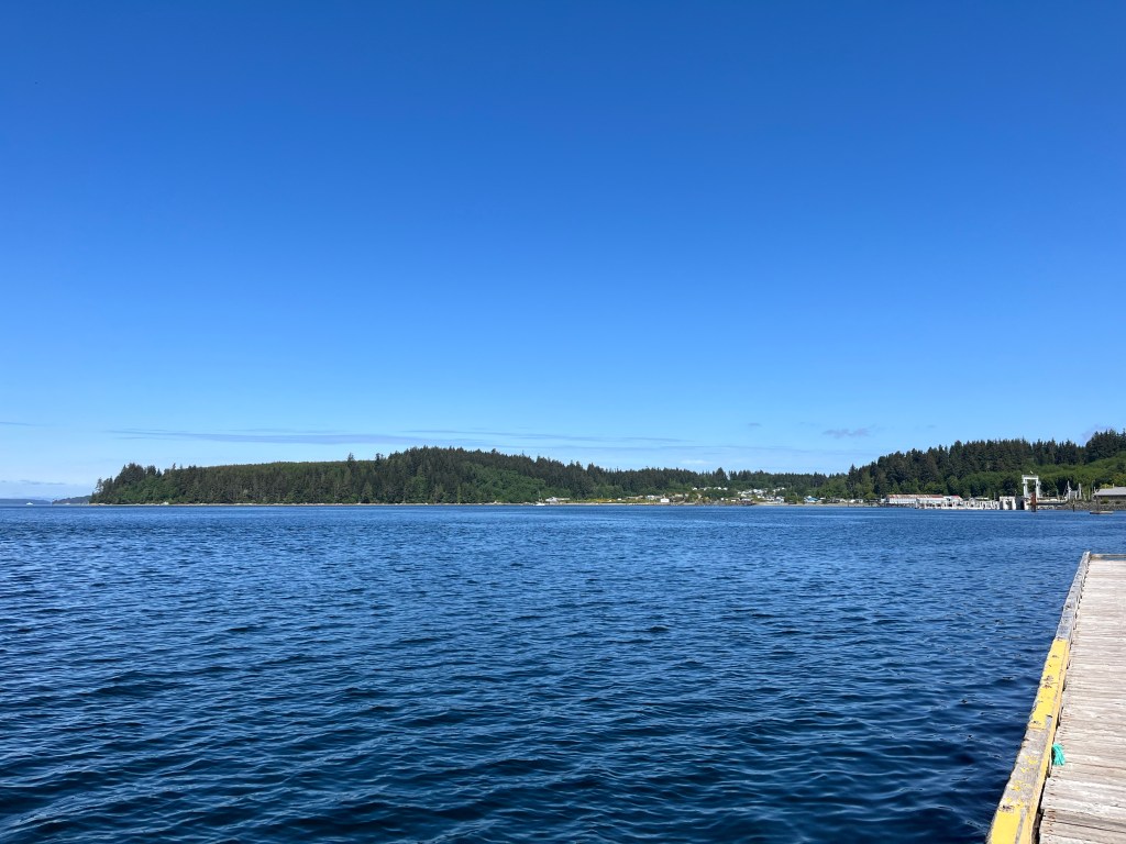
Whew – after all that, we then finally set out that Saturday morning a couple hours later than planned. Johnstone was still pretty bad as we exited the harbor. Even though it should have been running a flood there was still an ebb along the north side of the channel. The ebb west against the westerly wind maintained the nasty chop we’d experienced the day before. Luckily this only lasted for a few miles before the waves in the channel became more manageable for us.
Our bailout plan was to tuck into Port Neville if the chop was too bad. As the conditions were uncomfortable but acceptable, we pressed on, eventually rounding the Broken Islands and escaping Johnstone up the Havannah Channel.
Our timing was coincidentally perfect in getting to the Chatham Channel at slack tide. Ironically we would would have been early if we hadn’t had our mishap that morning. We motored up the channel and out into Knight Inlet.
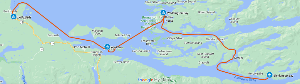
We tucked into the Broughtons turning north from Knight Inlet in front of the Ridge Islets. The black and white of the rock faces on the islets was striking against the green trees topping them.
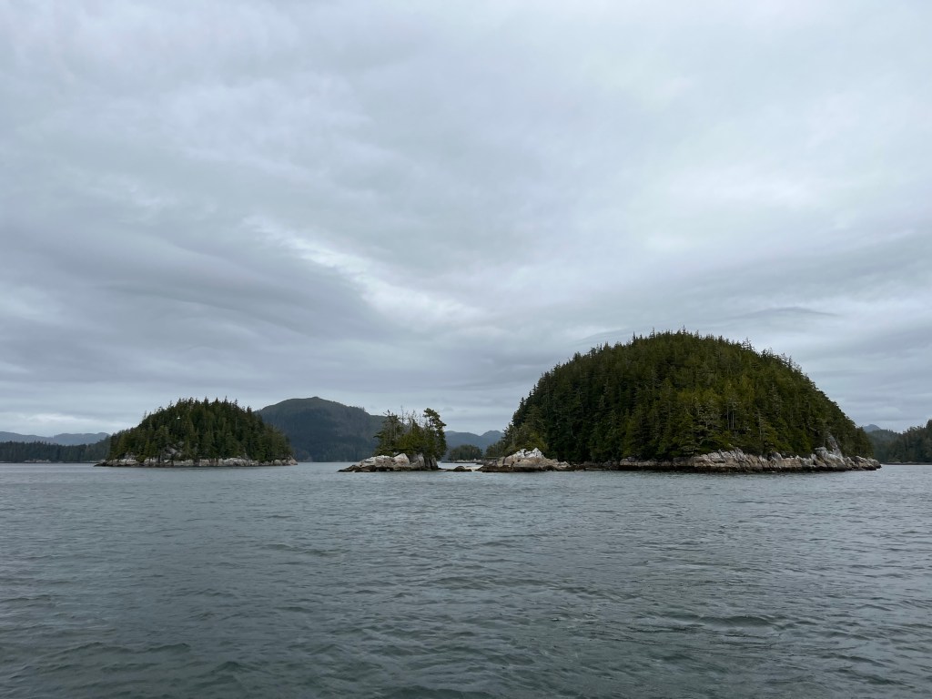
We headed north through the Broughtons past Health Bay, and saw a number of small fishing boats plying their trade in the waters nearby. We were headed to Waddington Bay, as it was stated in the Douglass Guide to be one of the more popular anchorages. I was only mildly worried that others would be there ahead of us since we’d only seen a handful of working boats even in the main passages that day.
Waddington Bay proved to be empty when we arrived, and we pulled back on our anchor in the northeast corner of the bay with plenty of room to swing. It was a peaceful afternoon, and we played with our fishing gear from the back of the boat for a while, not really hoping to catch anything in the shallow muddy bay.
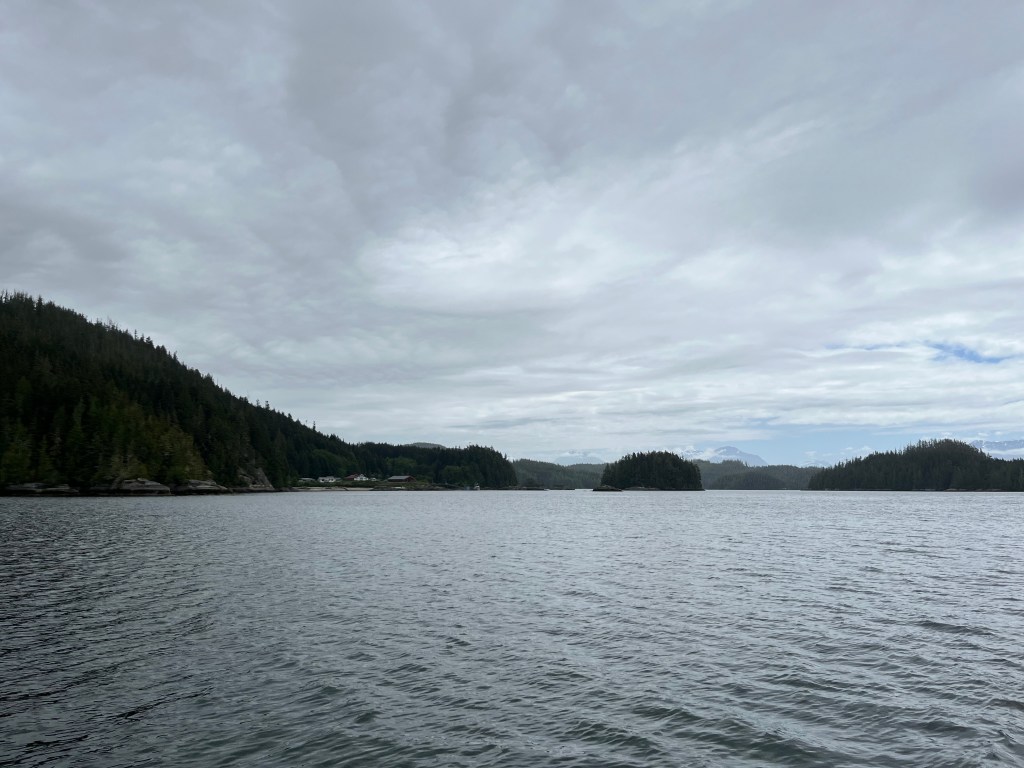
All of a sudden, our peace was intruded upon by a fishing boat that came right up to us in the bay, within maybe 50 feet initially. One of the crew yelled out that they didn’t believe the AIS information that we had a beam of 25 feet, and had to see for themselves. We’re a bit of a curiosity for sure, as you don’t see all that many sailing catamarans this far north.
The fishing boat dropped her hook on the other side of the bay and we didn’t hear anything more from the crew.
The next day we motored southwest to Alert Bay, in hopes of seeing the U’mista Cultural Centre and to have a good lunch ashore. We were stymied on both fronts, as there was a scheduled power outage on the north end of Vancouver Island which included Alert Bay. Much of the island was closed up for the day, including the Cultural Centre and all the restaurants we tried.
Having seen what we could of Alert Bay, we piled back into the dinghy and headed out to Perception, patiently waiting at anchor. As we were early departing due to the power outage, we changed our destination for the day. We’d originally planned to go to Port McNeill, which was relatively close to Alert Bay. There we intended to fuel and provision, staying for a couple days to catch our breath before approaching Cape Caution. Since. were early, we decided to press on a bit further up the coast of Vancouver Island to Port Hardy. This would set us up to take less of a beating getting across Queen Charlotte Strait for the next leg of our journey.
We motored into the wind once again that afternoon, though the sea state was relatively calm until we neared Dillon Point. The swell soon started to build, and I cut through the channel south of the Masterman Islands rather than take the swell around the outside. The swell continued to be uncomfortable on the other side of the point, chasing us all the way down Hardy Bay.
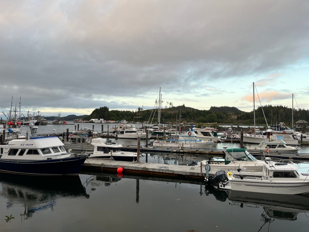
It was a relief to enter the relative shelter of the marina, but this was to be short lived comfort. We wanted to fuel up before going to our slip, so we wouldn’t be limited in our departure time. We chased all over the marina looking for the fuel dock, finally being directed outside the harbor to the Coastal Mountain Fuels dock in Bear Cove.
This was a miserable fuel dock in those swelly conditions. The dock was rimmed with old tires, and even with an old barge for a breakwater we were rolling all over the side of the dock. Our fenders rode up over the tires and we got some nice black scuffing from them as we fueled up. Nothing a magic eraser and elbow grease wouldn’t fix later, but super annoying nonetheless.
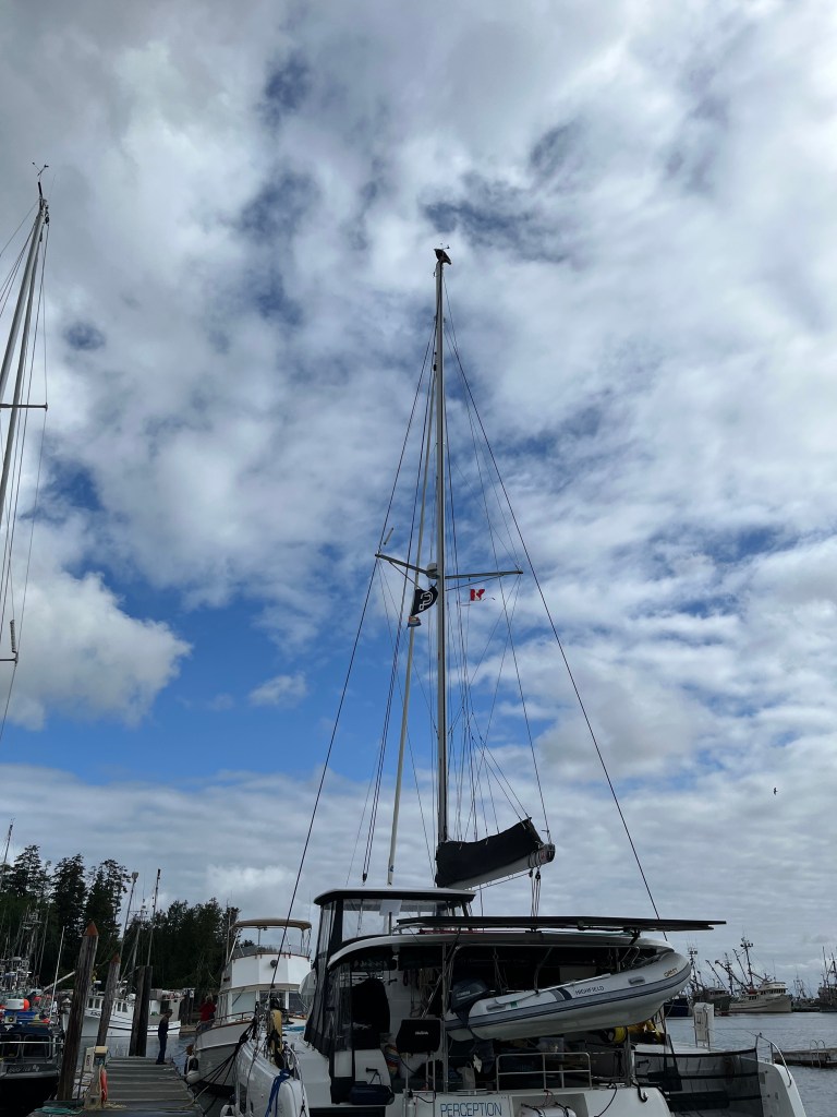
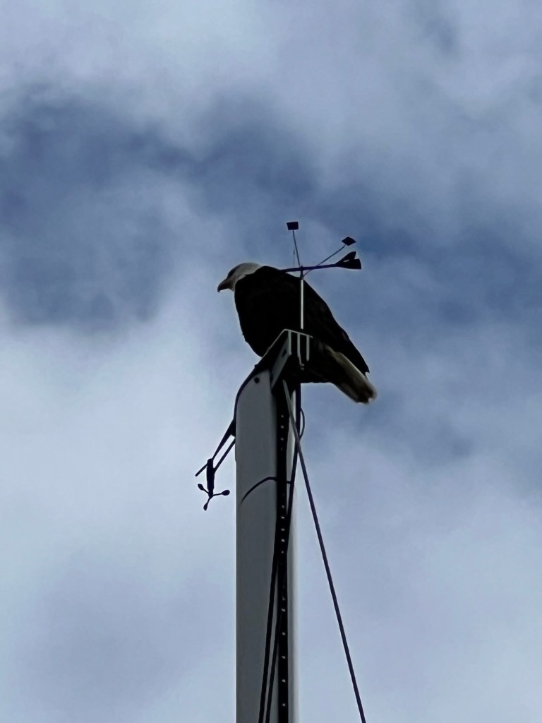
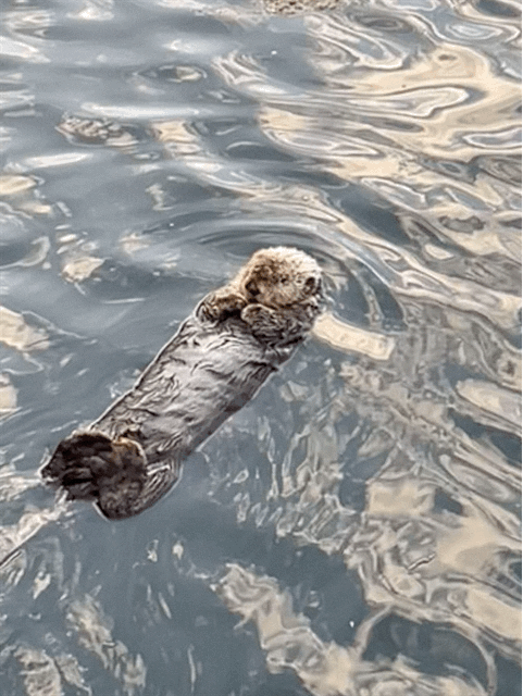
We spent two days in Port Hardy, and it was nice to have a day without moving after making some good progress to the northwest from Vancouver that week. We were entertained by a bald eagle taking a liking to our tall mast in the harbor – at least until I discovered that he’d roosted there overnight, leaving behind a job of deck cleaning for me! We also saw our first sea otters up close here, after passing a rack of them in the strait on the way up from Alert Bay.
I was able to make some progress on boat projects here as well. I had plumbed the watermaker product water output into the starboard water tank by teeing into the vent outlet. I had hoped that the flow would be low enough that air could still escape while the watermaker was running. This turned out to be a mistake, as water would completely fill the vent pipe, and pressure would slowly build until the watermaker output just ran over the side out the vent instead of into the tank. I would have to “burp” the tank every ten minutes or so while the watermaker was running, to keep the pressure down in the tank. After visiting three different hardware and marine supply stores in town, I was able to cobble together a new tee into the deck fill line. This has worked nicely ever since.
I also furthered installation of our Starlink network system. At least now it is all attached to the underside of the cockpit roof, though it still hangs out of it’s enclosure waiting for me to connect the high-gain Wi-Fi/Cellular antenna.
Two steps forward, and almost one big step backwards. I had also decided to clean the watermaker’s 20 micron filter, which was getting pretty green with filtered sediment at this point. I pulled out the filter, its housing, and the sealing ring, and set to work spraying it all off with the shower hose on the starboard sugar scoop. I knew I should have taken more care even as I did it, but I still set the sealing ring down next to me as I sat in the sun above the water rising the filter. Before you knew it, I distractedly knocked the ring off into the water, and watched it disappear out of sight in the 18′ of marina water under our boat.
Crew to the rescue once again, Melinda and Grace hung one of our new fishing weights from our endoscope to stretch it down, and dropped it to the marina floor under the boat. Before long we’d spotted the blue ring right below where I’d dropped it. Melinda fashioned an ultra-long retriever by strapping all three of our boat hooks together with zip ties. With Grace steadying the endoscope, I was able to snag the ring and pull it to the surface. Whew, disaster averted once again!!

2 responses to “May 27th-29th, 2023: The cost of complacency – escaping Johnstone Strait to our last stop on Vancouver Island”
Lots of new adventures & experiences!
LikeLike
[…] Centre to learn more about the history and culture of the area, but, as Jim mentioned in his last log entry, it was closed during our visit due to a scheduled power outage. This is the second misfortune in […]
LikeLike