
Melinda
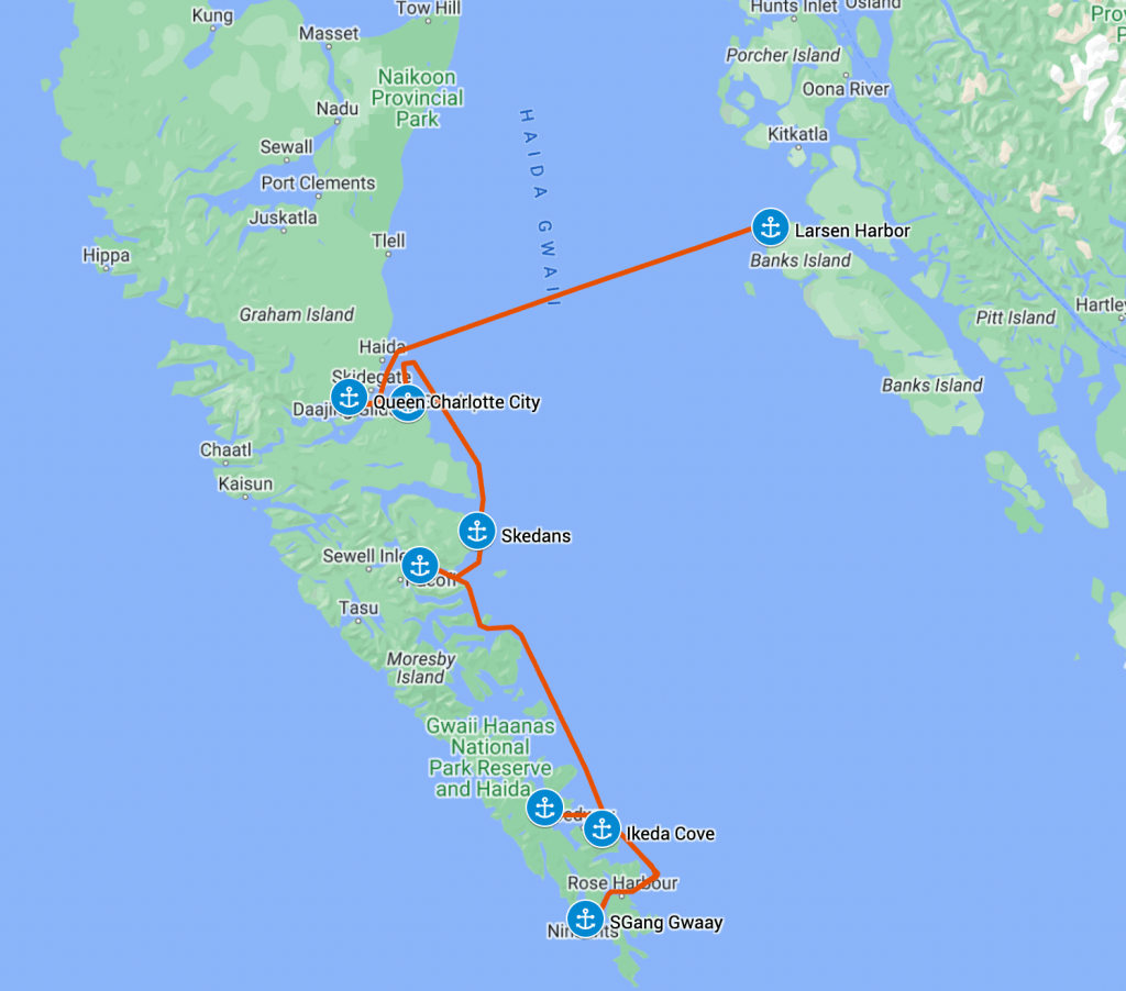
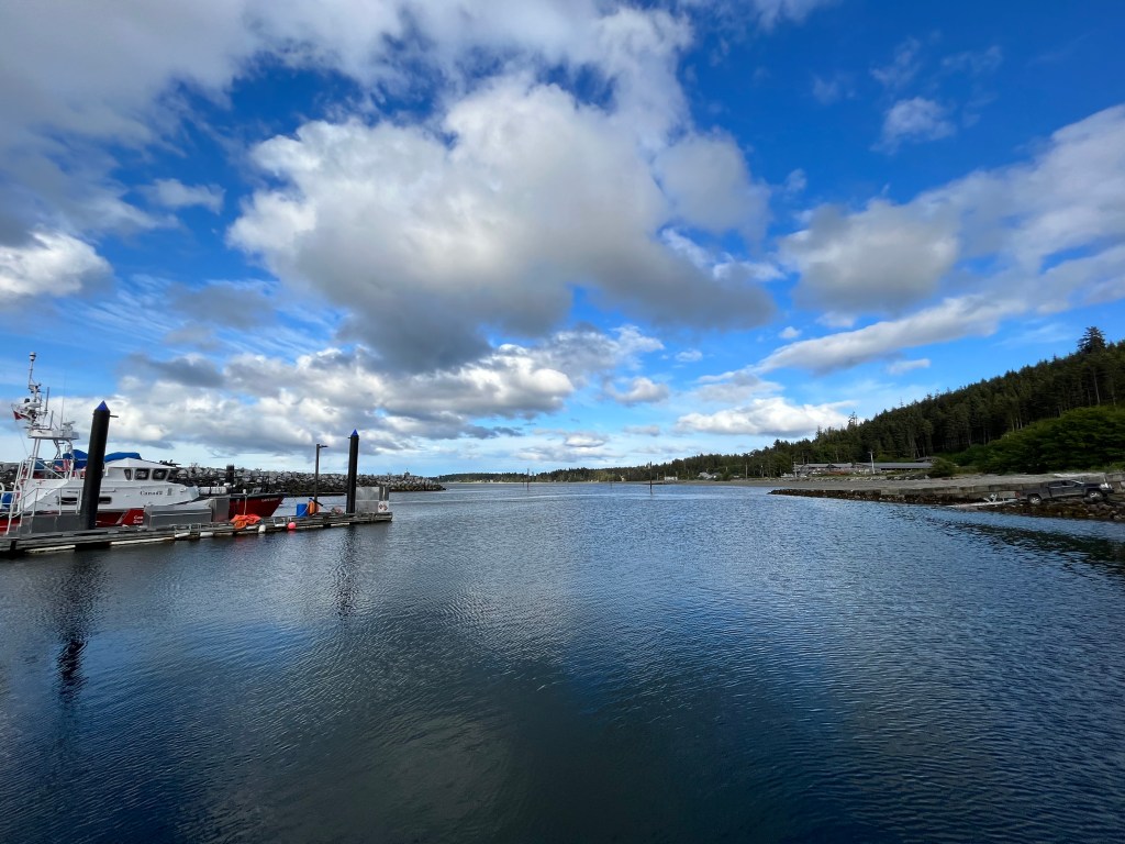
I piloted us across the Hecate Strait and we arrived at Daajing Giids on Graham Island to get ready for entry into Gwaii Haanas National Park Reserve, National Marine Conservation Area Reserve, and Haida UNESCO World Heritage Site. This was the ultimate goal of our trip north this season. The archipelago itself is difficult to get to. It is only accessible by seaplane or boat, which involves crossing the Hecate Strait. The Hecate Strait is open to the swell of the Pacific, and—because it’s quite shallow—the wind waves can quickly build into a treacherous sea state. We chose a calm day and crossed comfortably.
Haida Gwaii is known as the Galapagos of Canada and only about 2,000 people per year get to visit the renowned Haida Watchmen Sites for guided tours of the historic Haida village sites. We quickly understood the Galapagos nickname when a humpback welcomed us to the archipelago with a complete breach followed by a ¾ breach. We’d become accustomed to seeing lone orca or a small pod, but we saw a pod of at least 15 orca swim by while leaving our first Watchmen site, K‘uuna Llnagaay.
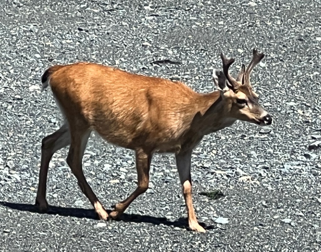
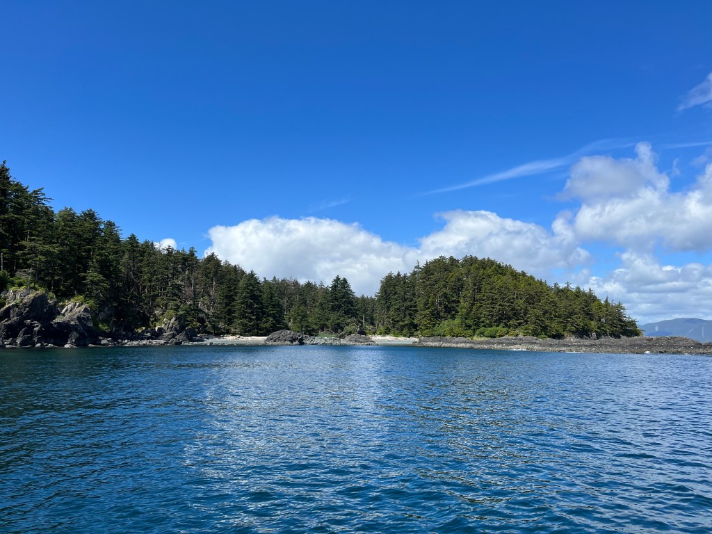
On the way out to SG̱ang Gwaay, we passed the Garcin Rocks which are covered by boisterous sea lions. We slightly regretted approaching close enough to smell them! The deer at SG̱ang Gwaay don’t seem to mind us being there at all.

While anchored for two nights in Bag Harbor, a pod of Risso’s dolphins kept us company. They swam back and forth through the anchorage from late afternoon until past midnight on both nights. We noticed one of the dolphins was trailing a long piece of kelp off of it’s dorsal fin like toilet paper stuck to his shoe. When it fell off, the dolphin doubled back and took it up again and swam off trailing that kelp like a laurel wreath. They were very entertaining!
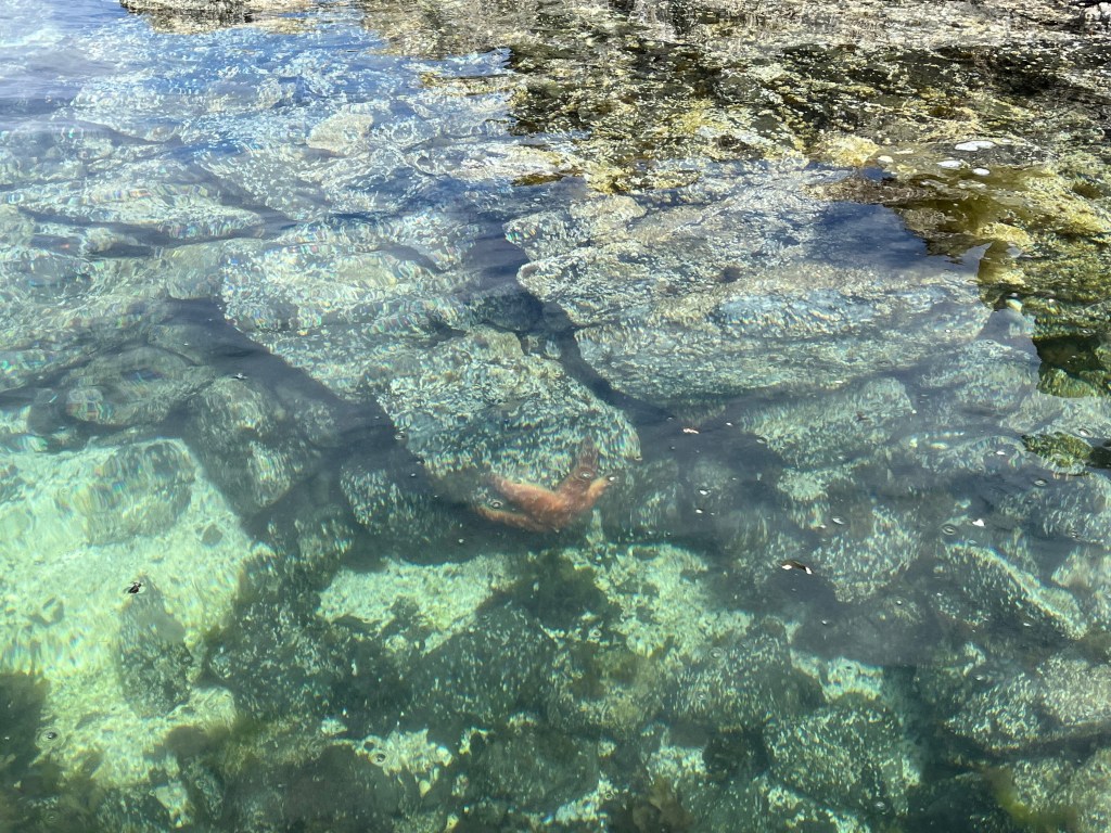
One thing we had been looking forward to seeing was a stretch of water called Burnaby Strait or Dolomite Narrows. In the Douglas Guide it had been touted as a “marvelous place to observe marine life” and purported to teem with almost 300 different species of life, and “they calculate that more protein per square meter exists here than any place in the world.” We expected quite a show when we climbed into the dinghy for our transit across this drying strait. We saw two sea stars and several jellyfish, along with lots of kelp with some crab stowaways.
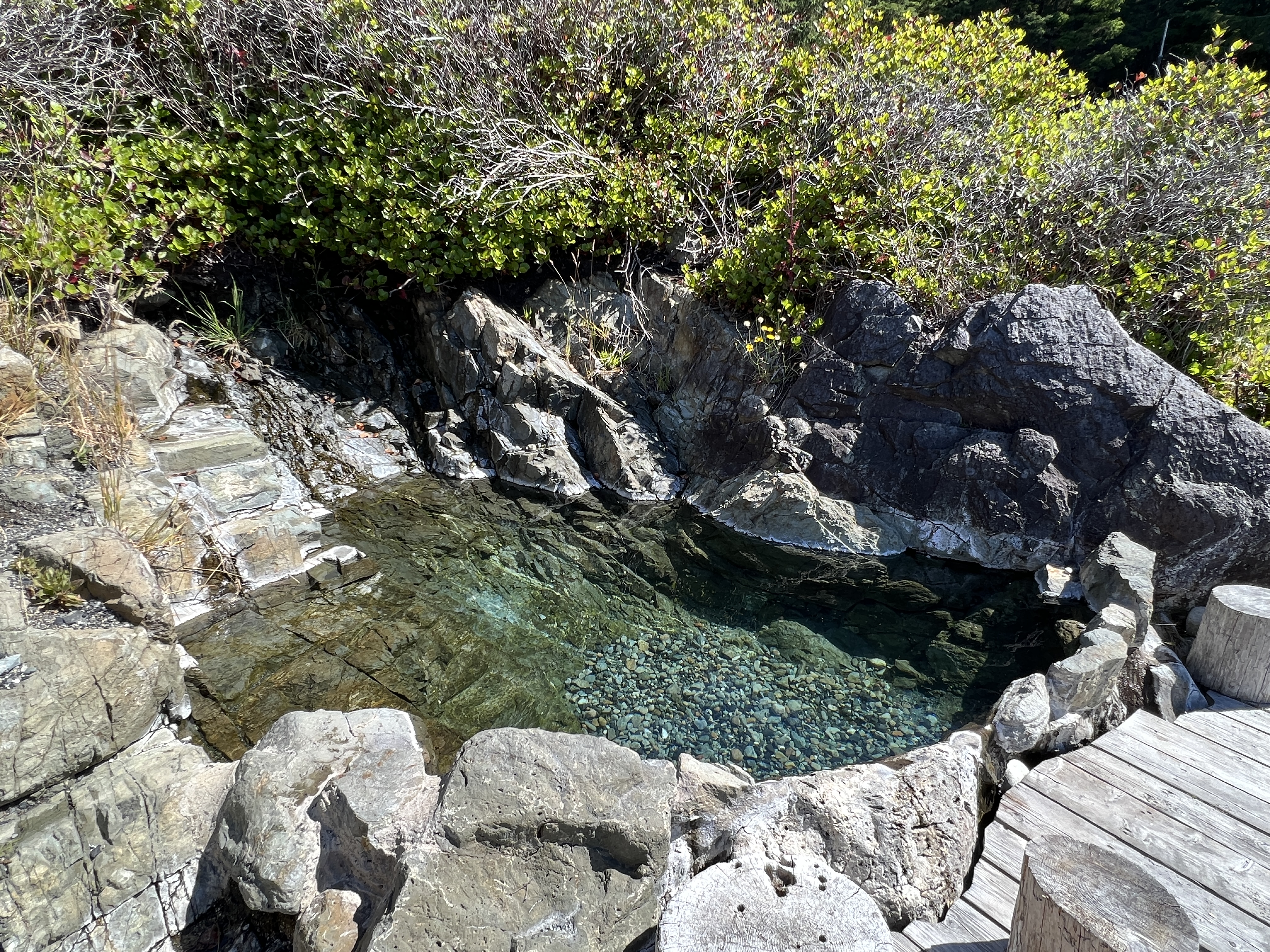
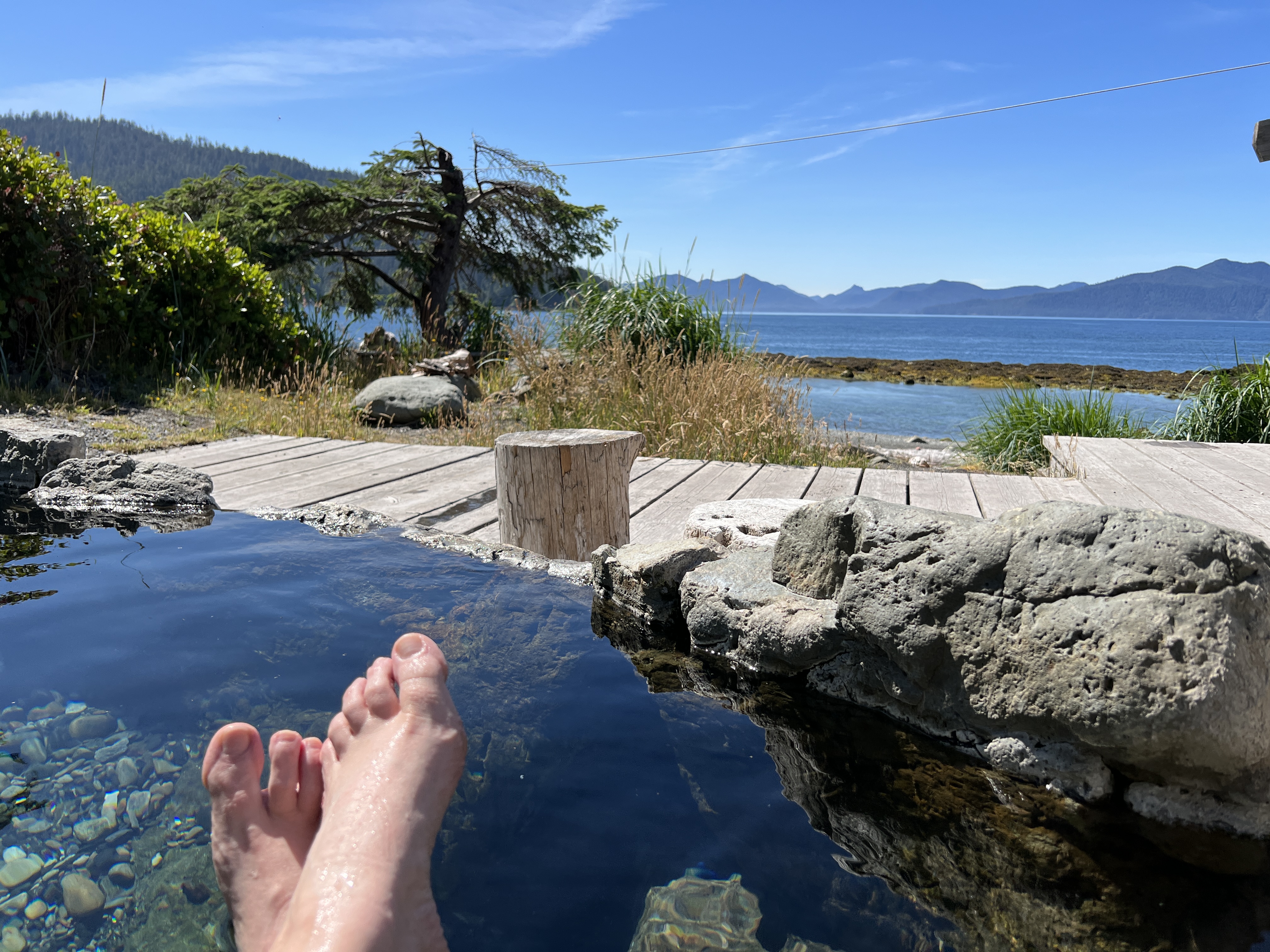
We made it to Gandll K’in Gwaay.yaay (Hotsprings Island) on the 4th of July. We happily stretched our legs on the pleasant hike from the landing beach to the hot springs, then enjoyed a nice soak in a few of the pools.
Skipper
Tuesday morning we were up with the dawn, ready to make our big crossing. This was the next big challenge for the Perception crew, with 50 nautical miles of open water ahead of us. The Hecate Strait has a nasty reputation for brutal crossings in the wrong weather, and I was anxious to see how it would be for us.
We’d picked a day when the swell was predicted to be less than one meter. I checked conditions that morning, downloading the latest GRIB files and checking the current sea and wind state on the Canadian government buoys. All looked reasonable, so we headed out.
We did indeed pick a nice day, and other than being a long crossing it was quite pleasant being out on the water. There was very little swell, and the light wind state meant almost no wind waves building on the surface. As with most of our trip we motored the whole way across in very light air.
We took the most conservative route into Skidegate Inlet, entering the entrance channel near the north end of the bar. I’d had some concern that there might possibly be breaking waves or at least significantly increased swell in the shallows of the bar, and wanted to avoid that. We saw no evidence of this the four times we crossed the bar in and out of Skidegate Inlet, though the wave state was never much worse than 1 meter when we did.
We anchored outside of the city marina in Queen Charlotte City. This was a fair sized anchorage with room for quite a few boats, and we ended up sharing it with 5 others by the time we left. It seemed like a crowd after the anchorages we’d been in for the last few weeks.
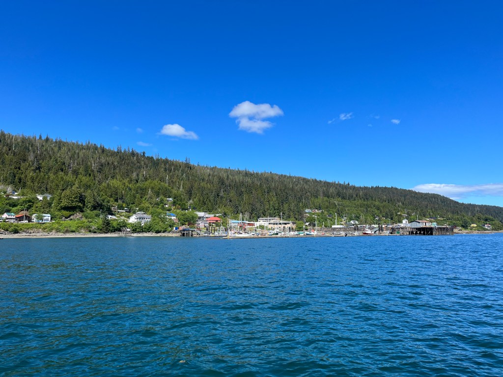
I wanted to fuel up again before heading down into Gwaii Haanas, since I wasn’t sure where we’d cross back to the mainland. We decided to relocate to Sandspit Marina to fuel up before going south, though in hindsight there was nothing wrong with fueling up in Queen Charlotte City other than their schedule for manning the fuel dock (apparently typically just 4-6pm, we later learned). In any case, we pulled anchor that evening after Melinda and Grace had visited the town and cultural center in Skidegate, and headed down to the southeast corner of the inlet.
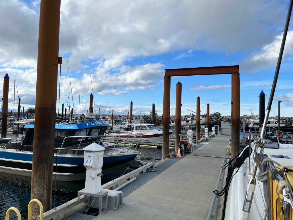
The marina at Sandspit was nice, plenty of space and seemed nearly unused but for local fishing boats. We soon learned why as there was no easy access to stores or restaurants, and no taxi service on that side of the inlet. We fueled up and eased into our slip for the night.
The next morning we headed south towards Gwaii Haanas. We actually had to head north before going south due to the bar across Skidegate Inlet. We cheated and went across the bar just north of the C19 channel marker, cutting about 8 nm off of our trip compared to exiting the channel at its northernmost entrance. I was a bit nervous about what we’d find in terms of depth and wave state, but the charts were accurate and we had at least the minimum 15′ at MLLW clearance the whole way across the shallows.
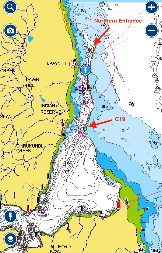
I was also happy that we didn’t see any increase in the height of the swell coming in as it crossed the bar. From the surface state there was really no indication that the bar existed. Of course we were in near optimal weather with < 1 meter sea state, so conditions could be radically different with significant swell.
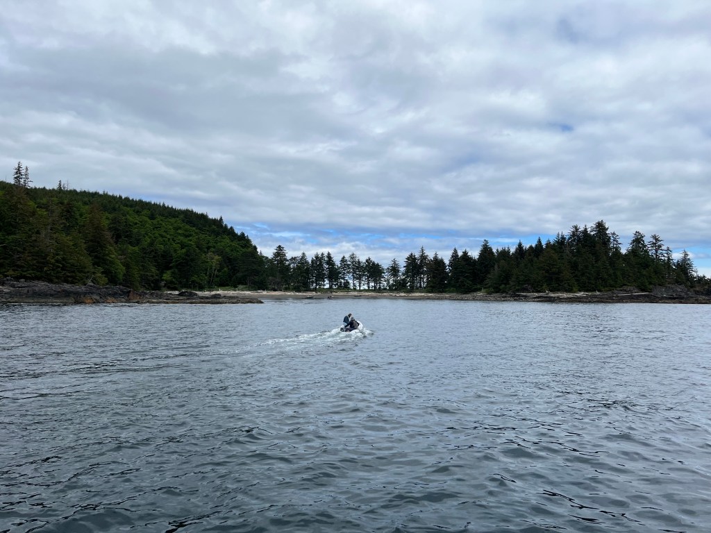
The first Watchman site we encountered was actually outside of Gwaii Haanas at Skedans on the eastern edge of Louise Island. We found good temporary anchorage (albeit in good weather) just south of the site in the northern part of Skedans Bay. I stayed on the boat for work meetings while Melinda and Grace headed over to the beach in Ghost.
After Skedans, we headed further south to find our anchorage for the night. We picked Rockfish Harbor on the south end of Louise Island as it sounded like we might find good fishing there. It seemed like most vessels headed south might go for Thurston Harbor as it’s a bit closer to the next Watchman site on Tanu Island.
Sure enough, we saw a couple of sailboats heading into Thurston, and found ourselves all alone in Rockfish. As we moved deeper into the inlet to anchor at the head, we saw a black shape on the shore. We’d joked previously about how many “rock-shaped bears” we were seeing on shore, but this one turned out to be an actual gangly juvenile black bear. After anchoring we watched him work his way along shore until disappearing into the trees at the head of the inlet.
We found Rockfish Harbor to be a solid anchorage, with little chop reaching us at the head. We understand that it may be different with a southeasterly blowing in, but for us it was a quiet evening.
The next day we attempted to get into the Tanu Watchman Site, but found that a charter boat with 20 people aboard had beat us to it. Since the Watchman Sites only allow 12 people ashore at any given time, we would have had to wait 2-3 hours to get ashore. We heard another boat call the charter and ask where they were headed, trying to avoid competing with them for access. It sounded like they would be working their way south—so in a pinch decision we decided to head to the southernmost Watchman Site and then work our way back north.
Our relatively short day turned into a long motor down the east coast of Haida Gwaii. Grace did some research and found that Ikeda Cove looked like an attractive spot that would set us up well for getting to S’Gang Gwaii the next day.

Ikeda Cove was an attractive, protected anchorage that penetrated deep into Moresby Island. It had an interesting history as a mining site for a company founded by Arichika Ikeda in 1907. At one point a hundred years ago there was a significant amount of infrastructure here, including a large wharf, a number of houses, and a large beached steamer that served as a bunkhouse for the miners. In 2023, all we found were a few rotting pilings and a rusty rail or strap that had been pulled up out of the ground. Other than some obvious mining scars on the hills, nature quickly reclaimed the cove as her own.

I had been stressing about getting down to the southernmost Haida site at S’Gang Gwaii, since it was both exposed to the Pacific Ocean and required us to go out into the Hecate Strait to get around Benjamin Point on Moresby Island. I was worried that the forecast called for increasing winds over the coming days, and we’d get ourselves trapped down in Rose Harbor for a week waiting it out.
At one point that morning we’d convinced ourselves that we should play it safe and go north, waiting for better weather to head down to S’Gang Gwaii. We headed out of Ikeda cove with this intention, but on entering open water we discovered that the swell was not bad at all, and winds were manageable. We decided on the spot that we should probe further south to see how bad things might be.
How happy I am that we made this decision, as we had a pleasant journey down around Garcin Rocks, pulling in close to ogle the sea lions that congregate there. We heeded the warnings about the inshore passage between Moresby Island and Garcin Rocks, worried about the tide rips that would form there and the “local knowledge required” moniker on our Navionics charts. We passed the rocks near slack tide and I had some regret that we didn’t just do the inshore passage to save time.
We had called the S’Gang Gwaii site on our VHF as we passed Rose Harbor and they reported that the swell was less than a meter. As we exited the west end of the Houston-Stewart Channel to cross to Anthony Island, the ocean swell started to pick up. As promised it was not high, and we had a very comfortable jaunt that day. My uncertainty as to the conditions was more stressful by far than what we actually experienced.
Since the wind was blowing from the northwest, we tucked into Grays Cove just south of the Watchman Site. We called in and the Watchmen said they would meet us at the beach on the north shore of Grays Cove. I was a bit nervous to leave Perception anchored there, but found the holding to be fine and the cove mostly sheltered from the wind.
After visiting the site, we retraced our path back through the Houston-Stewart Channel, around Garcin Rocks, past Ikeda Cove, and into the narrows between Moresby and Burnaby Islands. There we entered Bag Harbor, and dropped our hook after a very long day.
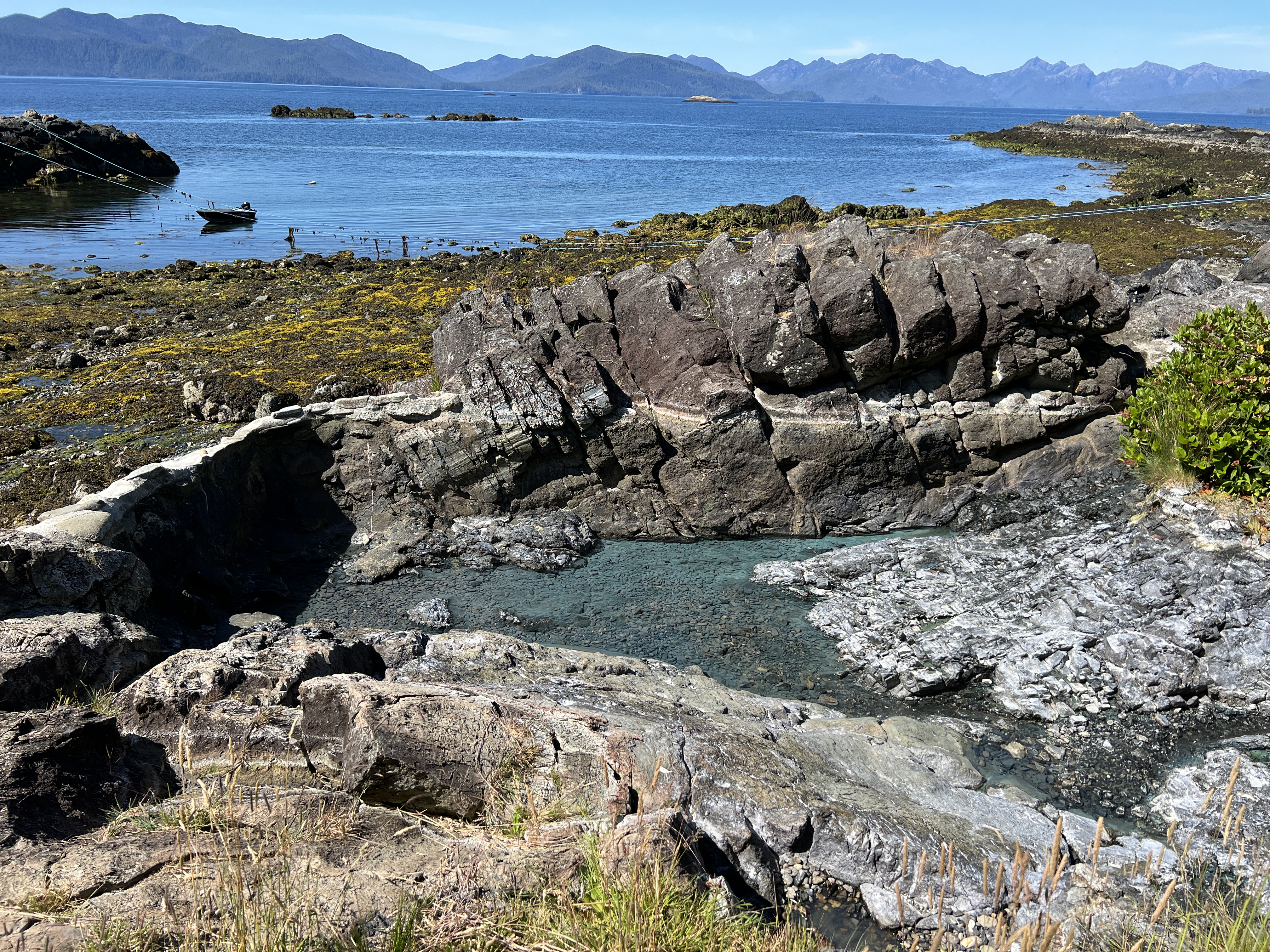
Bag Harbor was a great anchorage, with a relatively shallow, muddy bottom that provided good holding. There was another sailboat in the bay when we arrived, but another twenty boats could have easily fit in. We decided to stay for two days to rest and recuperate after multiple days of pushing hard from Prince Rupert. On our day of rest we took Ghost up into Burnaby Narrows — both to see the sea life and to check out what it might be like to pass through on Perception. Needless to say, we decided to take the long way around Burnaby Island.
