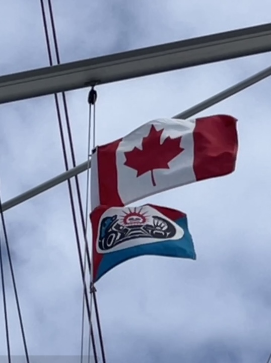
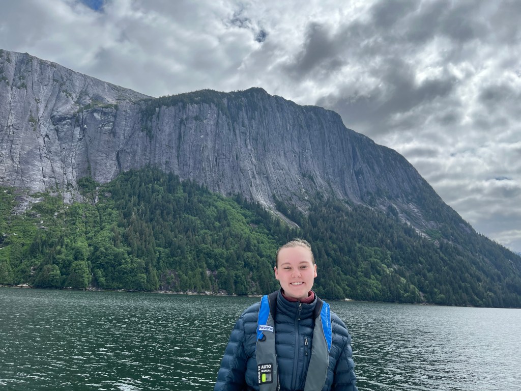
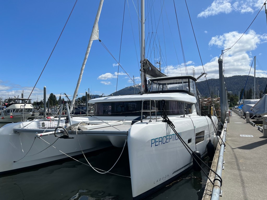
A little bit about nautical flag etiquette. When sailing a boat in a foreign country, you display the flag of the ship’s country of registry at the stern of the boat. The size of the home country flag is based on the size of your vessel, for our sailing yacht – in the category 40-45’ in length, a 24X36” flag is appropriate. In addition to your country of registry, once you have cleared immigration, you must display a courtesy flag of your host country. Courtesy flags are all the same size, 12X18”. They are to be raised on the starboard spreader and should fly higher that other personal or club pennants and flags. In 2010, the land formerly known as Queen Charlotte Islands, was given back to the Haida people and renamed Haida Gwaii. While it remains a part of Canada and considered by Canada to be a Canadian National Park, it is governed by the Council of the Haida Nation who never ceded the land to Canada. After we attended our online orientation, registered and were granted a reservation to visit, they mailed us a small flag along with our visitor badges. We assume it should be flown as a courtesy flag and placed it below the Canadian courtesy flag on the starboard spreader.
After a day of rest in Bag Harbor, we were ready to continue our exploration of Haida Gwaii. In hindsight, our pause for a day may have been a mistake, and we began to see the attraction of attempting to transit Burnaby Narrows at a high tide.
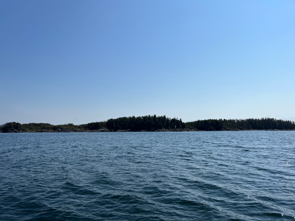
On July 3rd we pulled anchor and headed around the south end of Burnaby Island, intending to get up to Hotsprings Island that day. I’d hoped to make it around Scudder Point on Burnaby Island while the ebb was still occurring, thinking that in a flood against the northwesterly wind we would find steep, uncomfortable waves.
As we entered waters exposed to Hecate Strait, we encountered significant swell, which caused us to slow down. As we approached Scudder Point we were right at the edge of what we considered tolerable to make forward progress, and we were going so slow it became difficult to maintain helm. The bows were pounding through the swell even at these low speeds. Ahead of us at the point I could see whitecaps, even worse than what we saw immediately around us. Since we’d slowed our progress, the tide was starting to flood against the wind, increasing the nastiness of the sea state. We decided to follow the “misery is optional” mantra, bail out and wait for more favorable conditions.
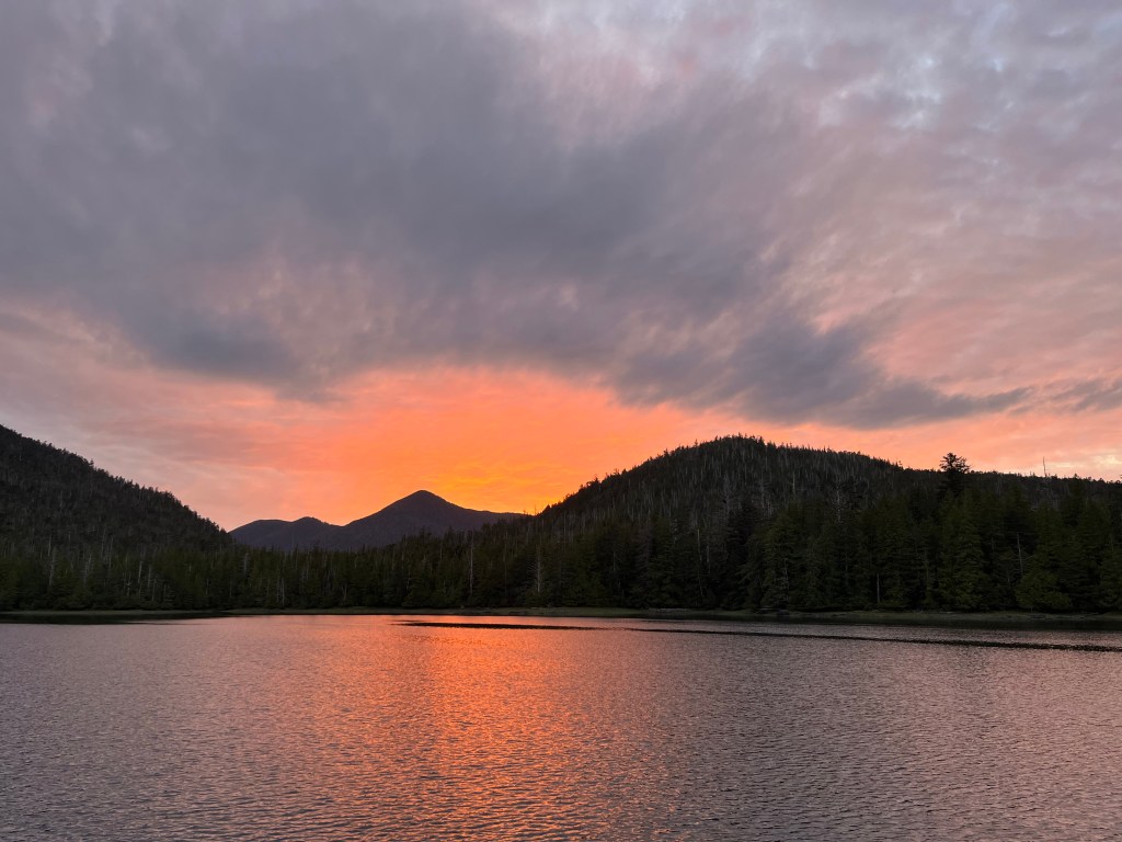
Calm seas south of Burnaby Island – poor indication of what was to come!
That began an unplanned stay in Poole Inlet, which presented a welcome calm after the pounding we took that morning. As soon as we turned Perception around, the swell became a following sea and my stress level dropped precipitously. As we entered Poole Inlet the swell fell off significantly. By the time we had penetrated to the head of the inlet we were in waters as still as one could hope to see.
View from the head of Poole Inlet
The following morning the sea state was significantly better, and we were able to pass Scudder Point without significant discomfort. We continued up to the Watchman Site at Hotsprings Island and anchored in the shallow channel between it and House Island.
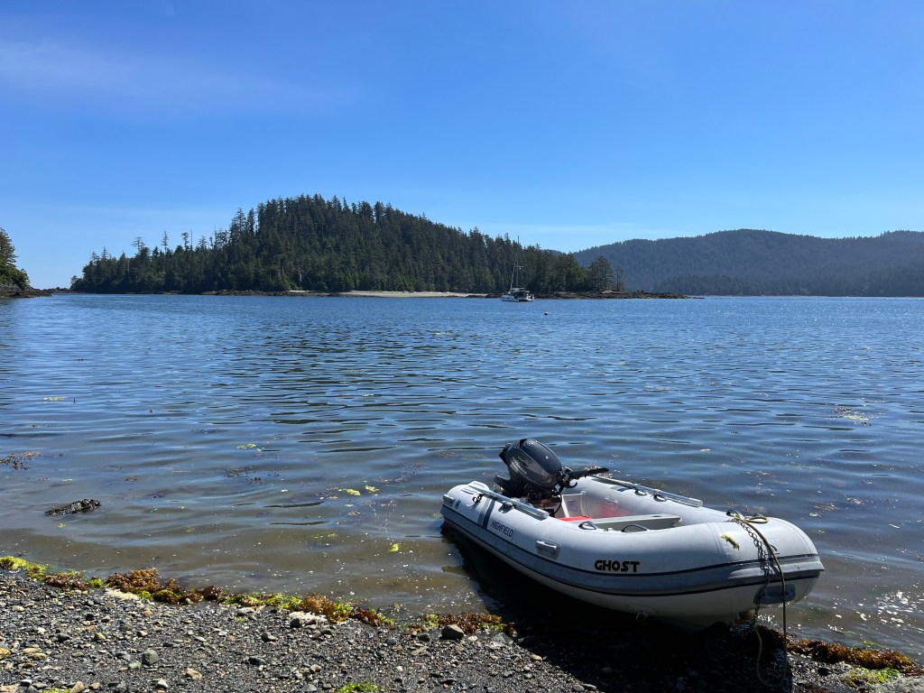
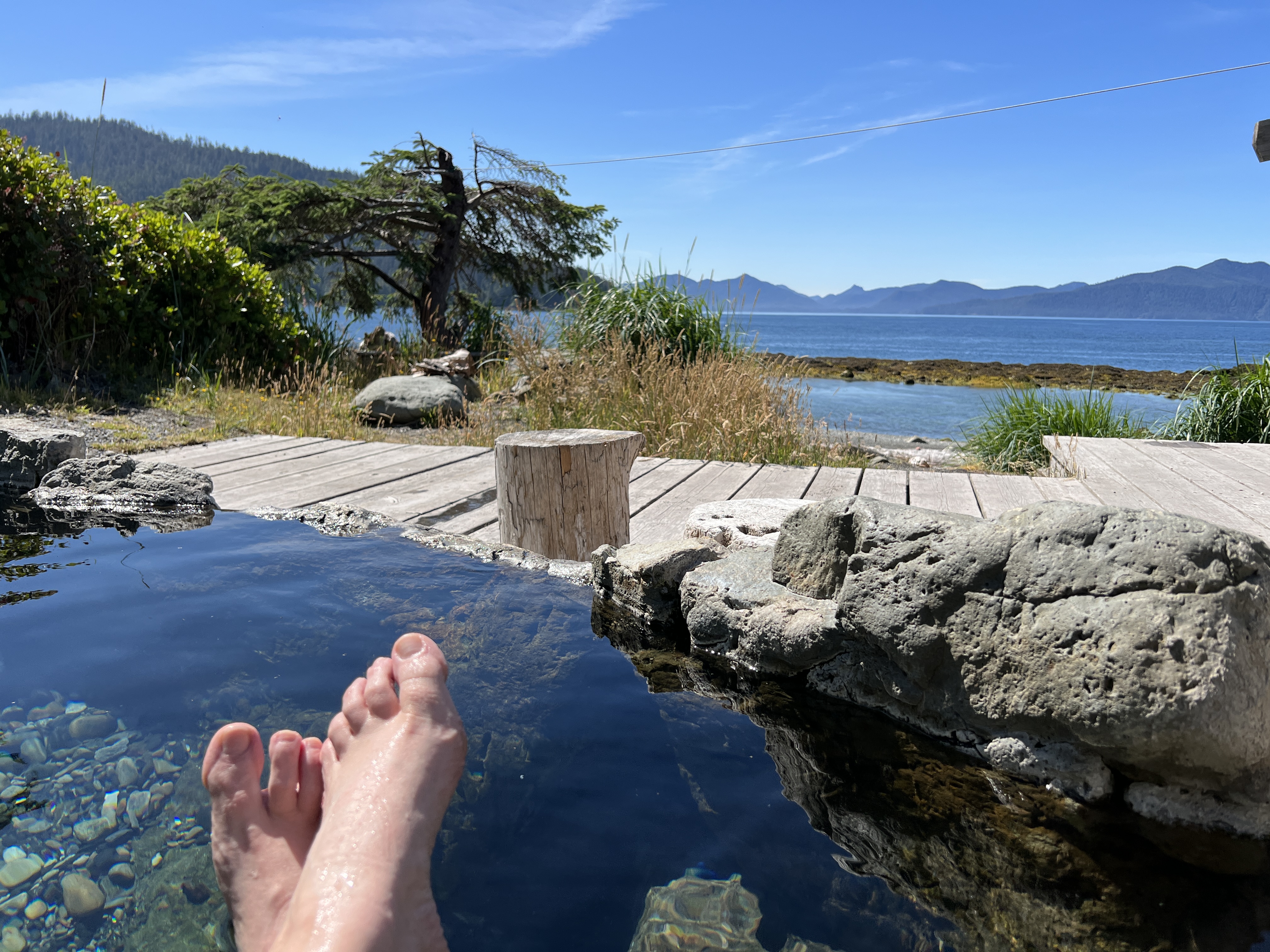
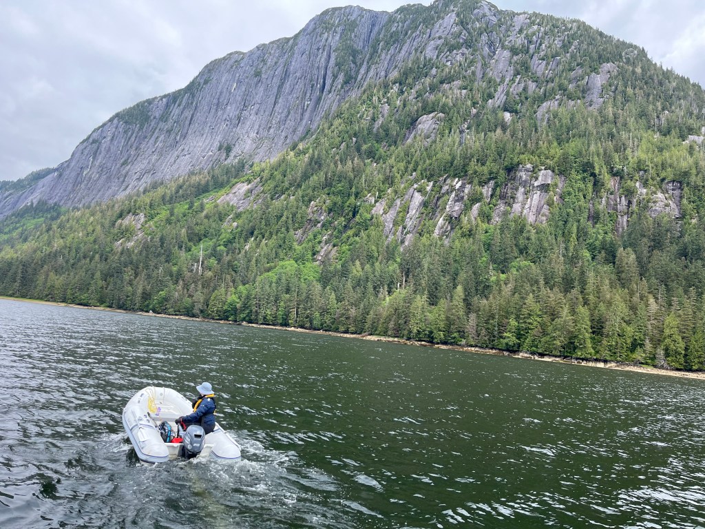
The tide was out, and we couldn’t see an obvious place to land our dinghy that wasn’t rocky. We called in to the Watchman Site and they recommended the east side of the island near where we’d anchored. We clambered out of the dinghy and waded 10 feet through the rocks to get ashore, tying Ghost off on a large rock as high up the shore as we could take the painter. We soon located a trail that promised to lead us across the island to the hot springs, and enjoyed a walk through the trees.
Perception anchored between Hotsprings and House Islands, with Ghost ashore
I knew I’d need to get back to check on the dinghy as the tide was coming in. After a quick dip in the hot springs, I went back. to the while Melinda and Grace soaked for a while. Lucky thing I returned when I did—the rock where I’d tied the painter was already under water, and I had to reach in to my shirt sleeve to get it untied. I pulled Ghost up onto the gravel beach over water that now covered the rocks we’d waded through earlier. At least it was easier to reload the dinghy for the trip back to Perception!
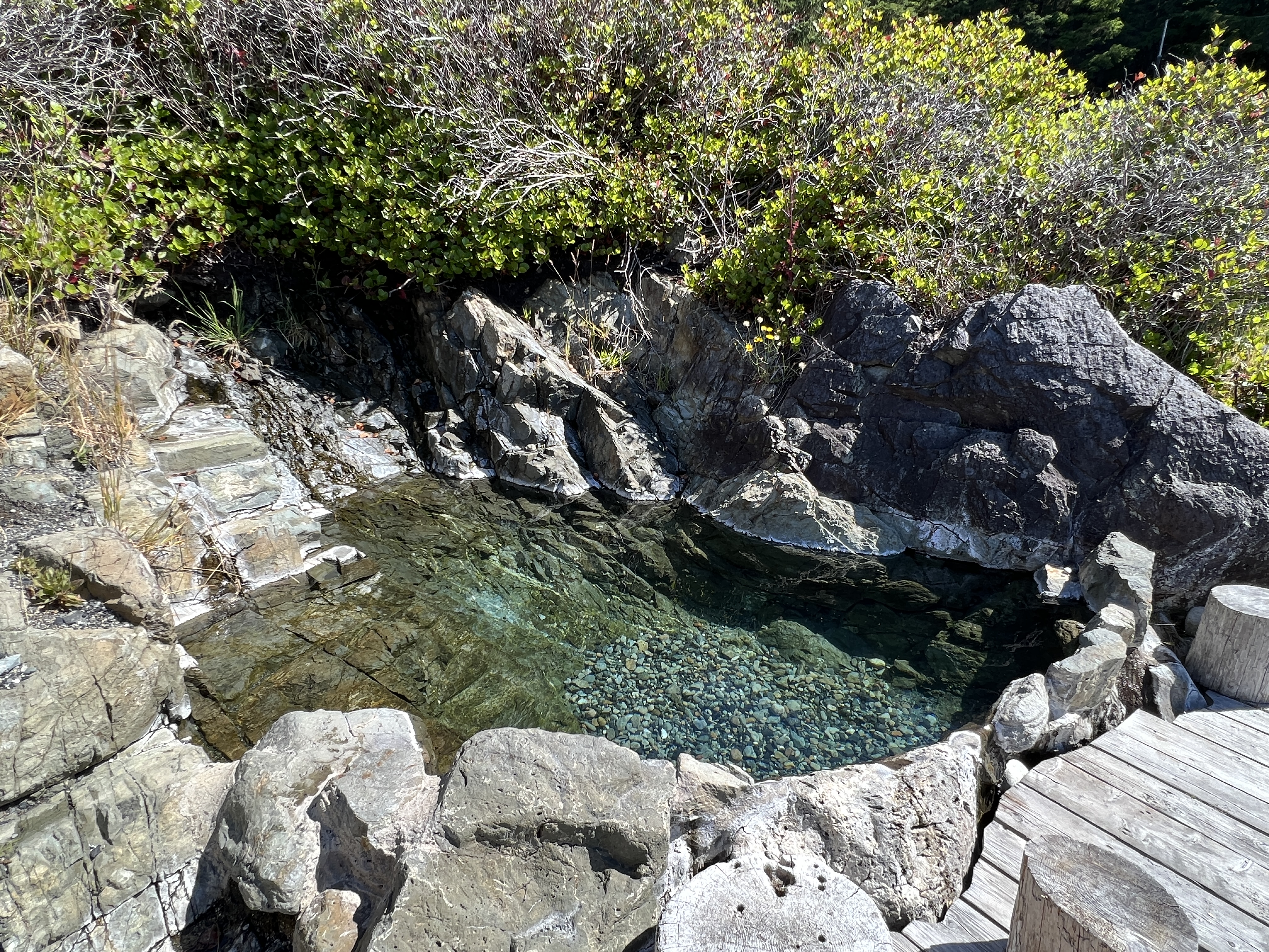
A note on the facilities at Hotspring Island—this is a well-developed site with cement rimmed pools that appear to be cleaned regularly. They have restrooms, showers, and changing rooms for you at the pools. Very nice place to spend some time.
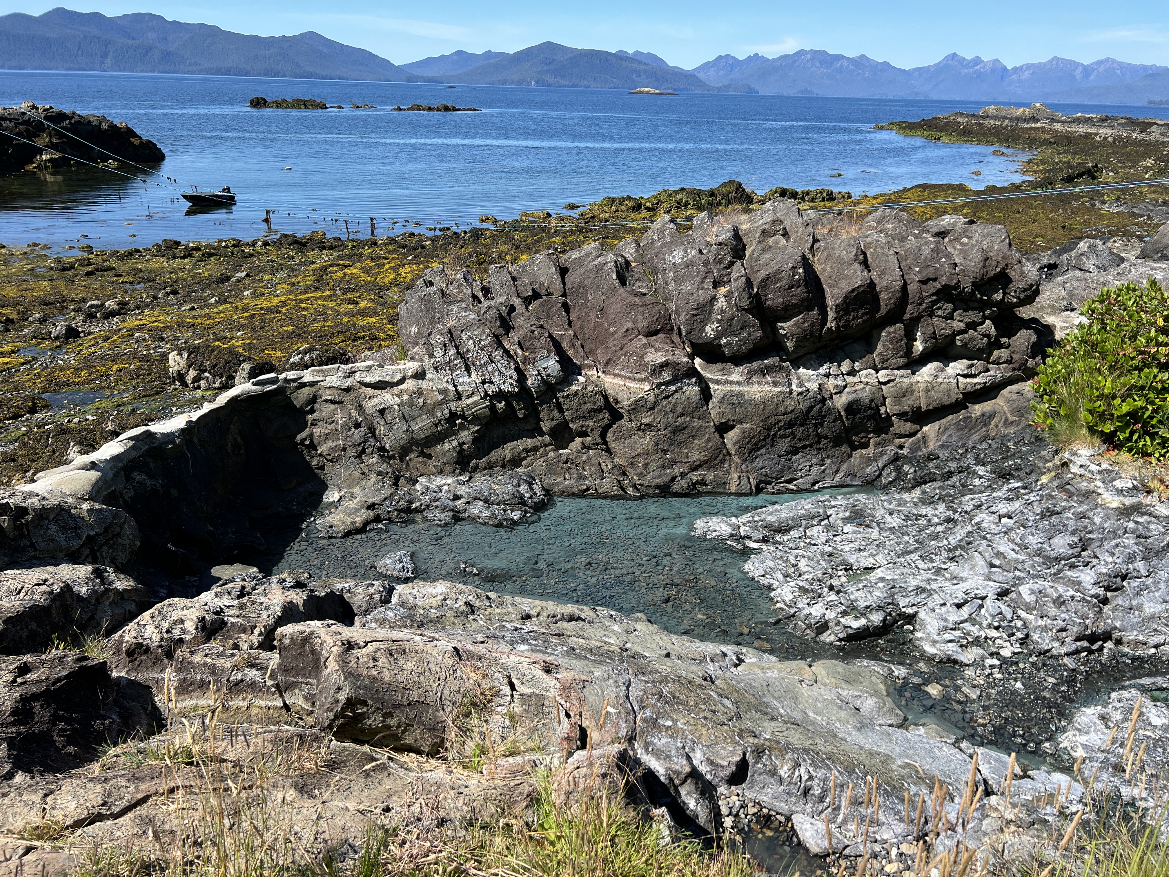
Anchored in the inner cove of Kostan Inlet, looking towards the entrance
After our visit to the hot springs we headed west to Kostan Inlet for the night. This interesting inlet must be entered at high tide across a drying channel, leaving you trapped until the tide rises again. We enjoyed the challenge of entering the inner harbor, and the resulting isolation and protection from the wind and sea outside.
As Wednesday morning dawned and I started my short week of meetings from Kostan Inlet, I found myself amazed again at how Starlink has enabled our lifestyle. Incredible to be attending all of my normal meetings via Zoom and Starlink, from a site that could hardly be more remote from civilization.
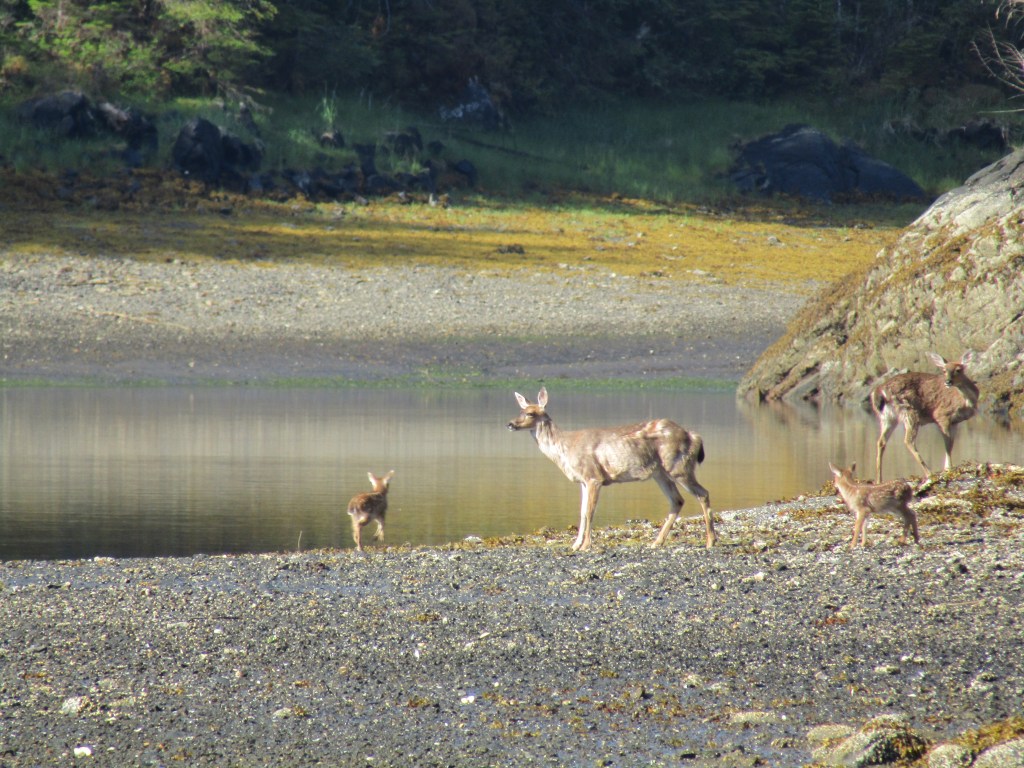
That day we moved a bit further north, heading for Crescent Inlet. This proved to be a well-protected inlet with a wide shallow head, good for anchoring. At the head of the inlet was a wide drying flat with sedge grass growing above it. Over the course of the evening we enjoyed watching a couple of black bears out in the grass, along with a small group of deer.
Perception at anchor in Crescent Inlet
Thursday we headed for the Tanu Watchman Site. We had some challenge anchoring there, as we found ourselves in the channel exposed to the currents in about 60 feet of water. I was in meetings when we arrived, so Melinda and Grace dropped the anchor with the intention of pulling back with the wind. Unfortunately the current was moving in the opposite direction, so they were immediately riding over the anchor as they dropped. We recovered by pulling up the anchor, repositioning, and letting the current pull us back into the set. I remained on Perception in meetings while Melinda and Grace went ashore to the site, so was able to make sure we didn’t move.
Entering Thurston Harbor
After the successful trip to Tano, we motored on up to position ourselves for the return jump up to Skidegate Inlet the next day. We picked Thurston Harbor this time, since we’d been in Rockfish on the way down. Thurston was a fine place to stay, but one could clearly see the logging scars on the hillsides–not the most beautiful of anchorages we’d been in during our stay. We did spot a number of deer grazing in the grass on the south shore of the inlet.
It was starting to look like Saturday would be a decent day for getting back across Hecate Strait, and I would be free to pilot us across. That Friday morning we headed back out around Cumshewa Head on Moresby Island and north to Skidegate Inlet to stage ourselves for the crossing.
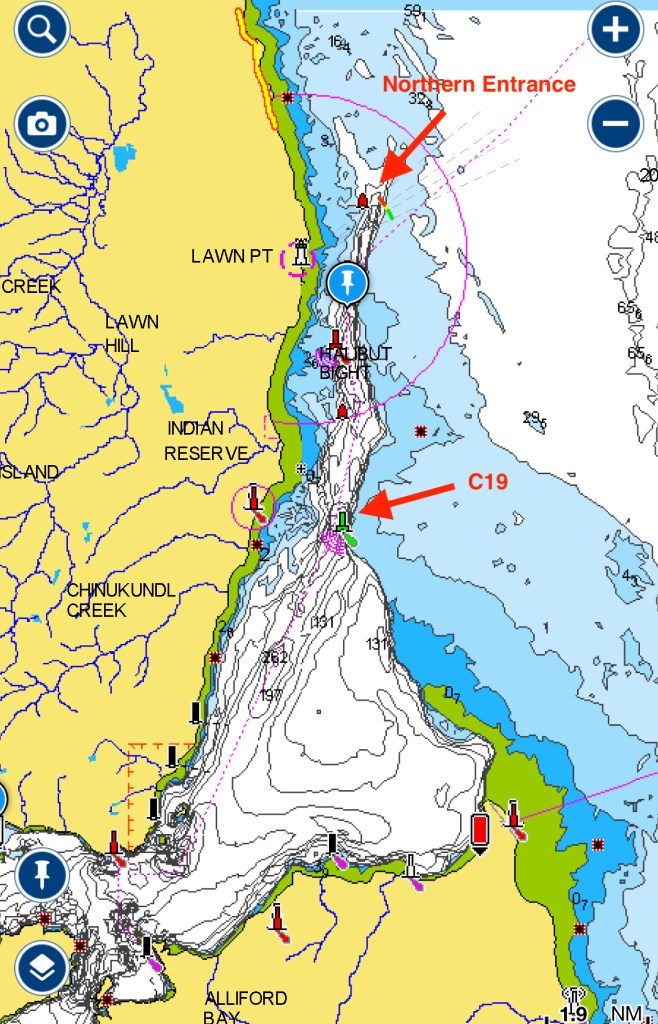
Coming back into Skidegate Inlet, we again cut across the bar just north of the C19 channel marker. The sea state was low, and we again had no issues scooting across at this point.
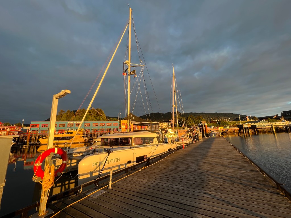
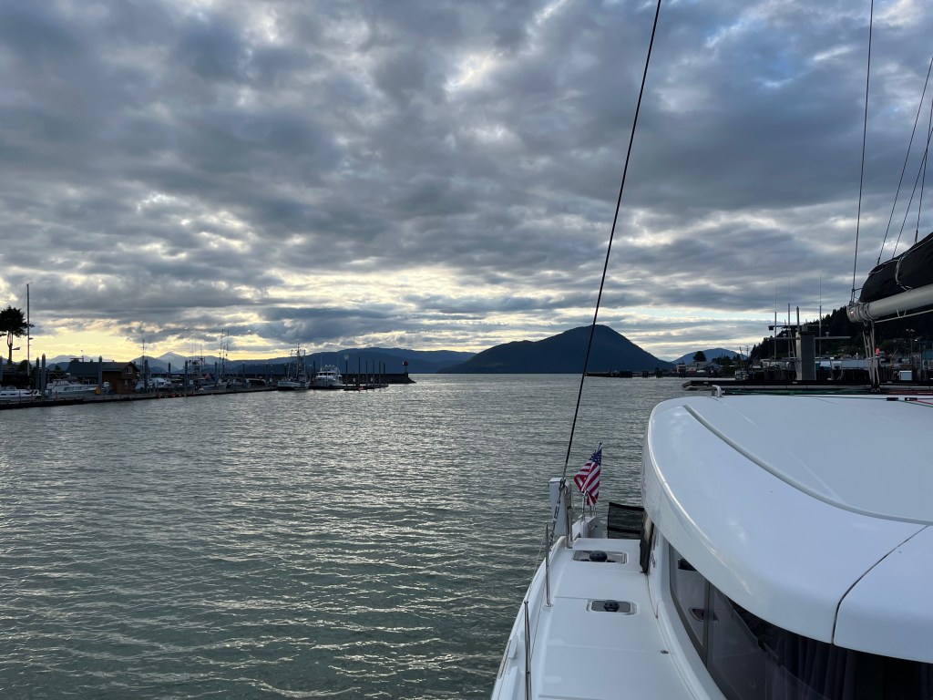
Sunset from the docks in Queen Charlotte City
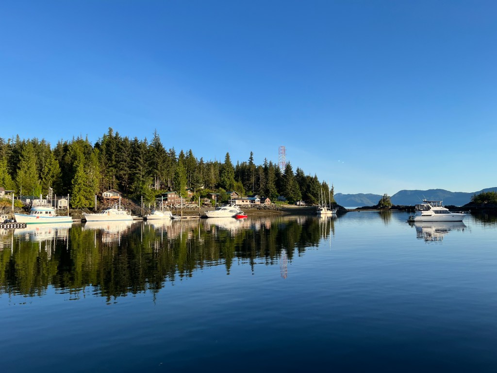
Upon arriving at the marina in Queen Charlotte City, we attempted to fuel up. It was about 2pm, and there was no one at the fuel docks, and no one answering the posted phone number there. We waited a bit, tried calling a few more times, and finally got someone on the other end. Turns out the fuel dock is only staffed from 4pm to 8pm daily, so we went on into our assigned slip at the marina to wait.
After a few hours we returned to the fuel dock and tanked up. We had to tie up to the end of the tee on the dock and could only secure at midships and aft cleats, but the sea was calm so no issues. It is quite shallow at the fuel dock, when we first approached earlier in the afternoon we were in about 8′ of water. We’d returned at a higher tide state and it wasn’t a concern at all. I think deeper draft boats could touch bottom here at low tides.
The marina was relatively nice, with a typical bull-rail setup, fresh water and power. We were able to wash down Perception for the first time in a while, and it felt good to get the salt spray off. We went out to dinner at Blacktail just east of the marina and enjoyed a wonderful restaurant meal. We savored the warm loaf of bread, something we greatly missed. The Salmon Wellington that I had was to die for.
Saturday morning dawned, and the forecast for Hecate Strait continued to look reasonable with some wind building from the southeast later in the afternoon. Patchy fog spotted Skidegate Inlet and the bar entrance, so we ran with lights and radar active to help avoid other boats. The sea was very calm in the morning, with almost no swell touching the surface.
Over the course of the day the wind steadily built out of the southeast as predicted. The wind waves started to pound, and the comfort level on the boat dropped. It wasn’t horrible, but definitely rankled on the nerves to be exposed with hours yet to go to safe haven. I took comfort that we could always turn around and head downwind, but it would be majorly disappointing after making it more than halfway across the strait. We suffered through, and in the end sighed with relief to come into the lee of Banks Island on the east side of the strait.
In the lee of Banks Island, welcome relief from the pounding in the strait
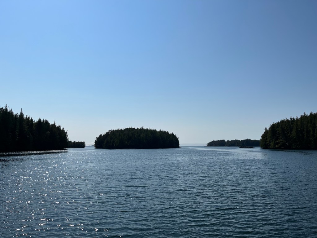
After the long crossing we thought briefly about just tucking back into Larsen Harbor where we’d stayed on the way out to Haida Gwaii, but decided instead to go a few more miles to Keswar Inlet on McCauley Island. After passing through a narrow channel, we were inside the inner cove for a peaceful night.
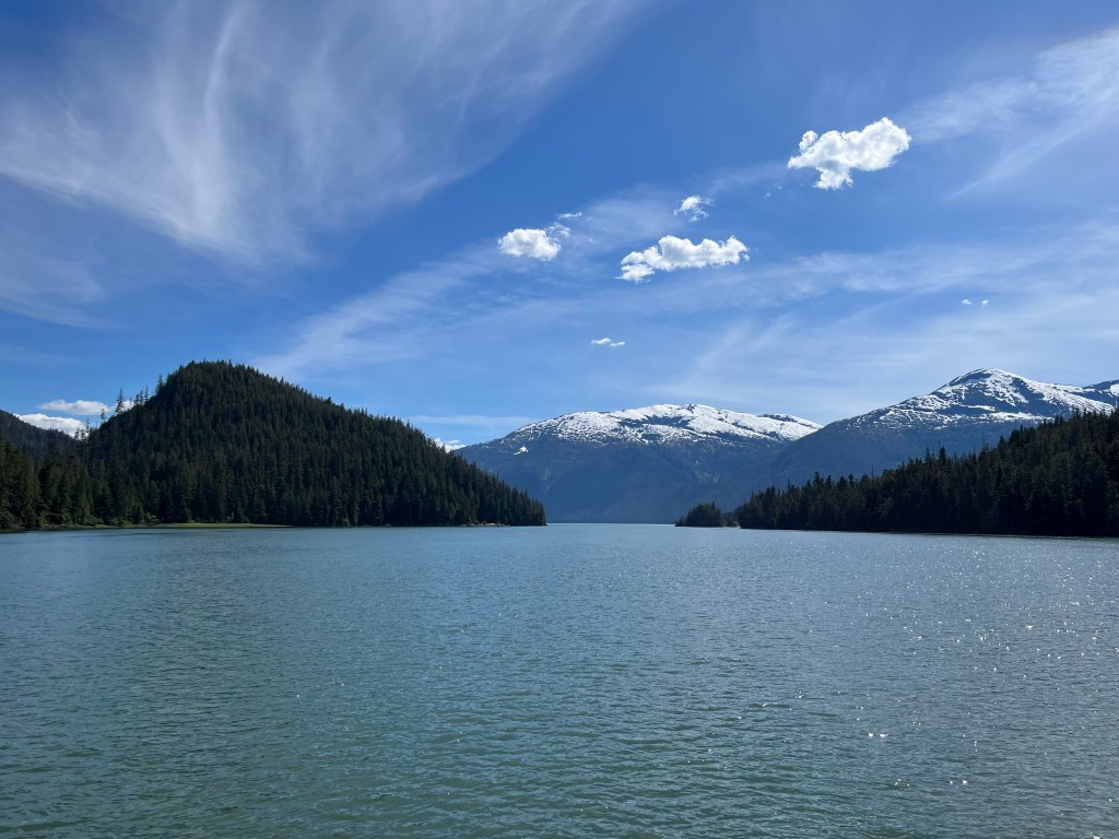
Looking west from the inner cove of Keswar Inlet
It felt good to have the Hecate Strait crossings behind us. While I wish we’d been able to sail more, we were still weighing caution against the extra time it would have taken to get across under sail. None of us wanted to spend more time beating into the wind when the sea state might worsen over time. We were looking for some good downwind time, and hoped to see more of it with northwesterly winds as we headed south.
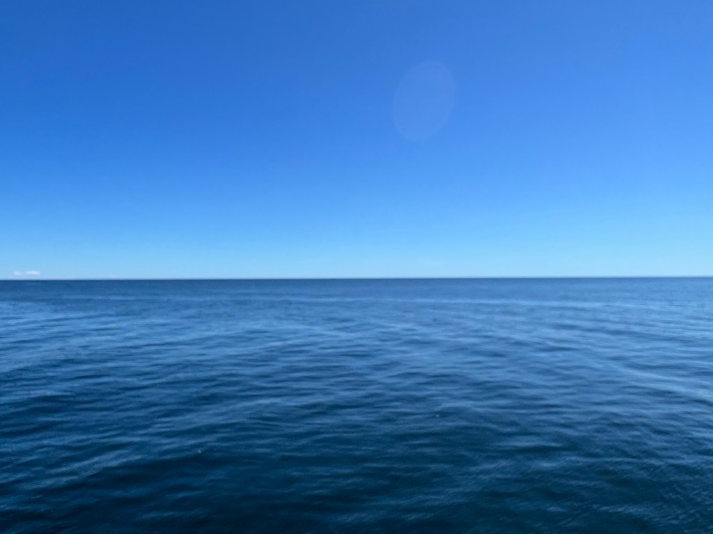
I piloted us across the Hecate Strait and we arrived at Daajing Giids on Graham Island to get ready for entry into Gwaii Haanas National Park Reserve, National Marine Conservation Area Reserve, and Haida UNESCO World Heritage Site. This was the ultimate goal of our trip north this season. The archipelago itself is difficult to get to. It is only accessible by seaplane or boat, which involves crossing the Hecate Strait. The Hecate Strait is open to the swell of the Pacific, and—because it’s quite shallow—the wind waves can quickly build into a treacherous sea state. We chose a calm day and crossed comfortably.
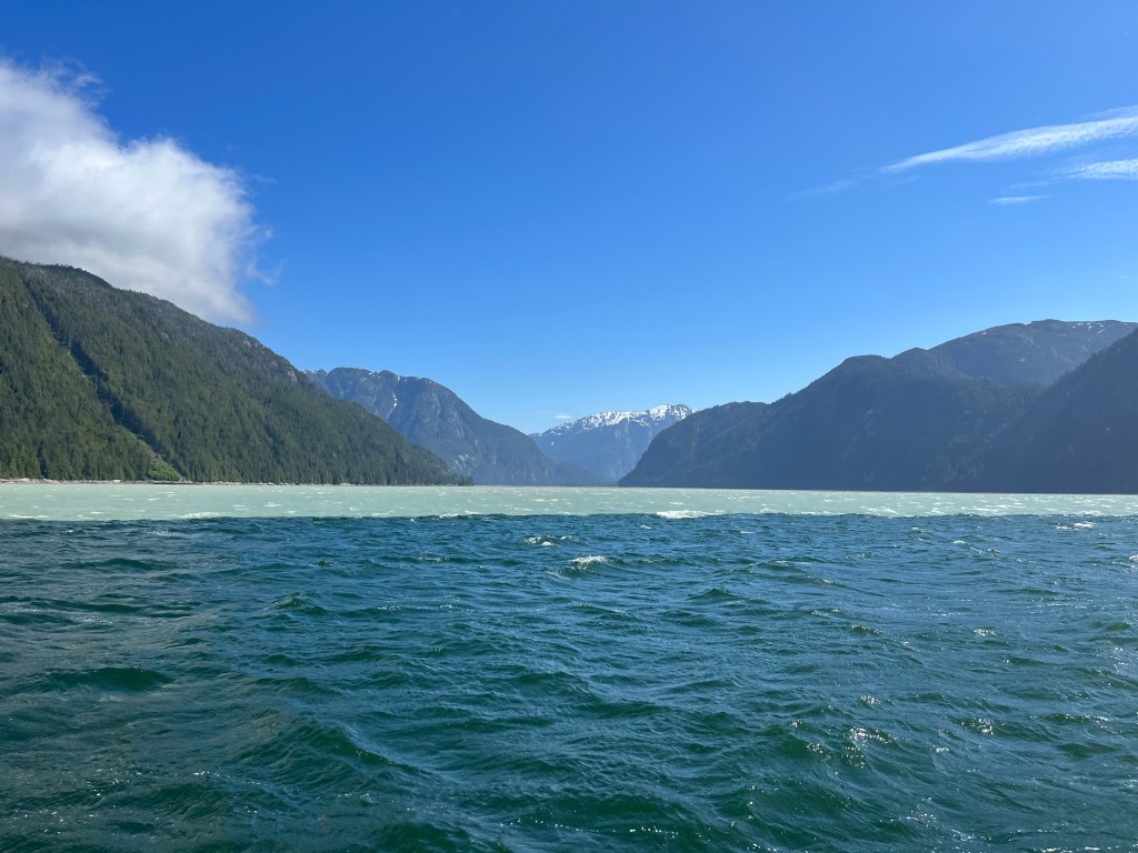
Nothing but blue sky and water in every direction
Haida Gwaii is known as the Galapagos of Canada and only about 2,000 people per year get to visit the renowned Haida Watchmen Sites for guided tours of the historic Haida village sites. We quickly understood the Galapagos nickname when a humpback welcomed us to the archipelago with a complete breach followed by a ¾ breach. We’d become accustomed to seeing lone orca or a small pod, but we saw a pod of at least 15 orca swim by while leaving our first Watchmen site, K‘uuna Llnagaay.
Orca off of K‘uuna Llnagaay
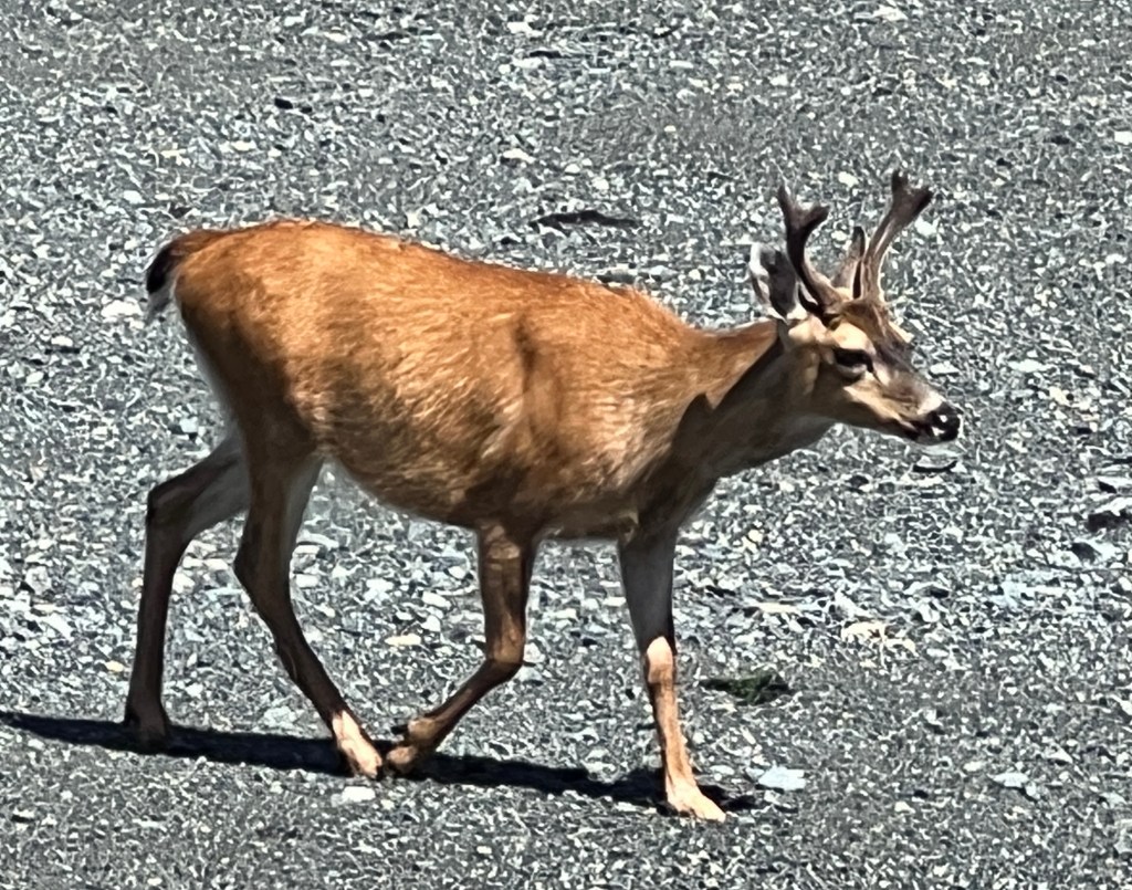
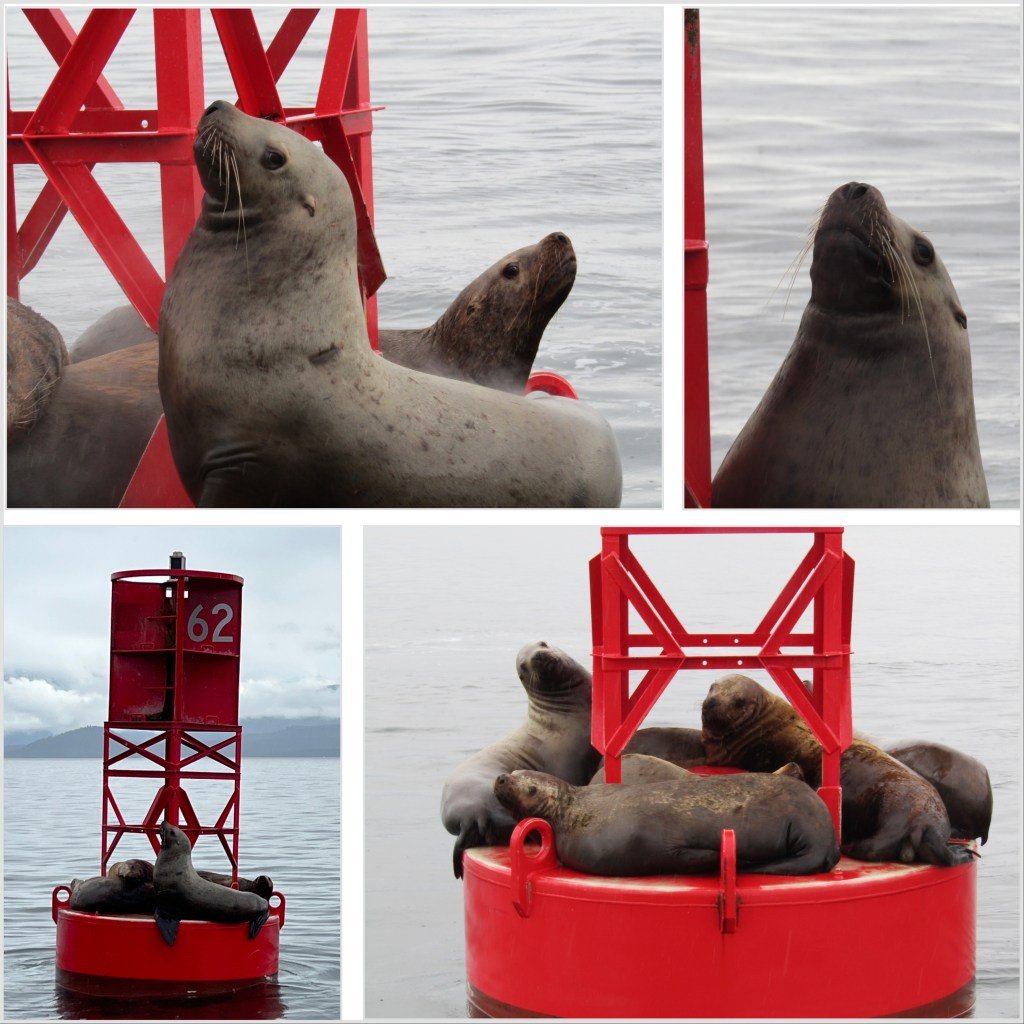
On the way out to SG̱ang Gwaay, we passed the Garcin Rocks which are covered by boisterous sea lions. We slightly regretted approaching close enough to smell them! The deer at SG̱ang Gwaay don’t seem to mind us being there at all.
Sea lions on Garcin RocksSmall buck at SG̱ang Gwaay
While anchored for two nights in Bag Harbor, a pod of Risso’s dolphins kept us company. They swam back and forth through the anchorage from late afternoon until past midnight on both nights. We noticed one of the dolphins was trailing a long piece of kelp off of it’s dorsal fin like toilet paper stuck to his shoe. When it fell off, the dolphin doubled back and took it up again and swam off trailing that kelp like a laurel wreath. They were very entertaining!
Playful Risso’s dolphins at Bag Harbor
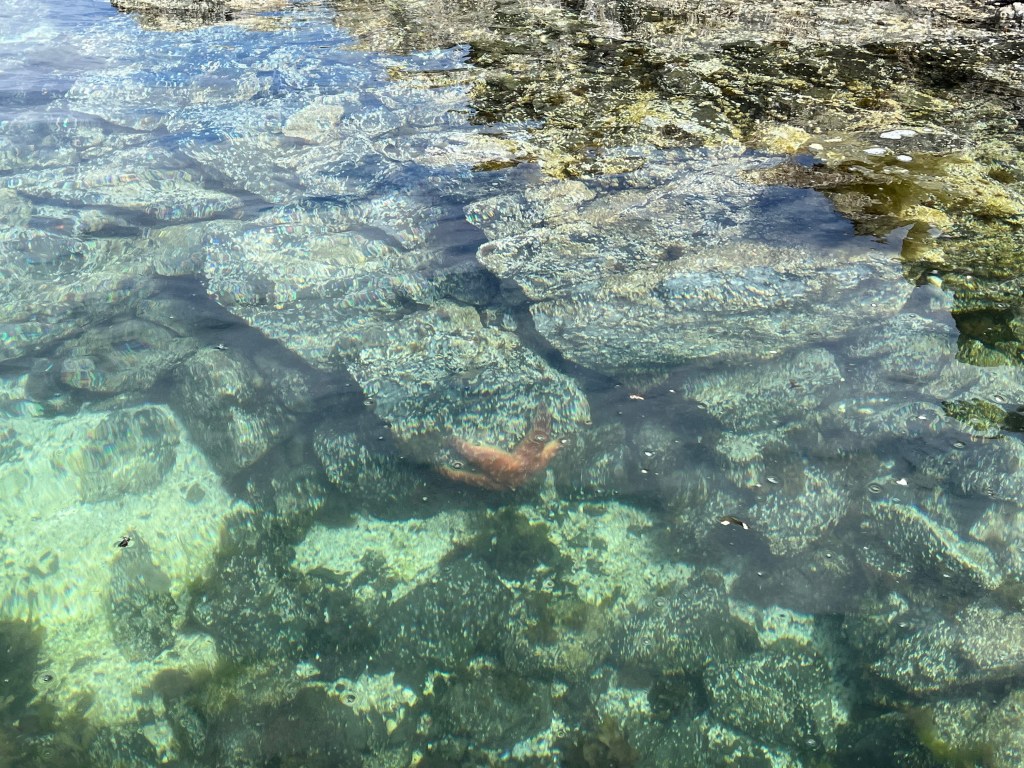
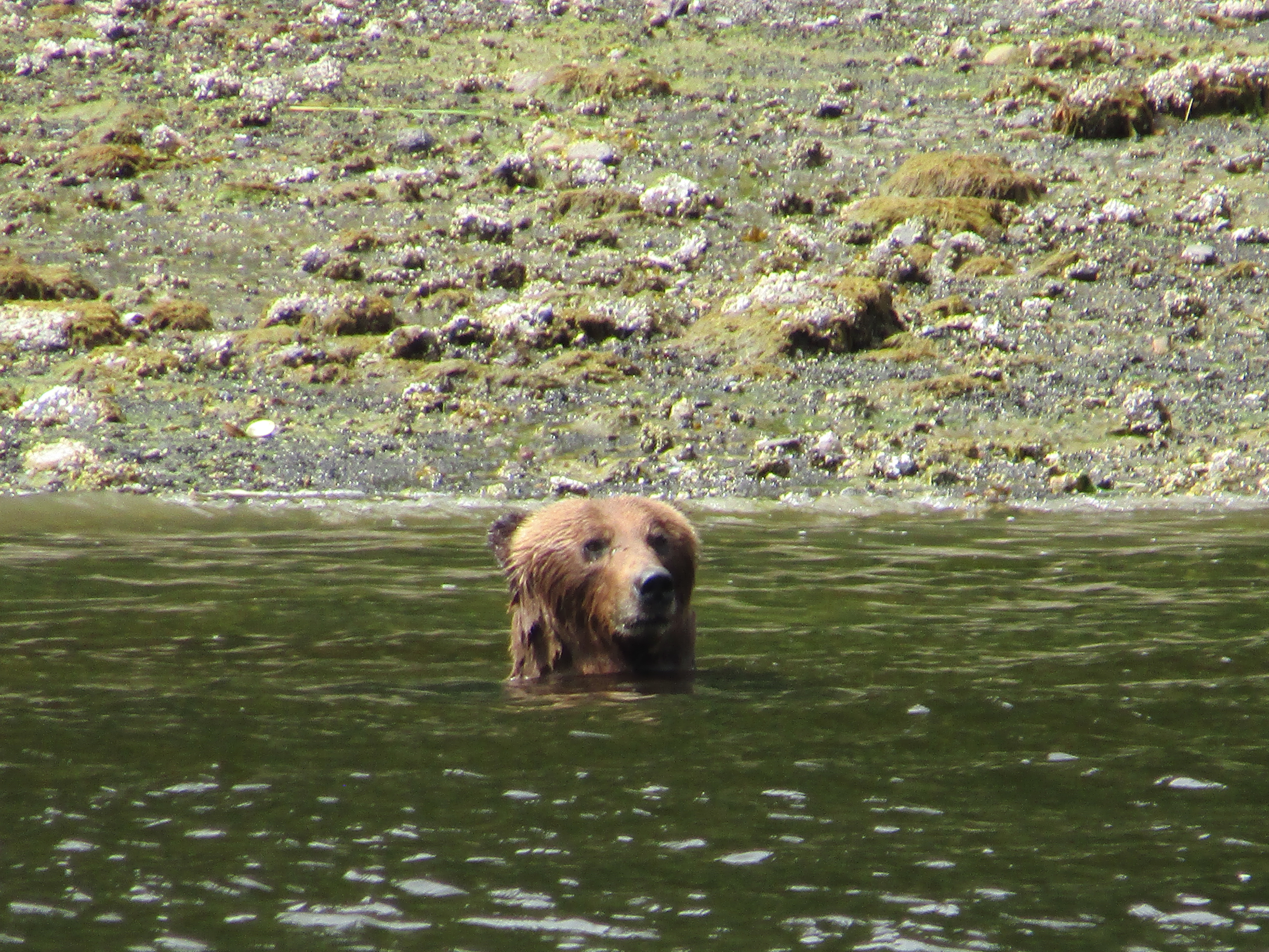
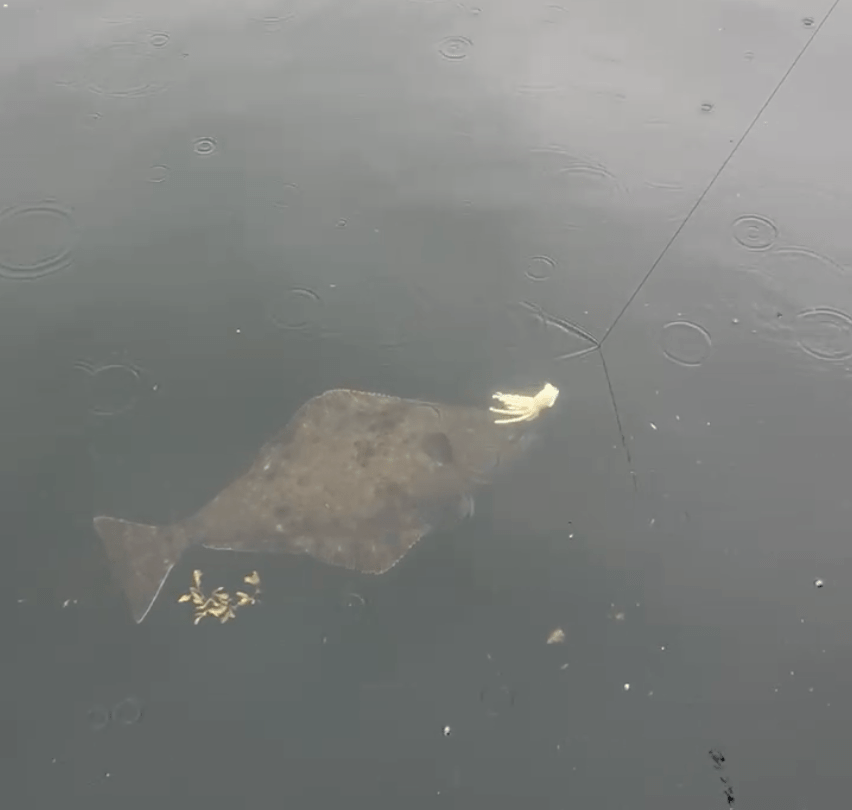
One thing we had been looking forward to seeing was a stretch of water called Burnaby Strait or Dolomite Narrows. In the Douglas Guide it had been touted as a “marvelous place to observe marine life” and purported to teem with almost 300 different species of life, and “they calculate that more protein per square meter exists here than any place in the world.” We expected quite a show when we climbed into the dinghy for our transit across this drying strait. We saw two sea stars and several jellyfish, along with lots of kelp with some crab stowaways.
Sea star in Burnaby Narrows
We made it to Gandll K’in Gwaay.yaay (Hotsprings Island) on the 4th of July. We happily stretched our legs on the pleasant hike from the landing beach to the hot springs, then enjoyed a nice soak in a few of the pools.
Skipper
Tuesday morning we were up with the dawn, ready to make our big crossing. This was the next big challenge for the Perception crew, with 50 nautical miles of open water ahead of us. The Hecate Strait has a nasty reputation for brutal crossings in the wrong weather, and I was anxious to see how it would be for us.
We’d picked a day when the swell was predicted to be less than one meter. I checked conditions that morning, downloading the latest GRIB files and checking the current sea and wind state on the Canadian government buoys. All looked reasonable, so we headed out.
We did indeed pick a nice day, and other than being a long crossing it was quite pleasant being out on the water. There was very little swell, and the light wind state meant almost no wind waves building on the surface. As with most of our trip we motored the whole way across in very light air.
We took the most conservative route into Skidegate Inlet, entering the entrance channel near the north end of the bar. I’d had some concern that there might possibly be breaking waves or at least significantly increased swell in the shallows of the bar, and wanted to avoid that. We saw no evidence of this the four times we crossed the bar in and out of Skidegate Inlet, though the wave state was never much worse than 1 meter when we did.
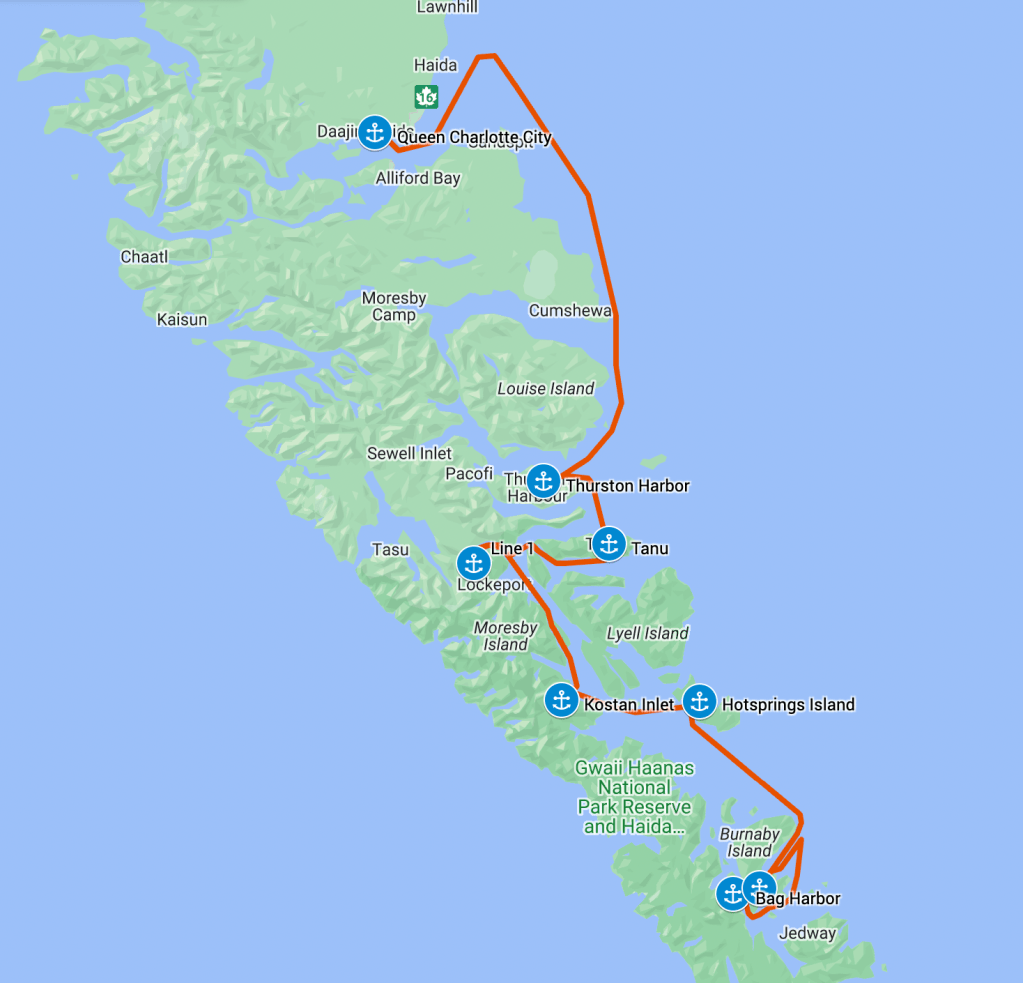
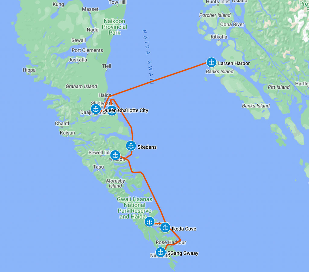
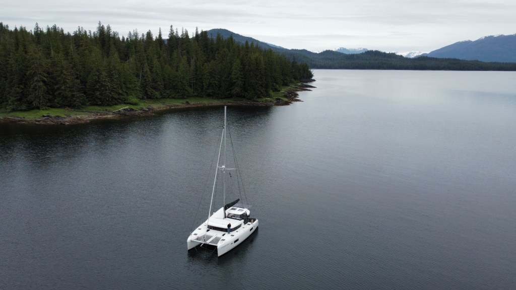
Perception’s route across to Haida Gwaii and south to S’Gang Gwaii and Bag Harbor
We anchored outside of the city marina in Queen Charlotte City. This was a fair sized anchorage with room for quite a few boats, and we ended up sharing it with 5 others by the time we left. It seemed like a crowd after the anchorages we’d been in for the last few weeks.
View from Bearskin Bay off Queen Charlotte City
I wanted to fuel up again before heading down into Gwaii Haanas, since I wasn’t sure where we’d cross back to the mainland. We decided to relocate to Sandspit Marina to fuel up before going south, though in hindsight there was nothing wrong with fueling up in Queen Charlotte City other than their schedule for manning the fuel dock (apparently typically just 4-6pm, we later learned). In any case, we pulled anchor that evening after Melinda and Grace had visited the town and cultural center in Skidegate, and headed down to the southeast corner of the inlet.
View of the entrance to Sandspit Marina from inside
The marina at Sandspit was nice, plenty of space and seemed nearly unused but for local fishing boats. We soon learned why as there was no easy access to stores or restaurants, and no taxi service on that side of the inlet. We fueled up and eased into our slip for the night.
Sandspit Marina
The next morning we headed south towards Gwaii Haanas. We actually had to head north before going south due to the bar across Skidegate Inlet. We cheated and went across the bar just north of the C19 channel marker, cutting about 8 nm off of our trip compared to exiting the channel at its northernmost entrance. I was a bit nervous about what we’d find in terms of depth and wave state, but the charts were accurate and we had at least the minimum 15′ at MLLW clearance the whole way across the shallows.
The bar across Skidegate Inlet
I was also happy that we didn’t see any increase in the height of the swell coming in as it crossed the bar. From the surface state there was really no indication that the bar existed. Of course we were in near optimal weather with < 1 meter sea state, so conditions could be radically different with significant swell.
The first Watchman site we encountered was actually outside of Gwaii Haanas at Skedans on the eastern edge of Louise Island. We found good temporary anchorage (albeit in good weather) just south of the site in the northern part of Skedans Bay. I stayed on the boat for work meetings while Melinda and Grace headed over to the beach in Ghost.
Melinda and Grace headed to the Skedans Watchman Site in Ghost
After Skedans, we headed further south to find our anchorage for the night. We picked Rockfish Harbor on the south end of Louise Island as it sounded like we might find good fishing there. It seemed like most vessels headed south might go for Thurston Harbor as it’s a bit closer to the next Watchman site on Tanu Island.
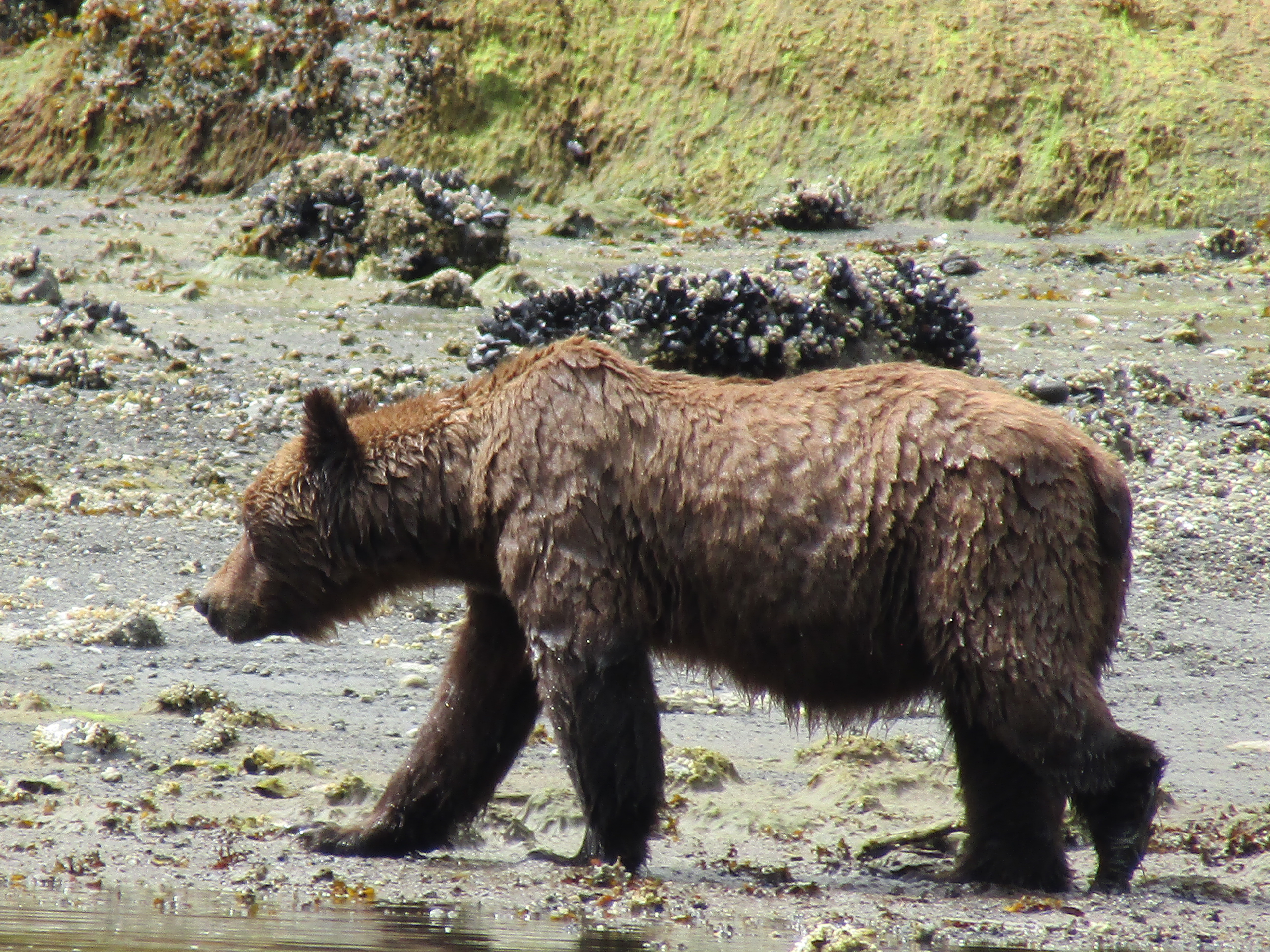
Sure enough, we saw a couple of sailboats heading into Thurston, and found ourselves all alone in Rockfish. As we moved deeper into the inlet to anchor at the head, we saw a black shape on the shore. We’d joked previously about how many “rock-shaped bears” we were seeing on shore, but this one turned out to be an actual gangly juvenile black bear. After anchoring we watched him work his way along shore until disappearing into the trees at the head of the inlet.
We found Rockfish Harbor to be a solid anchorage, with little chop reaching us at the head. We understand that it may be different with a southeasterly blowing in, but for us it was a quiet evening.
The next day we attempted to get into the Tanu Watchman Site, but found that a charter boat with 20 people aboard had beat us to it. Since the Watchman Sites only allow 12 people ashore at any given time, we would have had to wait 2-3 hours to get ashore. We heard another boat call the charter and ask where they were headed, trying to avoid competing with them for access. It sounded like they would be working their way south—so in a pinch decision we decided to head to the southernmost Watchman Site and then work our way back north.
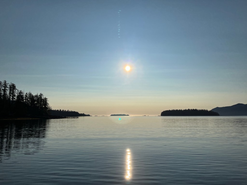
Our relatively short day turned into a long motor down the east coast of Haida Gwaii. Grace did some research and found that Ikeda Cove looked like an attractive spot that would set us up well for getting to S’Gang Gwaii the next day.
Ikeda Cove at sunrise
Ikeda Cove was an attractive, protected anchorage that penetrated deep into Moresby Island. It had an interesting history as a mining site for a company founded by Arichika Ikeda in 1907. At one point a hundred years ago there was a significant amount of infrastructure here, including a large wharf, a number of houses, and a large beached steamer that served as a bunkhouse for the miners. In 2023, all we found were a few rotting pilings and a rusty rail or strap that had been pulled up out of the ground. Other than some obvious mining scars on the hills, nature quickly reclaimed the cove as her own.
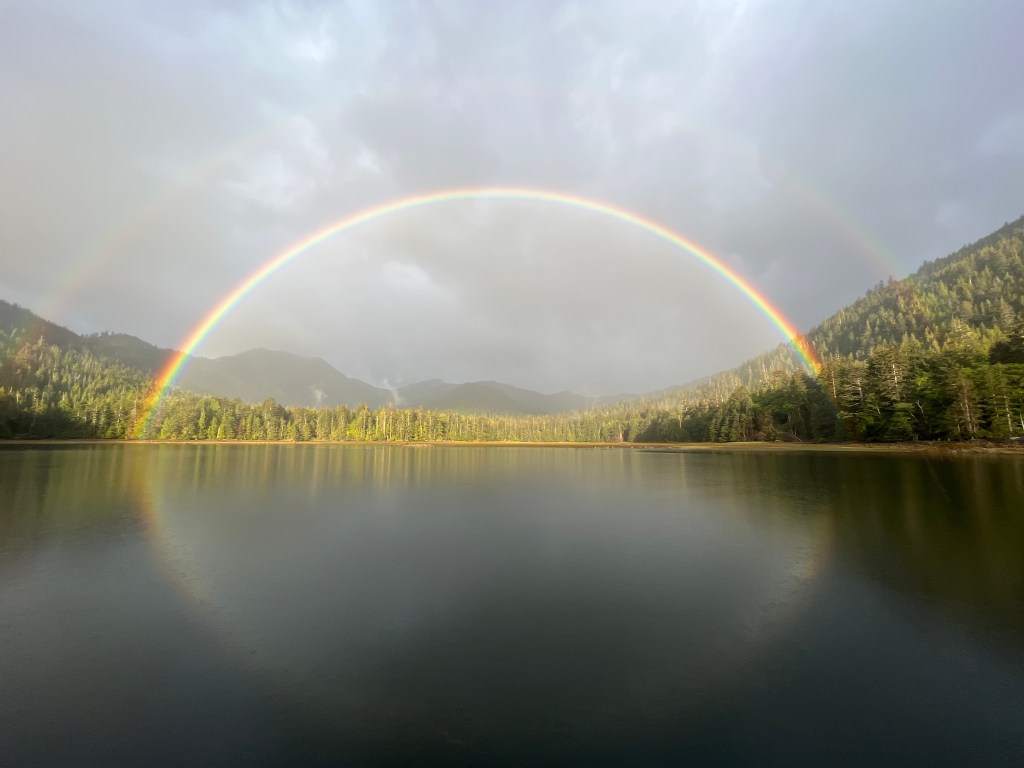
Triple rainbow at Ikeda CoveA flower ashore at Ikeda Cove
I had been stressing about getting down to the southernmost Haida site at S’Gang Gwaii, since it was both exposed to the Pacific Ocean and required us to go out into the Hecate Strait to get around Benjamin Point on Moresby Island. I was worried that the forecast called for increasing winds over the coming days, and we’d get ourselves trapped down in Rose Harbor for a week waiting it out.
At one point that morning we’d convinced ourselves that we should play it safe and go north, waiting for better weather to head down to S’Gang Gwaii. We headed out of Ikeda cove with this intention, but on entering open water we discovered that the swell was not bad at all, and winds were manageable. We decided on the spot that we should probe further south to see how bad things might be.
How happy I am that we made this decision, as we had a pleasant journey down around Garcin Rocks, pulling in close to ogle the sea lions that congregate there. We heeded the warnings about the inshore passage between Moresby Island and Garcin Rocks, worried about the tide rips that would form there and the “local knowledge required” moniker on our Navionics charts. We passed the rocks near slack tide and I had some regret that we didn’t just do the inshore passage to save time.
Grays Cove provides southern access to S’Gang Gwaii—we used the eastern of the two small beaches to land our dinghy
We had called the S’Gang Gwaii site on our VHF as we passed Rose Harbor and they reported that the swell was less than a meter. As we exited the west end of the Houston-Stewart Channel to cross to Anthony Island, the ocean swell started to pick up. As promised it was not high, and we had a very comfortable jaunt that day. My uncertainty as to the conditions was more stressful by far than what we actually experienced.
Since the wind was blowing from the northwest, we tucked into Grays Cove just south of the Watchman Site. We called in and the Watchmen said they would meet us at the beach on the north shore of Grays Cove. I was a bit nervous to leave Perception anchored there, but found the holding to be fine and the cove mostly sheltered from the wind.
After visiting the site, we retraced our path back through the Houston-Stewart Channel, around Garcin Rocks, past Ikeda Cove, and into the narrows between Moresby and Burnaby Islands. There we entered Bag Harbor, and dropped our hook after a very long day.
Bag Harbor at Sunset
Bag Harbor was a great anchorage, with a relatively shallow, muddy bottom that provided good holding. There was another sailboat in the bay when we arrived, but another twenty boats could have easily fit in. We decided to stay for two days to rest and recuperate after multiple days of pushing hard from Prince Rupert. On our day of rest we took Ghost up into Burnaby Narrows — both to see the sea life and to check out what it might be like to pass through on Perception. Needless to say, we decided to take the long way around Burnaby Island.
Having seen what we came to see in Misty Fjords, it was time to turn our attention to the capstone of the trip – Haida Gwaii. We pulled anchor on Friday the 23rd and headed south towards the US-Canada border. As with our trip north, we’d stop in Foggy Bay on the way south to break the trip into two manageable legs.
Perception’s route from Misty Fjords to Larsen Harbor
As we exited Rudyard Bay, we cruised across out of our way to catch a glimpse of New Eddystone Rock, which was named by George Vancouver for its resemblance to the Eddystone Lighthouse off of Plymouth, England. The rock was formed is a basalt intrusion that erupted as the ice sheets melted off at the end of the last ice age, approximately 15,000 years ago. As the Earth’s crust underwent isostatic rebound, cracks formed in places allowing basaltic magma to intrude from below. New Eddystone Rock is the only such intrusion to show above the waterline, others having been eroded by wave action. Given that the original intrusion was likely conical, it’s amazing that so much has eroded in just 15 millennia, a very brief period in geological sense.
Foggy Bay didn’t disappoint as a place to stop. As an anchorage it is a wide, mud-bottom bay with about 30′ depth throughout. Great holding, and you can see out into the Revillagigedo Channel through a gap. The only downside is that some swell will enter the harbor through this gap at high tide, but it’s not all that bad.
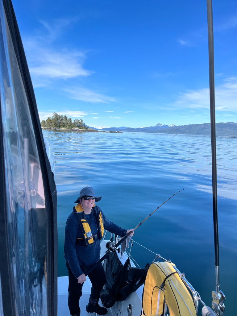
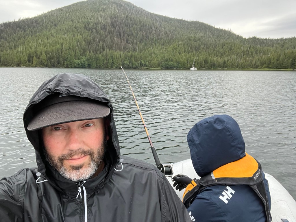
Looking towards the entrance to Foggy Bay, Melinda and Grace fishing in the distance
We saw a family of black bears again, at least the mother and two cubs. Perhaps the same family we saw on our way north. We also ran into Eric and Wendy of Escape, who had been on our LeConte tour with us and were also headed south. We were both planning to cross the Dixon Entrance back to Prince Rupert the next day, and agreed to meet up there for a cocktail.
The next day we left early in the morning, about 5am, just a bit after Escape had pulled anchor. The swell wasn’t predicted to be all that bad, but motoring out of the bay we encountered some waves in excess of two meters, which build as they approach the shallows. We pounded through these at low speed, trying to prevent the bows from crashing into the following waves. Once we reached deep water the wave state became more acceptable and we moved faster to the south.
As we entered open water at the Dixon Entrance I was struck again at how the current predictions did not match reality. At least this time it was in our favor – NOAA predicted a strong westerly current that we’d have to crab against to clear the east side of Dundas Island. This current was virtually nonexistent, and we made better time that I had expected.
As we were approaching Prince Rupert near slack tide, I was more confident going through Venn Passage as a shortcut. As usual, I was underwhelmed by the difficulty – the passage was well delineated with channel markers, and plenty wide to pass traffic headed in the opposite direction without concern.
Perception in the evening sunlight at Cow Bay Marina in Prince Rupert
We soon saw Prince Rupert before us, and pulled up to the customs dock at Cow Bay Marina to clear in. It took a bit longer to get through compared to our entry earlier in the spring, presumably more traffic into Canada this time of year. We made a quick trip to the fuel dock, and settled into our slip for the evening – this time inside the breakwater. It was a much better position than we had outside the breakwater on our way north, and this time we watched a motor yacht on the outside take the beating from incoming wakes that we had experienced then.
We met up with Eric and Wendy, and had a wonderful time chatting with them over drinks and dinner at Breakers Pub. It was really our first time socializing with other cruisers, and it was great to hear of their experiences, especially as they had been cruising the BC coast for years. The next morning I met up again with Eric and he showed me a few recommendations for stopping on the way back south. He and Wendy also invited us to stop by and see their farm on Thormanby Island on our way south.
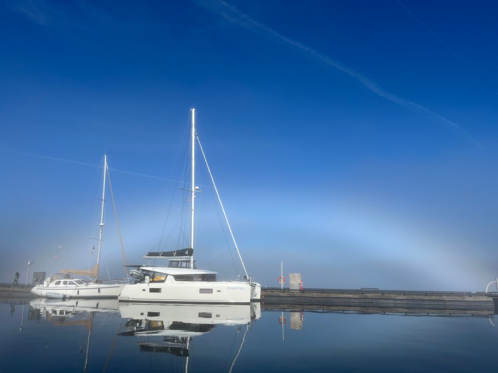
Fogbow at Cow Bay
We stayed a couple days in Prince Rupert to reprovision and clean. Sunday morning a fog had rolled in, and the rising sun created an interesting fogbow that was fun to photograph.
Monday we headed south once more. The forecast was showing that we would have settled conditions for a crossing on Tuesday, and possibly also Thursday or Friday. As conditions Tuesday looked best, we decided to make the dash to set up for the crossing.
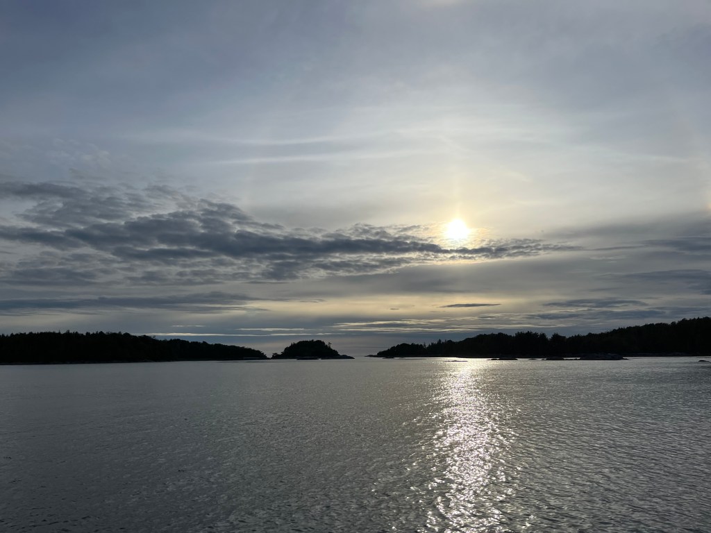
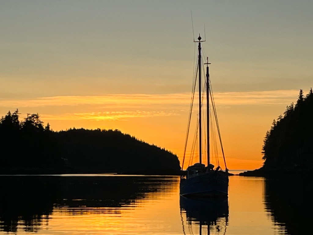
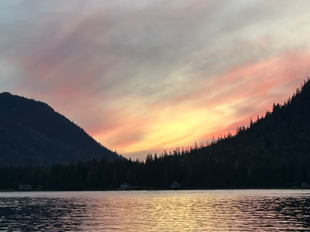
Looking out towards the sun sinking over Haida Gwaii from Larsen Harbor
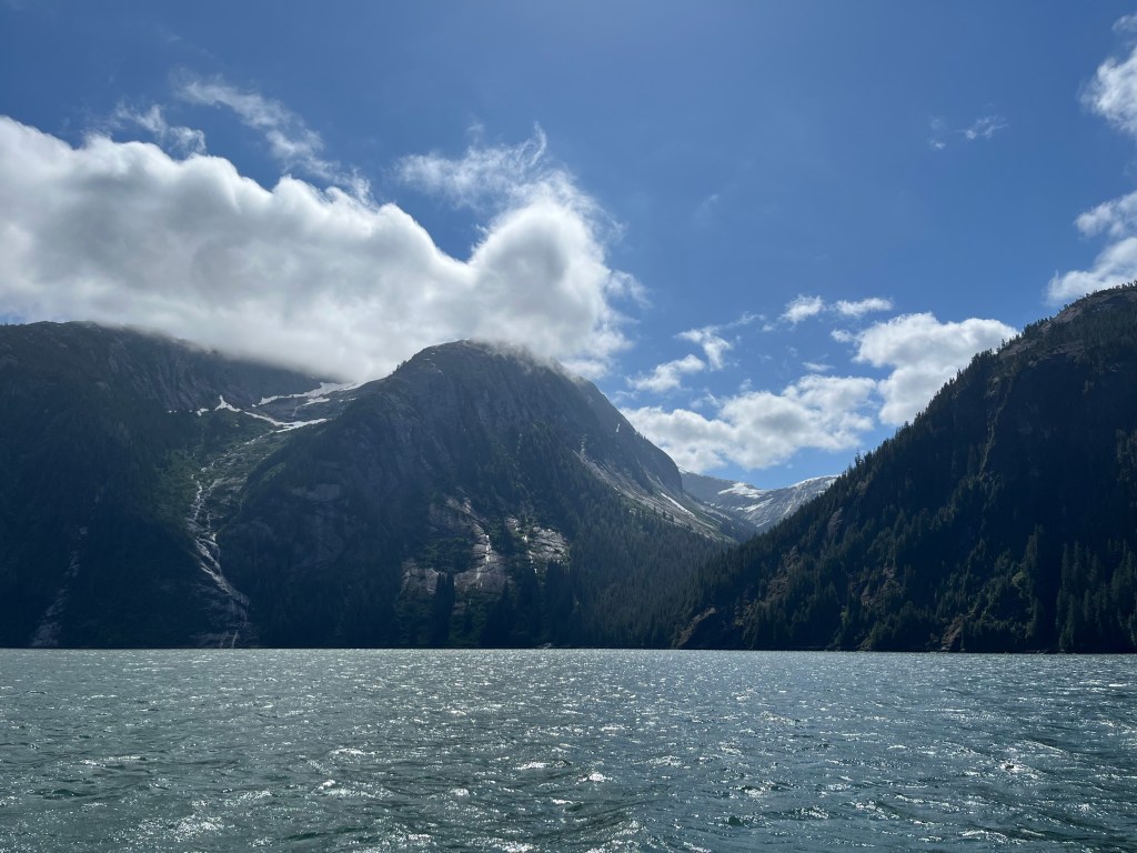
We headed to Larsen Harbor, a narrow inlet on the north end of Banks Island. This would put us as close as possible to the start of the shortest crossing of the Hecate Strait to Skidegate Inlet on Haida Gwaii.
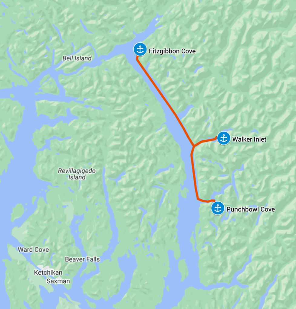
After a pleasant evening in Fitzgibbon Cove we were ready to move into the more majestic sections of the Misty Fjords. The weather forecast promised settled weather and I thought we’d be cruising out on an ebbing current southward. Should be an easy, fast run down to Walker Inlet.
Wrong on both counts! As soon as we turned back out into Behm Canal we were hit with 20-25 knot winds ripping up the channel. The wind tunnel effect strikes again. I also clearly didn’t understand how the current flows in the Behm Canal, and we found a strong current flowing northwards against us during the ebb. All in all, it made for a miserable slog beating up the channel under motor, running slow to avoid pounding.
Perception’s route in Misty Fjords
The current direction was clear as we passed the inlet where the Chickamin River flows into the Behm Canal. The outflow was light colored from the silt, and was moving northwards on the ebb. The distinct line in the water was striking.
Outflow from the Chickamin River
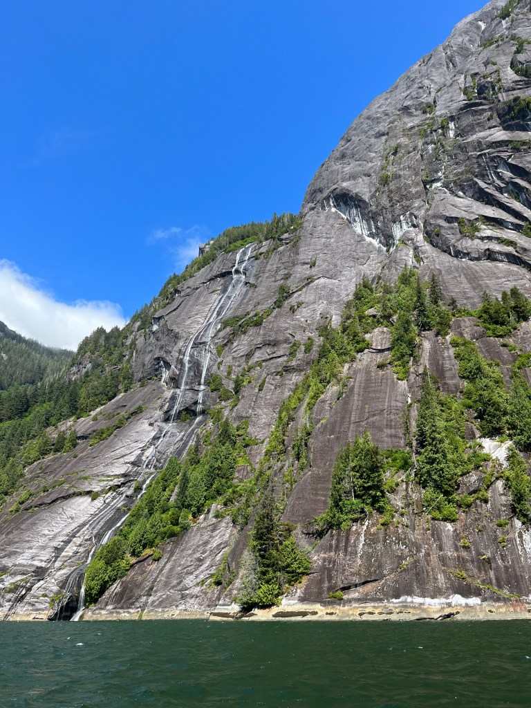
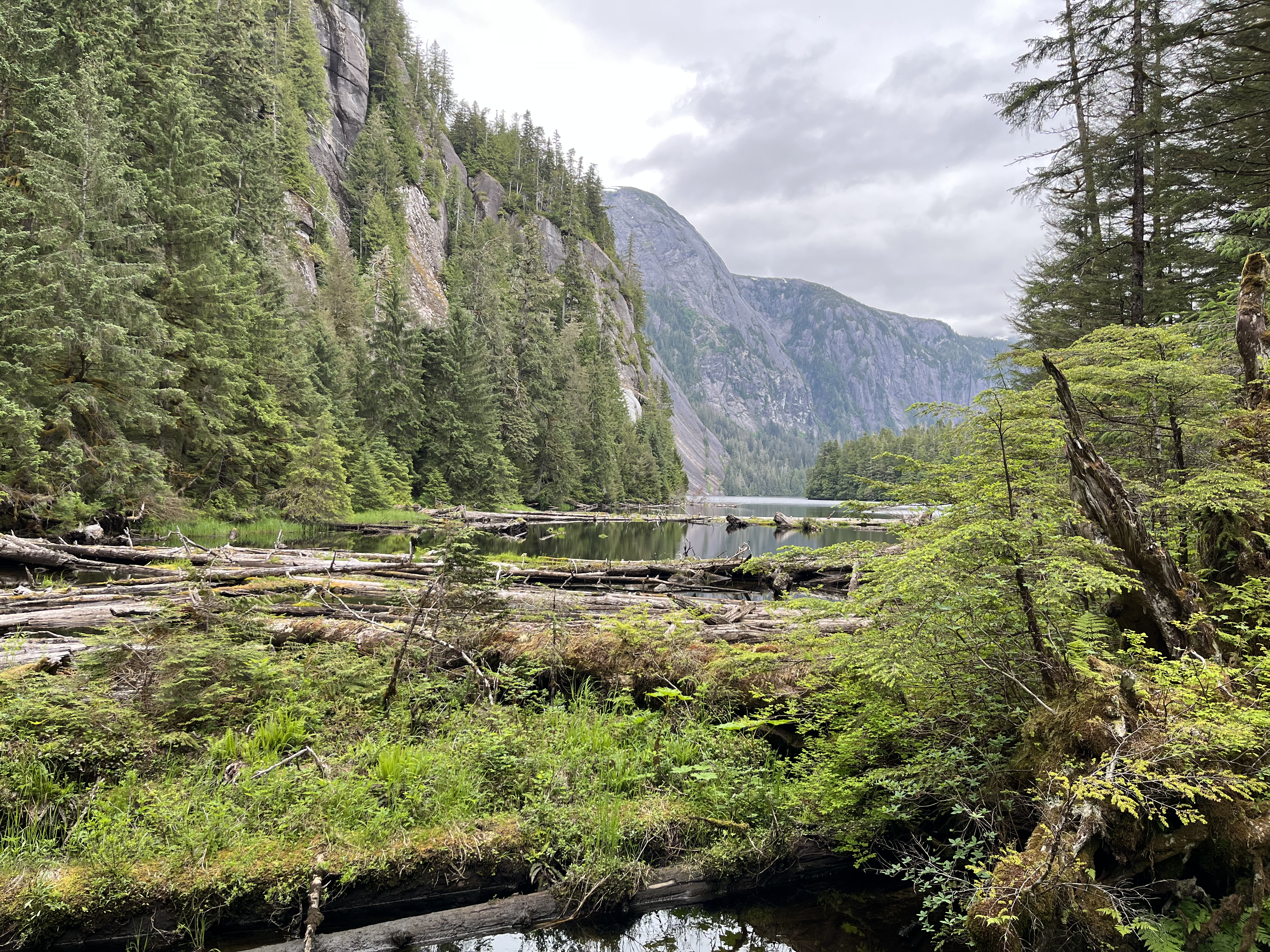
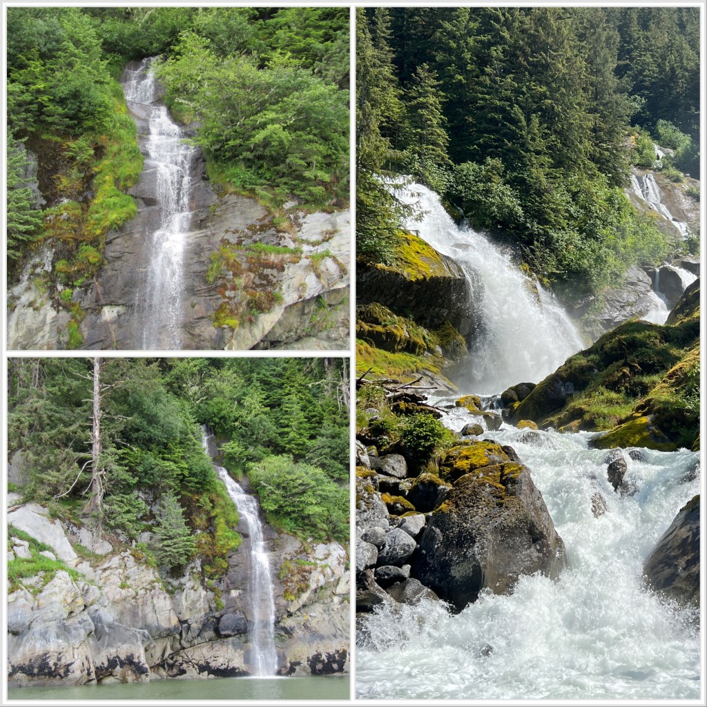
The tension reduced significantly as we turned into Walker Inlet, and had relief from the wind and current on our nose. Cruising up the fjord was magical. Many of the massive granite cliffs had waterfalls streaming down like pieces of white yarn. The sheer cliffs plunged directly to the water into depths of 500-900 feet below the surface.
Walker Cove waterfalls
The glacially carved hanging valleys above us were often capped with snow, feeding the waterfalls below. Clouds clung to the tops of the cliffs like grasping hands from above.
Scenery in Walker Cove
Our challenges returned as we moved into Walker Cove, a bight on the side of the inlet relatively close to the head. Anchoring here was purported to be challenging, and the one parks department mooring ball was the recommended place to stay. As there were no other boats in the inlet, we went for the mooring ball.
The “ball” was more of a “tire”, painted white with a big steel hoop affixed to the top. We couldn’t reach this from the bow of the boat, so backed in and grabbed it from the stern. The wind was still quite high at this point, and I was helping pilot in between meetings. Once we snagged the ball and secured it to an aft cleat on Perception, I returned to meetings and we rested for a bit.
Once my meetings ended, we went back at the mooring. We really wanted to be tied at the bows with a bridle, but also didn’t want to let go of our existing connection in the wind. We slowly worked the connections around to the bows by taking a line to the midship cleat, then to the bows, and finally to both bows. It was an arduous process that took about a half-hour to complete, and we were exhausted by the time we were settled in correctly.
In hindsight it likely would have been better to just hang by the stern until later in the evening when the wind died, but it wasn’t clear at the time that the wind would subside. Given my failure to predict both current and wind that day, my confidence was at a nadir…
Perception on the mooring buoy in Walker Cove
As the wind began to subside in the early evening, the cove became quite pleasant. We were able to hear what we think were bears in the trees to the east. Something growling and groaning in a horrible way in any case. The noisy denizen never emerged from the trees to give us confirmation.
After dinner we took Ghost (our dinghy) up the small stream coming into the cove. We couldn’t get very far in before it turned into small, rocky rapids, and we had to turn back.
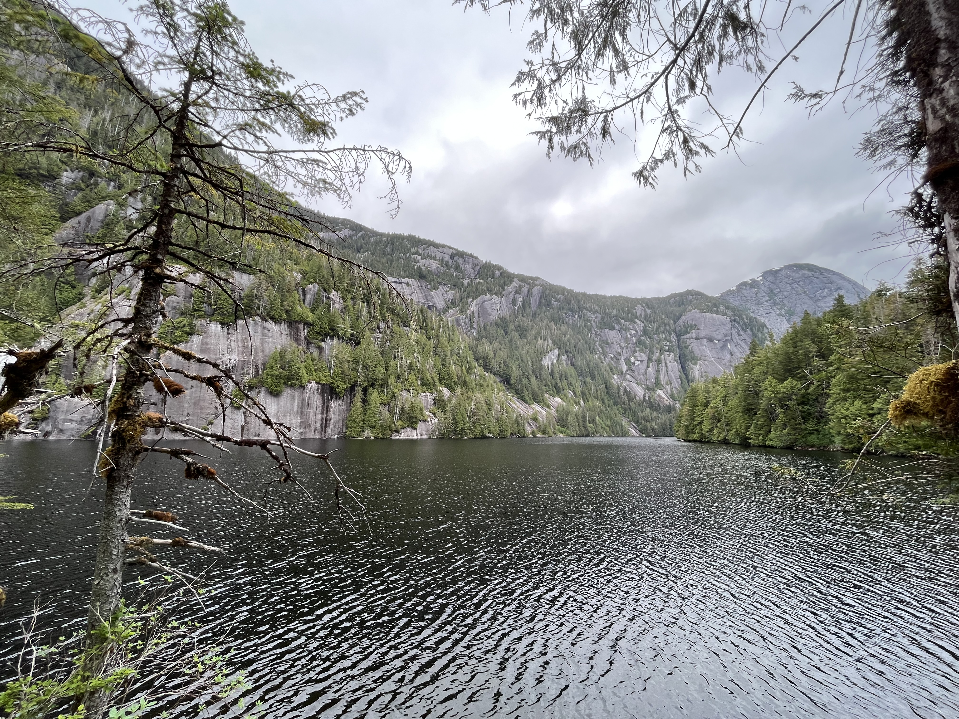
I was stunned by the majesty of Walker Cove, and even more so by the isolation. We didn’t see a single other boat here while we stayed, and no airplanes overhead. It was like we were in Yosemite, but on the water with the whole place to ourselves.
Perception in Walker Cove
The next day we moved south to Punchbowl Cove. Upon entering we immediately felt the oppression of humanity returning. There was another boat in the cove!! And on the single mooring ball to boot. Anchoring was not such a challenge here, so we dropped our hook near the outflow from the streams at the head of the cove and settled in.
Smile for the Punchbowl!
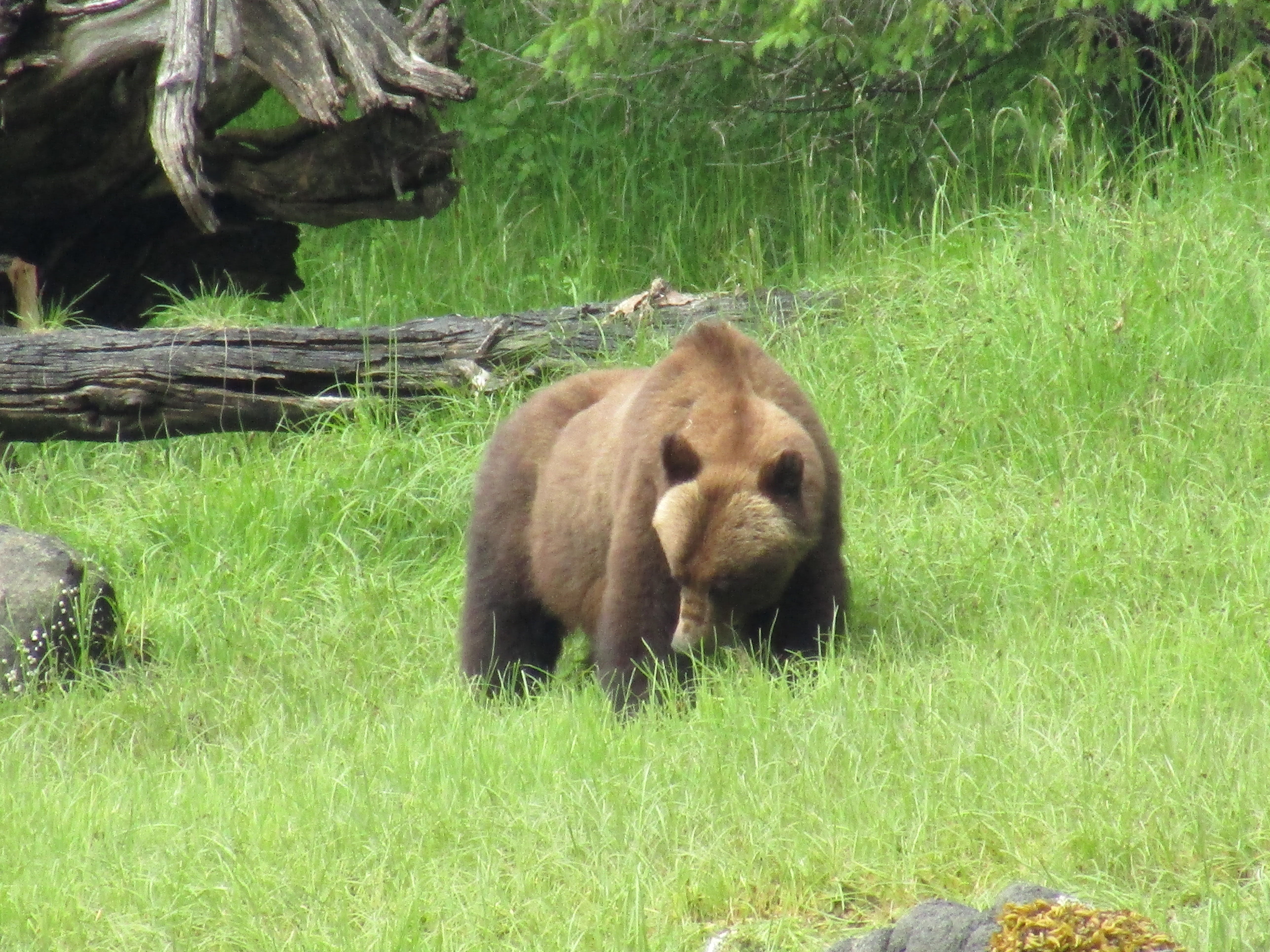
Before long we noted that there was a dinghy ashore. A couple from our neighbor boat were soon aboard and paying us a visit. They pointed out a grizzly on the shore nearby that had just emerged from the trees, apparently a daily visitor. The couple had been looking for the trail to Punchbowl Lake, a presumably short hike with a steep climb to the lake perched above the cove. As they had found more bear signs than trail, they decided to give up and move on to their next anchorage.
Melinda heads out to fish in Punchbowl Cove
The couple told us they would be leaving soon, so we could take the mooring ball once they were off. Melinda decided to head out to fish from the dinghy, and would tie to the ball until we could move Perception over. This worked out well as I was in meetings most of the day, so we could take our time getting over to the ball without worrying about another boat coming in to take it before us. It also allowed Melinda to loop our mooring lines through the ball from the dinghy, and we could tie off directly to the bows without the shenanigans of the day before.
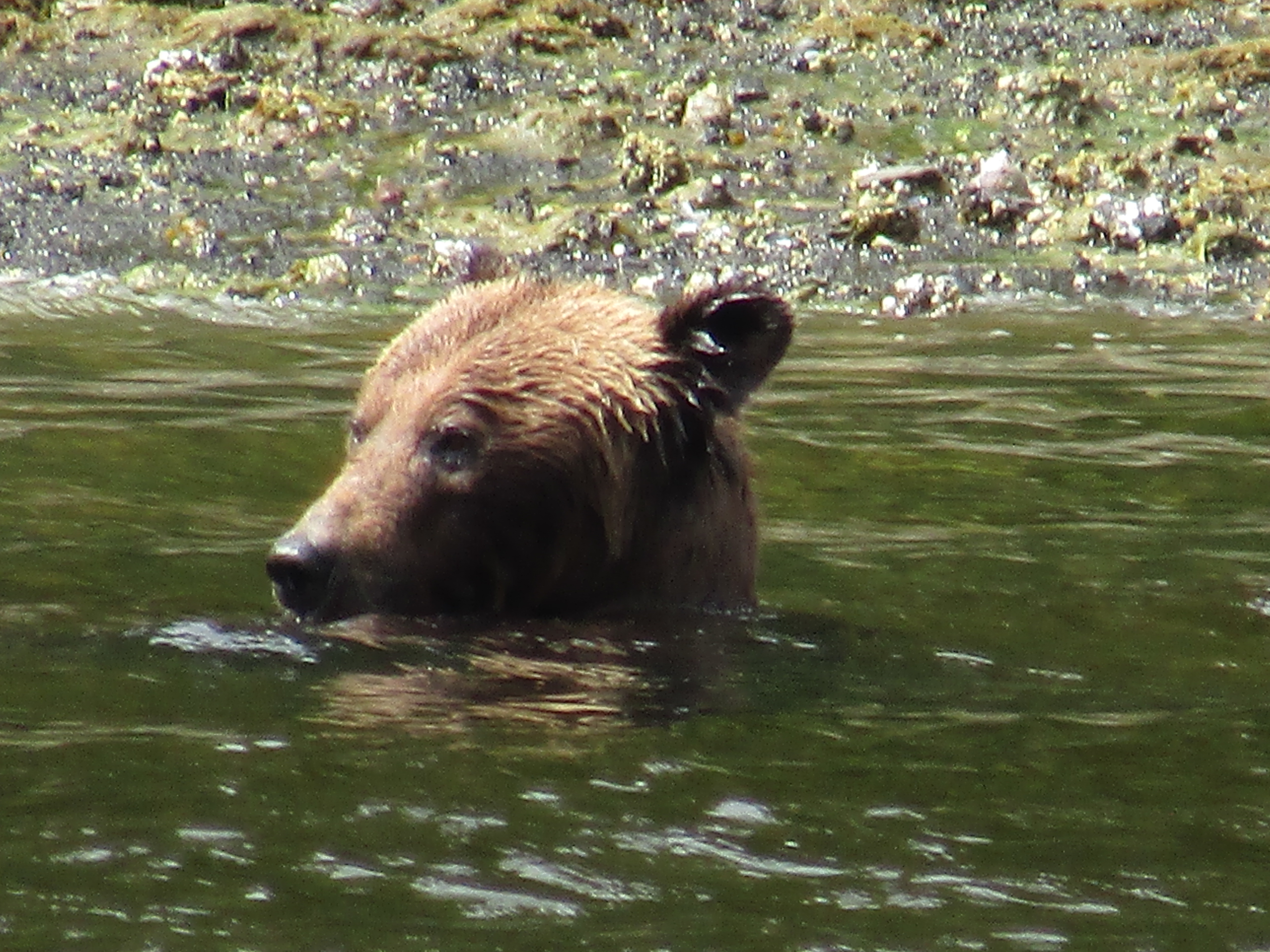
We took a number of pictures and videos of the resident grizzly. We were a bit startled at his move into the water, but it appeared he only had interest in the shallows. His apparent bulk was greatly reduced by his bath, though even when wet his size was formidable.
Once work was over for me, Grace and I decided to try our luck with the trail to Punchbowl Cove. We hadn’t stretched our legs for a while, so thought it would be fun. Melinda was the smartest of us as usual, and declined as the description of the trail was a “challenging scramble.”
Grace and I located the trailhead without much trouble, but also saw the paw prints and scat piles left by bear or bears. As we figured the resident bear was up on the other side of the cove, we proceeded with caution. We were equipped with our bear spray, the air horn from the boat, and an annoying proclivity for singing obnoxiously (mostly me) in a loud voice. Our intent was to alert any bear in our path to our presence well before it became a surprise.
The trail was indeed brutal, but Grace and I soldiered on. The trail had been nice at one point, with wooden steps and handrails at the worst places. These features were now reduced to rotten and missing planks, often with rusty nails remaining to bite ankles as you passed. It was indeed a scramble, and about all we could do to pass with our atrophied bodies after weeks on the boat.
The worst section was about two-thirds of the way up. A rockfall had pushed down trees to cover the trail, and we had to pick our way carefully through across a steep slope. Any misstep could have led to a painful fall down. Definitely not the best USFS trail we have been on!!
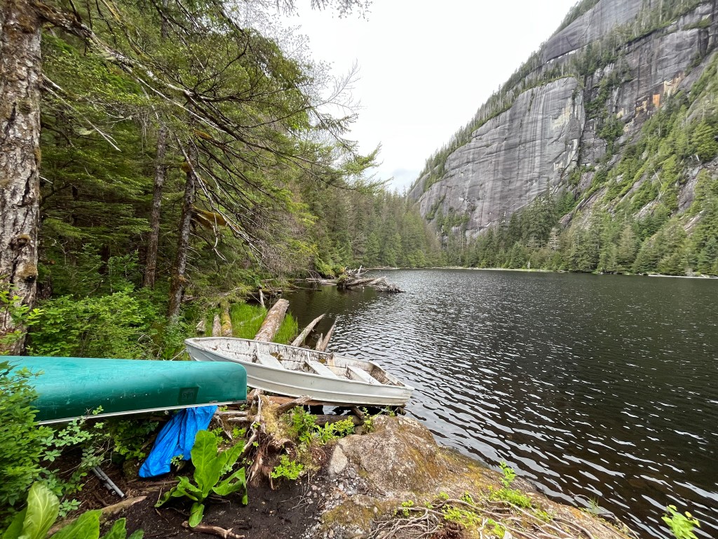
We finally emerged into open air again as Punchbowl Lake opened before us. We decided we really must find the boat house that was described in the park documentation. We trudged on along the lake shore, with the trail sinking into muddy soup every so often. Grace submerged a foot more than once, with the black mire sucking off her shoe before she could extract her appendage.
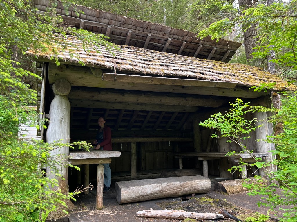
Grace signs the logbook in the Punchbowl Lake House
Eventually we found the lake house, which was a three-sided structure that was fairly well intact. It had not yet returned to the forest as much of the trail had. Inside was a deteriorating log book, so Grace put us down as “highly recommends” – actually writing “we survived”.
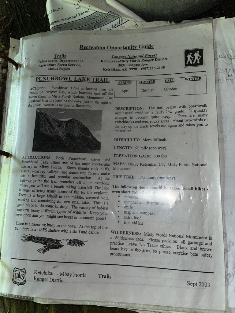
The log book also humorously contained more information about the trail than I’d been able to find online. Given our extreme fatigue after reaching the lake, we both sneered with sarcasm at the title “recreational opportunity guide”.
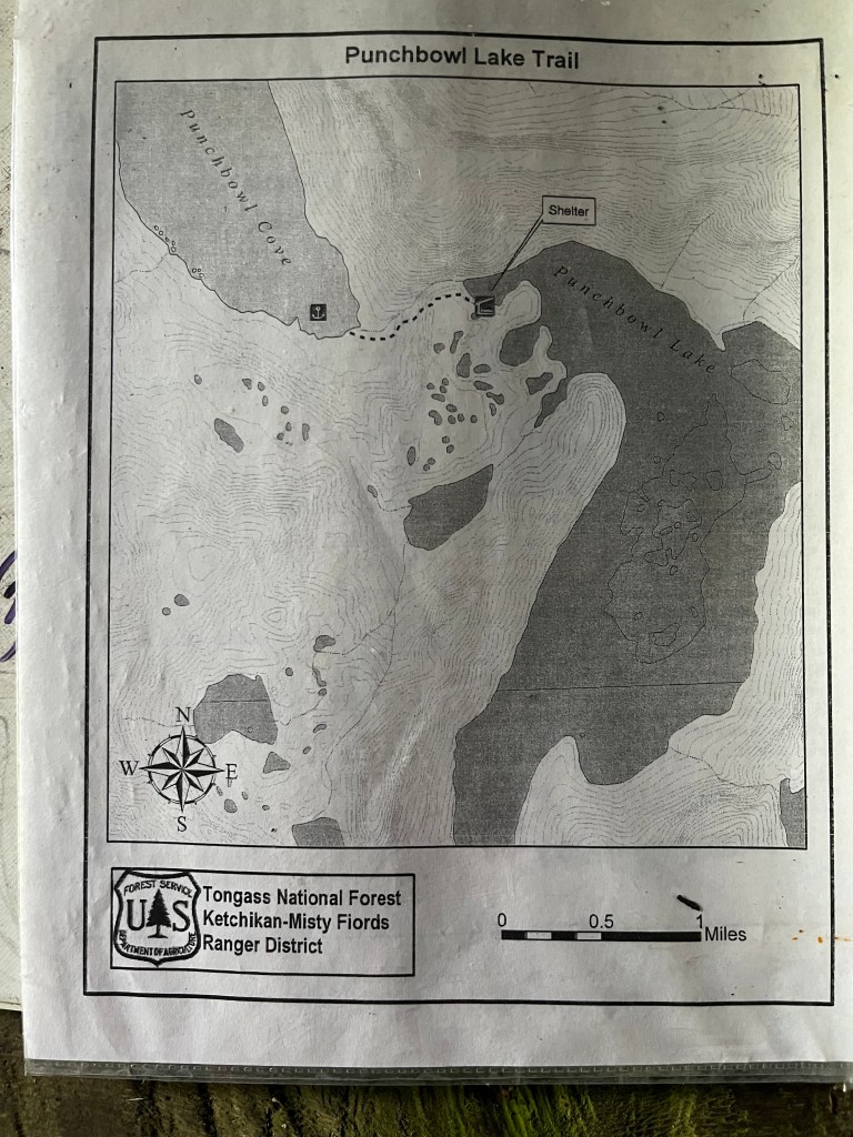
Map of the Punchbowl Lake TrailRecreation Opportunity Guide
Amazingly the lake house even included a canoe and a dinghy for exploring the lake. If we’d had triple the constitution and time, we might have tried taking one out. There were also oars stowed in the lake house.
Boats to use on Punchbowl Lake
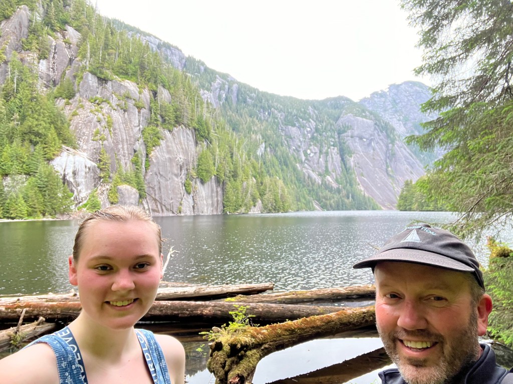
I immensely enjoyed my time with Grace, challenging ourselves to reach the top. Little did we know that the real challenge was just beginning!
Weary walkers at Punchbowl Lake
As we began our descent, the extent of our fatigue became apparent. We were both quite tired and the way down was really no easier than the climb up. Singing at the top of our lungs to the mortification of the local bear population, we picked our way carefully along the trail, trying not to slip or step on sinking ground.
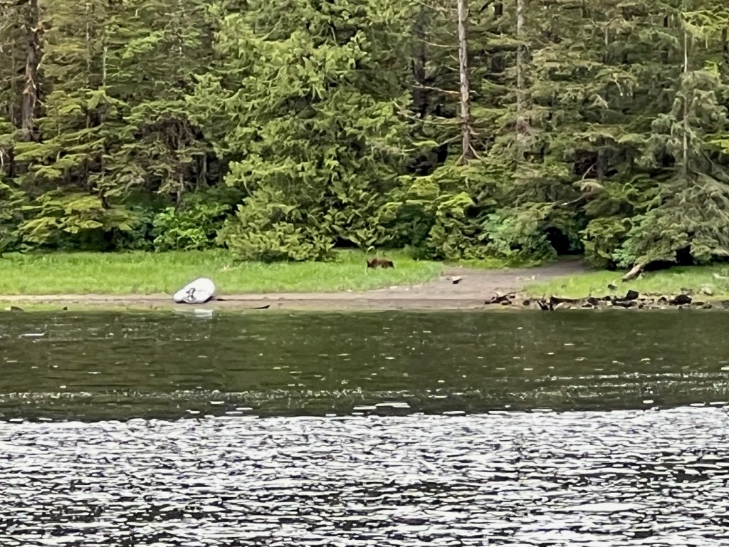
We’d brought along our handheld VFH to check in with Melinda, and called her once we had eyes on the cove from above. We were startled to learn that Mr. Bear from earlier in the day had made his way to the dinghy, and was now munching away on the sedge grass nearby.
Grace and I redoubled our efforts to make noise as we descended the rest of the way down the trail, getting our air horn out to sound the occasional blast in time with “Oh a Hunting We Will Go.” Melinda let us know by VHF that our efforts were in vain, and the bear had moved even closer to the trailhead where we would emerge onto the shore.
Mr. Bear near the dinghyMoving closer to the trailhead
Finally, when we were about 100 meters from the trailhead, the bear began to move away. The airhorn enhanced singing had finally done the trick, and the bear wanted no part of that. We were quite alarmed though, as Melinda told us the bear had moved “up into the trees”, which was where we were at the time. Luckily he had gone off to the side, so there was no unfortunate encounter between man and beast.
Our final challenge was to get the dinghy back into the water. As we’d been away for almost three hours, the receding tide had left Ghost high and dry. With our bone-weary bodies, we hauled the 500 pound launch down the sandy beach to the water. Our remaining energy was coaxed to the surface imagining Mr. Bear watching us hungrily from the eaves of the forest.
Once back on the boat, we sloughed off our muddy wear into Melinda’s tender care, and took our turns in the shower to remove the sweat and grime. Quite the adventure for us, and so good to be back on the safe, comfortable boat.
Distance on water is measured in nautical miles, and a nautical mile is about 15% longer than a mile. Why the difference? A mile on land equals 5280 feet, while a nautical mile equals one minute of latitude1. It varies from 6046 feet on the equator to 6092 feet at a latitude of 60°. Therefore, 10 nautical miles equals about 11.5 miles on land.
Speed on water is measured in knots. One knot equals one nautical mile per hour, or roughly 1.15 MPH. Perception’s cruising speed is typically 7.5 knots, which converts to about 8.6 MPH. (We travel a little slower than your average skateboarder!)
The term knot dates from the 17th century, when sailors measured the speed of their ship using a device called a “common log.” The common log was a rope with knots at regular intervals, attached to a piece of wood shaped like a slice of pie. Mariners would lower the wood piece into the water and allow it to float freely behind the ship for a specific amount of time (often measured with an hourglass). When the time was up, they would count the knots between the ship and the piece of wood, and that number estimated their speed.1
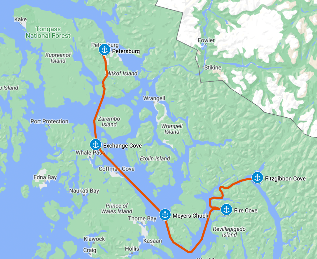
With our successful visit to the LeConte Glacier out of Petersburg, we were ready to turn the boat south. We returned to Petersburg from the glacier Saturday afternoon just about at slack water, so decided to buck the coming ebb into Wrangell Narrows and get some miles behind us that day.
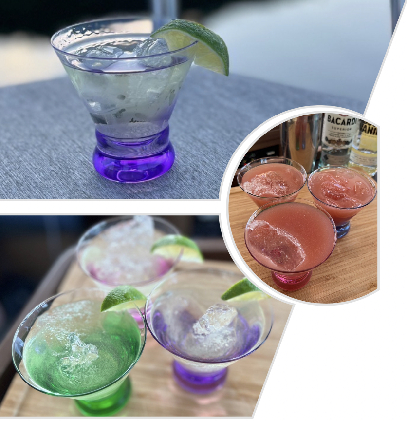
Since the tidal midpoint of the channel was close to Petersburg, we didn’t have far to go before we were sliding down the south side of the channel with the ebb current behind us. Wrangell Narrows was old hat for us at this point, and we again encountered no large vessels or tugs in the channel to cause any concern. We tucked into Exchange Cove on Prince of Wales Island for the evening with one other boat, and enjoyed our first glacial ice cocktails.
Glacial Ice Cocktail in Exchange Cove
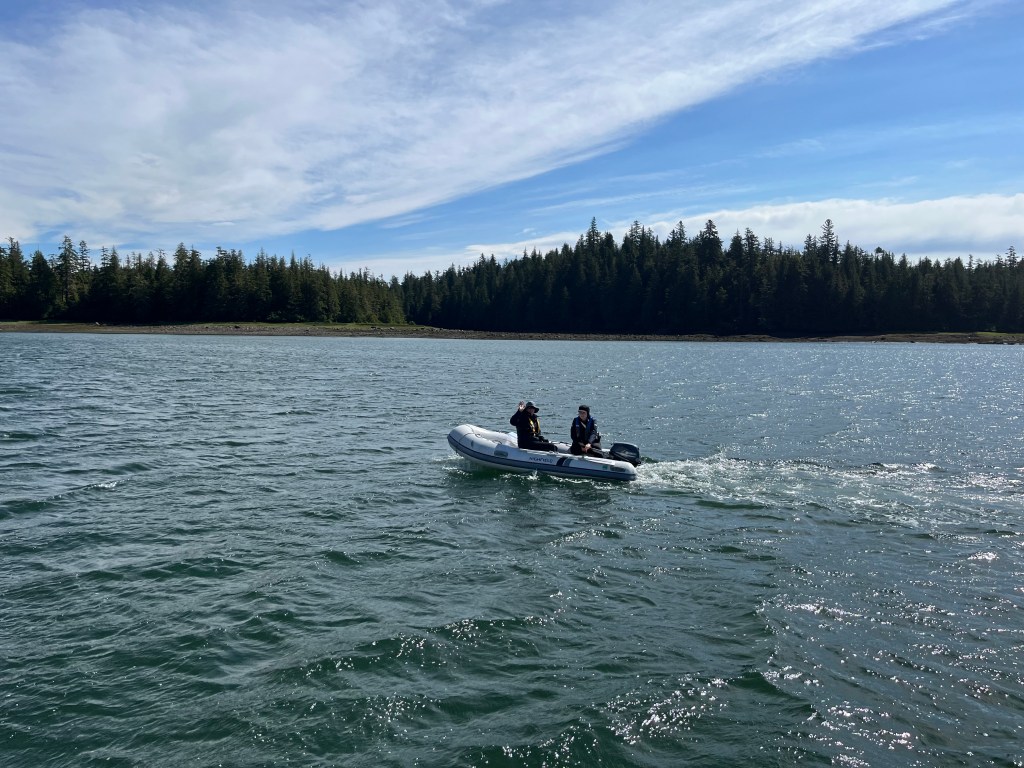
The flood tide being early in the day, we decided to hang out in Exchange Cove for a while and push onwards after noon. It was a restful morning, so Melinda and Grace went out for some fishing from the dinghy while I worked on a few minor boat projects.
Melinda and Grace heading out for some fishing in Exchange Cove
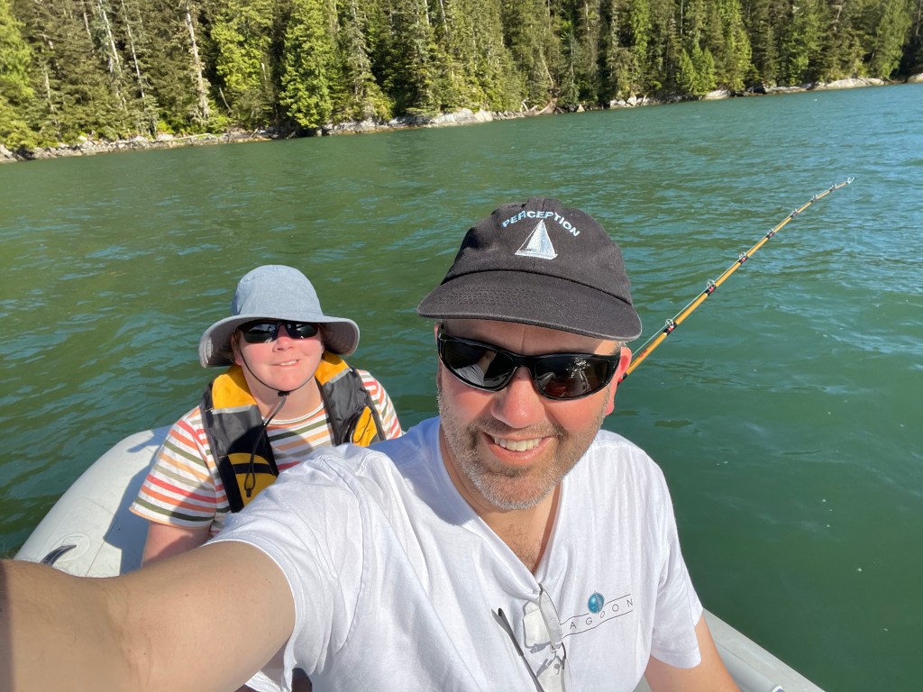
At noon we raised anchor and started making our way south. At the south end of Kashevarof Passage, we paused for a bit to try our luck fishing. Melinda and Grace hadn’t had any luck in Exchange Cove, and we were all eager to try and land a halibut.
Melinda fishing from the boat off the Clarence Strait
We drifted at a few spots among other fishing vessels, sadly losing our favorite lure in the kelp there. Again no halibut, but we enjoyed the peace and quiet of the water. Before we saw them, we began hearing humpbacks blowing as they surfaced in Clarence Strait. The sound would carry for a mile or more across the water. We soon spotted them, and a while later a second group of whales further south. When we tired of fishing, we pointed the bows at Meyers Chuck and motored on.
As we entered Clarence Strait, the whales from the second group surfaced just ahead of us. They were likely minke whales, though we had some discussion that their dorsal fin shape looked more like blue whales.
Meyers Chuck in the evening sun
We pulled into Meyers Chuck as the day started to wane. The entrance to the bay is narrow, and the left/green channel marker seems to be missing in the narrow passage in. It was nice again to have the Navionics Sonar Chart view to guide us in through the deepest part of the channel.
Our neighbor sailboat in Meyers Chuck at sunset
We found a few other boats anchored in the bay, and a number on the docks in front of the community. As it was late, and we were weary from the day, we did not attempt to go ashore.
We pulled anchor early the next morning to catch the ebb tide south, hoping to round the corner into Behm Canal before the flood started. After rounding Caamano Point, we attempted fishing for a while in the waters there but unfortunately snagged and lost our last halibut lure. Sadness ensued…
With heavy hearts and light tackle boxes, we continued north towards our target for the evening: Fire Cove. This little nook is nestled at the southeast end of Neets Bay, which was generally referenced as a good place to fish for Salmon. With a light wind on our aft quarter, we put up the jib and killed the engines, sailing the length of the bay at a couple knots to facilitate trolling. We struck out again, unable to attract any scaled denizens to our complex diver/flasher/lure arrangement.
Neets Bay was fascinating, but not really what we’d hoped to find. During the day a constant stream of fishing trawlers worked the bay with nets. The noise of their diesel engines filled the air, and we soon longed for the quiet of our earlier anchorages.
Nearing the head of the bay, we furled our jib and motored into Fire Cove. As we entered the inner bay, we were surprised to see a new type of aquatic creature – this time a deer swimming across to the islet protecting the cove.
Odd sea life in Fire Cove
Back in Idaho we like to put out salt blocks for the deer to enjoy. Here they can create their own salt licks in the form of a seawater rinse of their fur.
The deer was truly amphibious – it must enjoy a salt bath
After exploring the small inner cove, I felt there wasn’t enough room to swing without a stern tie. Not anxious to clamber ashore, we backed out of the inner cove and dropped our hook in the slightly deeper water of the outer cove, free to swing with impunity.
Fortunately as the evening progressed, the fishing vessels disappeared and left us with peace and quiet again. The bay was scenic, and we continued our search for local fauna.
The view north from Fire Cove
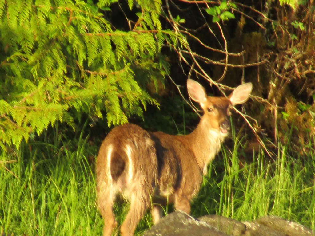
The morning brought out more deer, including some speckled fawns. We believe these are Sitka Black-Tailed Deer.
Deer in Fire Cove
We had enjoyed our long weekend, with my employer giving us Juneteenth off that Monday. As it was Tuesday and another work day, Melinda and Grace were at the helm again. They navigated us up through Hassler Pass and Behm Narrows, taking us in to Fitzgibbon Cove to anchor for the evening. Our intent was to set up for exploration of Walker Inlet and Punchbowl Cove over the next couple days.
View southwest from Fitzgibbon Cove
We dropped the hook near the head of the bay with plenty of room to swing. I’m starting to enjoy putting out 200′ of chain in deeper water that is further from shore, where I don’t have to worry quite so much about swinging into rocks. I keep our flag up overnight as well, which is mounted right above our cabin. I can hear it flapping when the wind comes up, alerting me that we might be getting blown in unproductive directions. I still don’t trust that the anchor alarm on my iPhone will alert me in time to save us from our anchor dragging, and like this other low-tech method to remain situationally aware at night.
Fishing in Fitzgibbon Cove
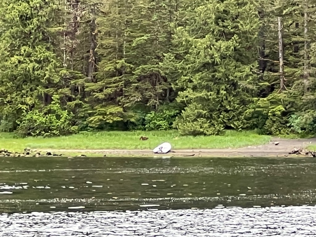
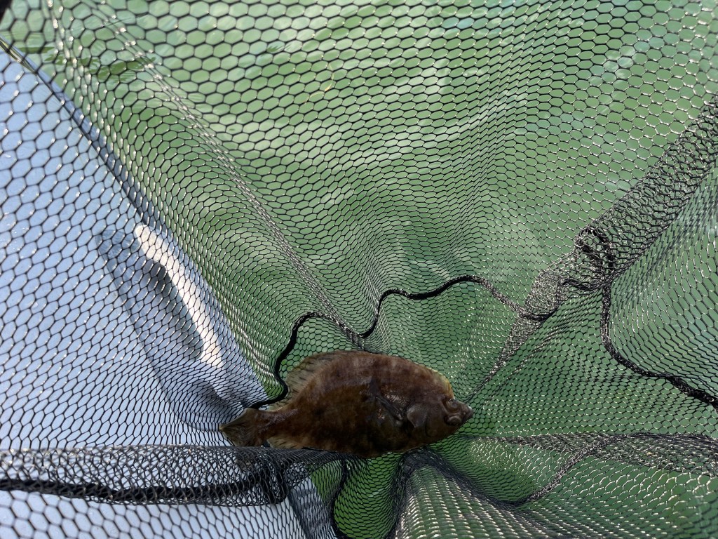
We continued our manic search for a halibut, creating our own halibut rig from a squiddy lure, a wire tie, and a weight. We actually had our first luck with this setup at the entrance to Fitzgibbon, landing a wee halibut that we returned to the deep. Not enough meat on him to feed even a mini-me.
Our first catch! Too small to keep…
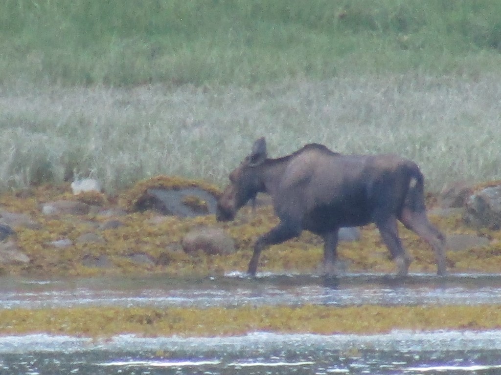
Back at the boat, we had a couple more cruisers come in and drop anchor behind us closer to shore. One of them stopped by to chat, and pointed out a moose in the shallows at the head of the bay. Grace caught this nice photo with her zoom lens from the back of Perception.
Check moose off the list!
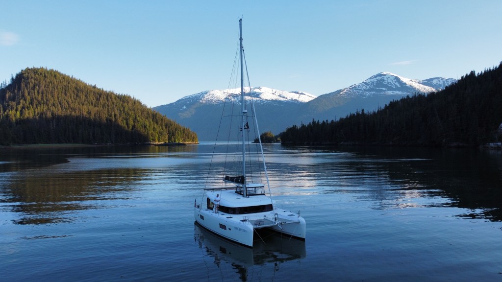
I cracked out the drone as well, and got some shots of Perception with the snow capped mountains in the background. We haven’t tired yet of the beautiful anchorages we’ve found in Southeast Alaska. There is so much to explore! I can see why so many boaters head here summer after summer.
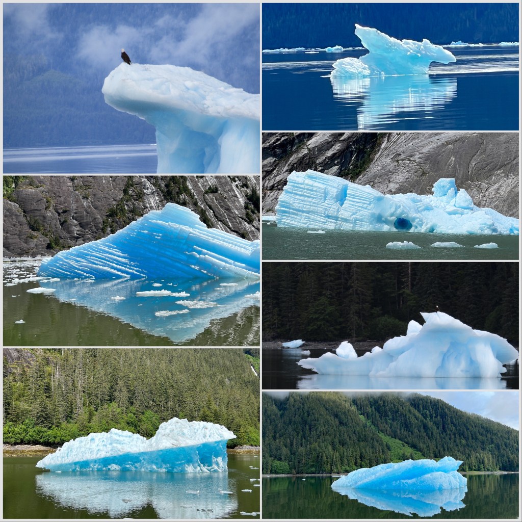
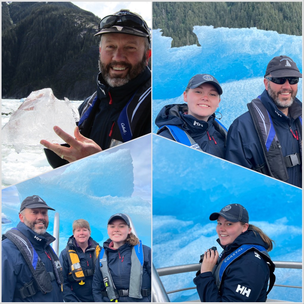
The crew of Perception had some big decisions to make. While we all really wanted to see a tidal glacier, from the get-go we never thought we’d have time to go deeper into Alaska than Ketchikan. Our priority was always to get to Haida Gwaii, but the weather, current and tides had largely been in our favor and we were at least 10 days ahead of schedule. Could we afford a 10 -12 day trip up to one of the southern glaciers? If so, do we try for Juneau and see the Mendenhall Glacier, or venture up the Tracy Arm and see the Sawyer Glacier? Glacier Bay was out of the question, we did not have reservations to enter as we hadn’t planned on getting so far north. There was also a glacier accessible from Wrangell and Petersburg — LeConte Glacier, but the bay is so full of icebergs that fiberglass boats don’t dare venture in far enough to see it. We had inquired in Wrangell about joining an excursion and found out quickly that they are booked well in advance. So we kept heading north, still undecided, when the weather turned. We would be held up in Petersburg for a few days, cutting into our extra time. We couldn’t jeopardize our Haida reservations by going much further north once the weather cleared. After talking with some other mariners in the area, we heard rave reviews about a local Petersburg guide with excursions to LeConte that would not disappoint us. Sure enough, I called Dan at Seek AlaskaTours and he got us booked for the upcoming Saturday, June 17th, and even promised the weather would be clear for us.
As billed, Dan did not disappoint. He and his deckhand, Sage, picked us up from our boat in his aluminum jetboat, Point Retreat, and after stopping for another small group, we were glacier bound. We stopped first at some 8,000 year old petroglyphs depicting a canoe, the sun, and rain, then began the trip into LeConte Bay.
The jetboat flew across the water at about 25 knots, more than 3 times the cruising speed of our catamaran. It was unusual to get where we were going so quickly!
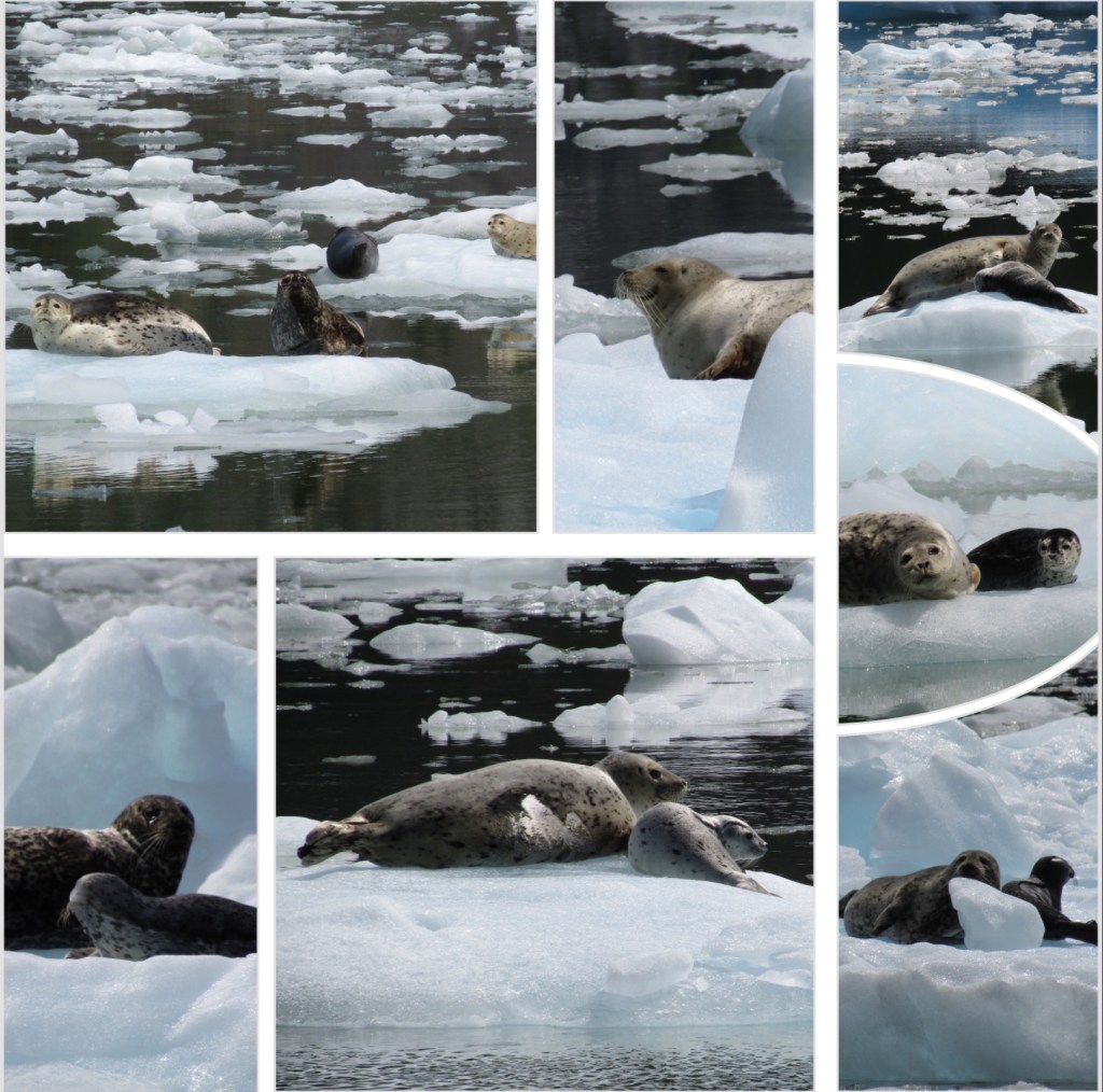
We stopped along the way at photo-op sites like a nun buoy covered in sea lions, a waterfall and some of the more massive icebergs where Dan would nose his boat all the way up to the feature so that we could literally reach out and touch them. This was also very foreign to us as it’s our policy to keep Perception far away from anything solid, while Point Retreat gets as close as possible. Once in LeConte Bay, we were delighted to discover it was calving season for the seals. The mothers give birth to the pups on the icebergs where they are somewhat protected from predators. Some of the pups had been born yesterday, while others were as old as 3 weeks. It was an amazing site. The whole scene was practically sensory overload. The thousands of unique and icebergs glistening in the sun, many with the hundreds of seal mamas and pups, eagles flying overhead, all the while zigzagging through the bergs and inching closer to the glacier which we couldn’t even see yet. Every now and then the hull would hit a smaller iceberg and scrape by others. This was no place for a fiberglass sailboat, that is for sure!
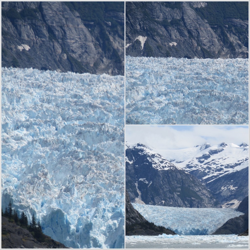
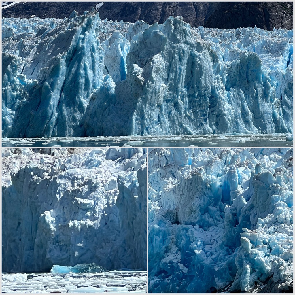
After a few miles of this we rounded the final turn and the glacier was in view. The bay was now mostly full of ice and Dan had to sometimes push through areas of smaller blocks and other times he chose a larger berg (without a seal family) to use as a plow. Grace had taken so many photos of the seal pups that her good zoom camera battery was dead. We were momentarily bummed that we wouldn’t have the good zoom for the glacier but since we kept getting closer and closer to the glacier with each pass through the ice it turned out to be a non-issue. We couldn’t believe how close we ended up getting to the actively calving face of the glacier. It was as close as we could safely be.
We saw some small calving events and a couple of shooters (icebergs that release under water and come shooting up like torpedoes) before nosing up into a waterfall that was just off one edge of the glacier face. After spending at least an hour at the face, he turned the boat around to head back. As Dan had predicted, the ice had shifted and closed in behind us and it was an even more slow and zigzagged path back out.
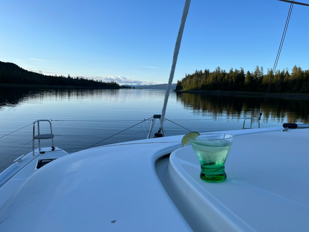
We collected a few “bergie bits” to chill the evening cocktails.(Melinda)
We’d finally reached our goal of Ketchikan, and found ourselves there almost a week ahead of schedule. After touring the town, we were left with the choice of what to do next. It seemed premature to head south again so soon, and then be early for our jump across to Haida Gwaii. We knew we wanted to see Misty Fjords, but figured that would just take a few days at most.
We’d also started to feel the itch to see a tidal glacier – one that is terminating in the sea. The southernmost tidal glacier in the world is at LeConte, which was just a few days north of Ketchikan for our mode of travel.
Another significant factor weighing on our decision making was our exhaustion. We’d been pushing hard almost every day since Vancouver, other than a day’s rest in Port Hardy. We were all ready for a break, and the thought of a very leisurely pace back down to Haida Gwaii was attractive.
We’d actually decided to head south again through Misty Fjords, but after a day’s rest in Ketchikan we were all rejuvenated. By Saturday evening we had flopped our decision back to going north to see what we could see with our extra time.
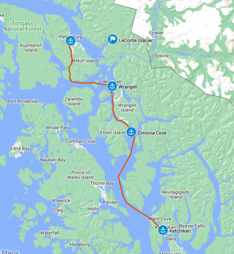
Sunday morning we started forging our way north. We headed up Tongass Narrows and entered Clarence Strait. As we passed Guard Island, the cruise ship Regatta was just approaching from the west, getting ready to turn down into Tongass Narrows for Ketchikan. They hailed us to make sure we wouldn’t try to cross in front of them – not a problem given their speed was about 3x ours!
It was a long day motoring into the wind, which later died almost completely. As we rounded Lemesurier Point on Cleveland Peninsula, we noticed a number of fishing boats out near McHenry Ledge. Melinda had just purchased a fishing license for Alaska, so we stopped for a while and put down our lure. We drifted and reset our position a few times, had a few possible nibbles, but never a solid bite. We moved on up Ernest Sound towards our intended stop at the southern end of Zimovia Strait.
Perception’s route north beyond Ketchikan
Further up in Ernest Sound off Menefee Point we were joined by a group of Dall’s porpoises. For the second time during the trip we had a group swimming alongside us for a spell. Even when we are getting tired from a long day, seeing wildlife like this really rejuvenates the whole crew. Our spirits were high as we passed the final few miles and entered Zimovia Cove for the evening.
Anchorage in Zimovia Cove
We dropped anchor in about 60′ of water near the head of the cove, leaving plenty of swinging room around us. We were all alone, and didn’t see a single other boat passing in the channel outside the cove until the next morning. We were starting to feel the loneliness of Alaska. We’d experienced a bit of this in the Broughtons, but here it was even more apparent how small we are in the vastness of the untamed.
In Zimovia cove we had our first significant luck – good and bad – at fishing. We dropped our lure down off the back of Perception at anchor, not really expecting to have any success, but as soon as the lure hit the bottom we had a big bite.
There was definitely something large and unhappy on the end of our line. We brought the line up in fits and starts, easing off when the monster at the end would fight. Eventually we surfaced a fairly large halibut. I attempted to gaff the fish, but missed, and shortly after the fish had thrown the hook and descended back into the murk.
The first halibut we hooked – felt like a monster!
This near-success launched us on a new mission to catch a halibut. We were to spend many hours from here on out fishing off the boat and from the dinghy, honing – or at least attempting to hone – our nascent fishing skills.
Fishing in Zimovia Cove
The next day our target was Wrangell, a relatively sizable town of about 2000 people that had once been a major gateway for the gold rush. We were looking forward to seeing their large collection of petroglyphs, and to see if we could perhaps book a tour of the LeConte glacier. We left our comfortable spot in Zimovia Cove after work ended for me, intending to catch the flood tide up Zimovia Strait.
We transited Zimovia Strait to get to Wrangell, enjoying the winding path through the well-marked channel. It is super-nice to have such a good set of channel markers in almost every place we navigate. Once of the benefits of sailing in US and Canadian waters. Things will likely be different as we head south this fall.
Once through the narrows we should have had an easy time of it getting to Wrangell. The flood current should have been carrying us northward at a high clip. Instead we found that we were pushing against a significant current the whole way, which didn’t match the NOAA predictions at all. I can only guess that water flowing from the Stikine River past Wrangell was impacting the current flow in Zimovia, working against us even in a flood tide.
Tight channel markers in Zimovia Strait
As a result we arrived in Wrangell more than an hour later than I had predicted, and I was definitely worn from the day of work and the time at the helm. It was a relief to get tied up to the dock – we stayed at the Reliance Float near to the heart of the town.
It took me three tries to land Perception, even in relatively light wind. The wind seemed to be shifting around a bit, first blowing us on, then off the dock, and we were trying to squeeze in between two fishing boats already tied there. Just as soon as I start feeling comfortable at the helm, something like this shows me I still have a ways to go.
On the Reliance Float in Wrangell
Safely docked for the night, Melinda and I did a bit of exploration to find the trash and the laundromat. We also happened to find the Marine Bar, and went in for a libation. It was a colorful though relatively quiet place, nice to sit on a stool for a bit with your feet up. The barkeep took good care of us, and we vowed to return the next day with Grace.
Drinks at the Marine Bar in Wrangell
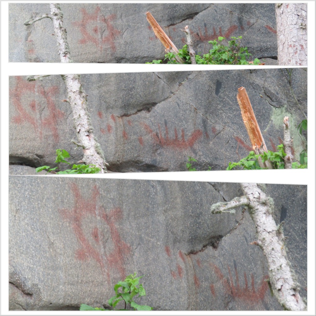
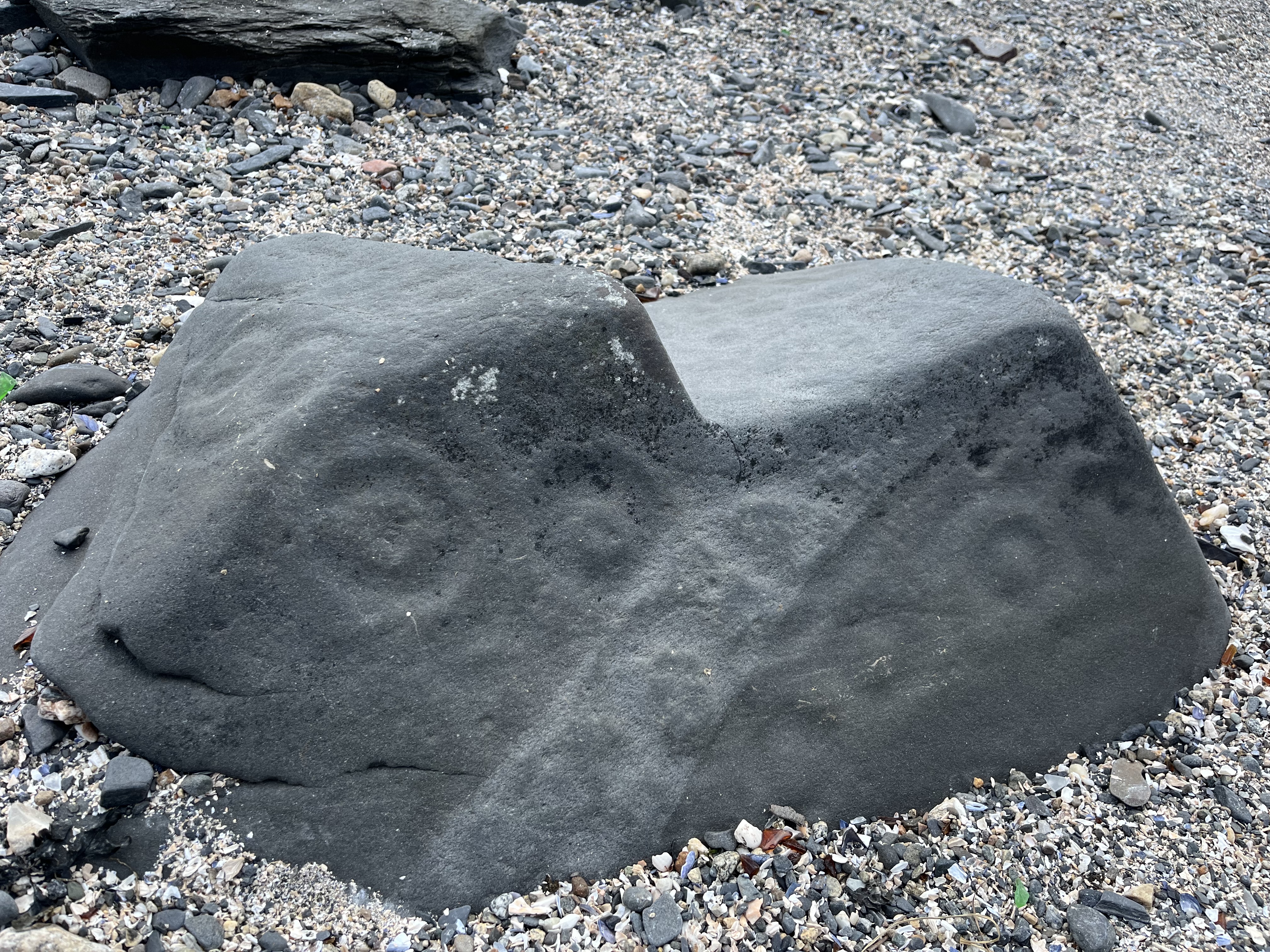
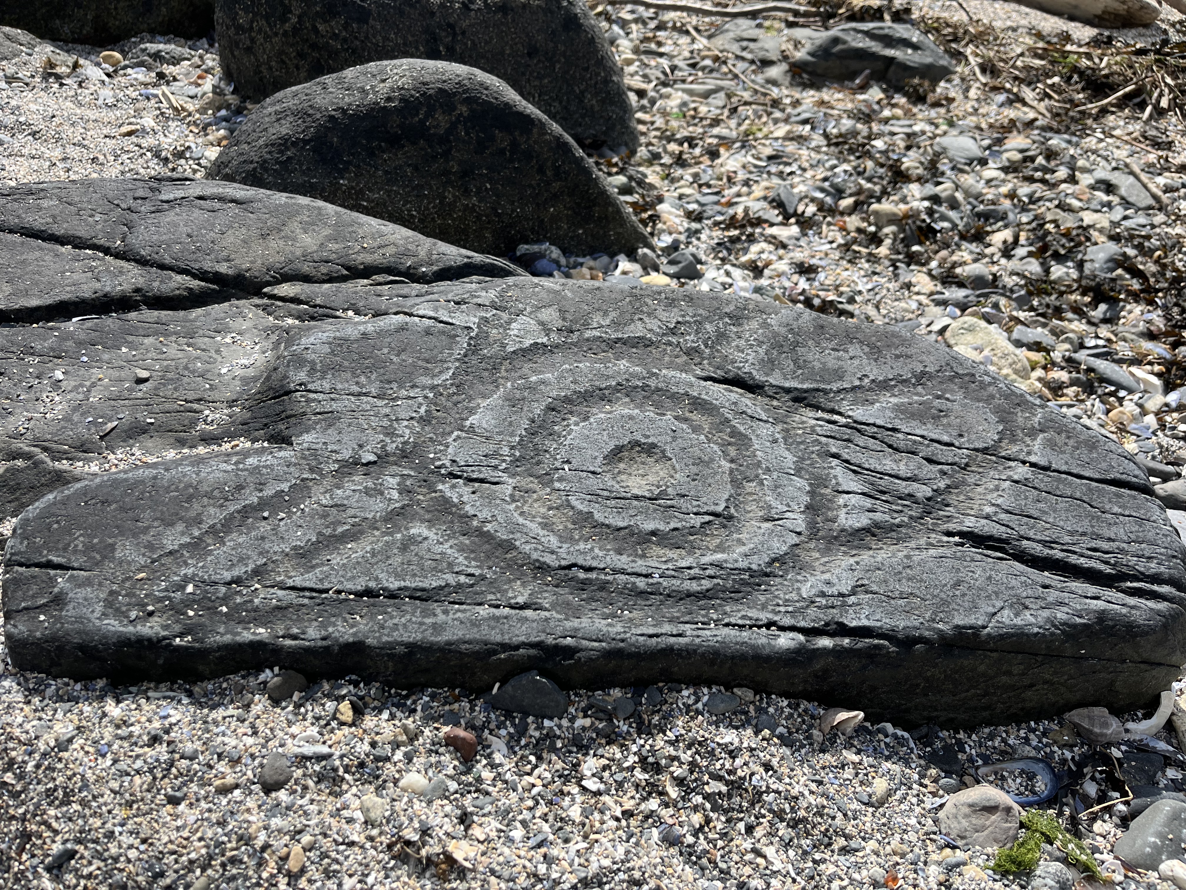
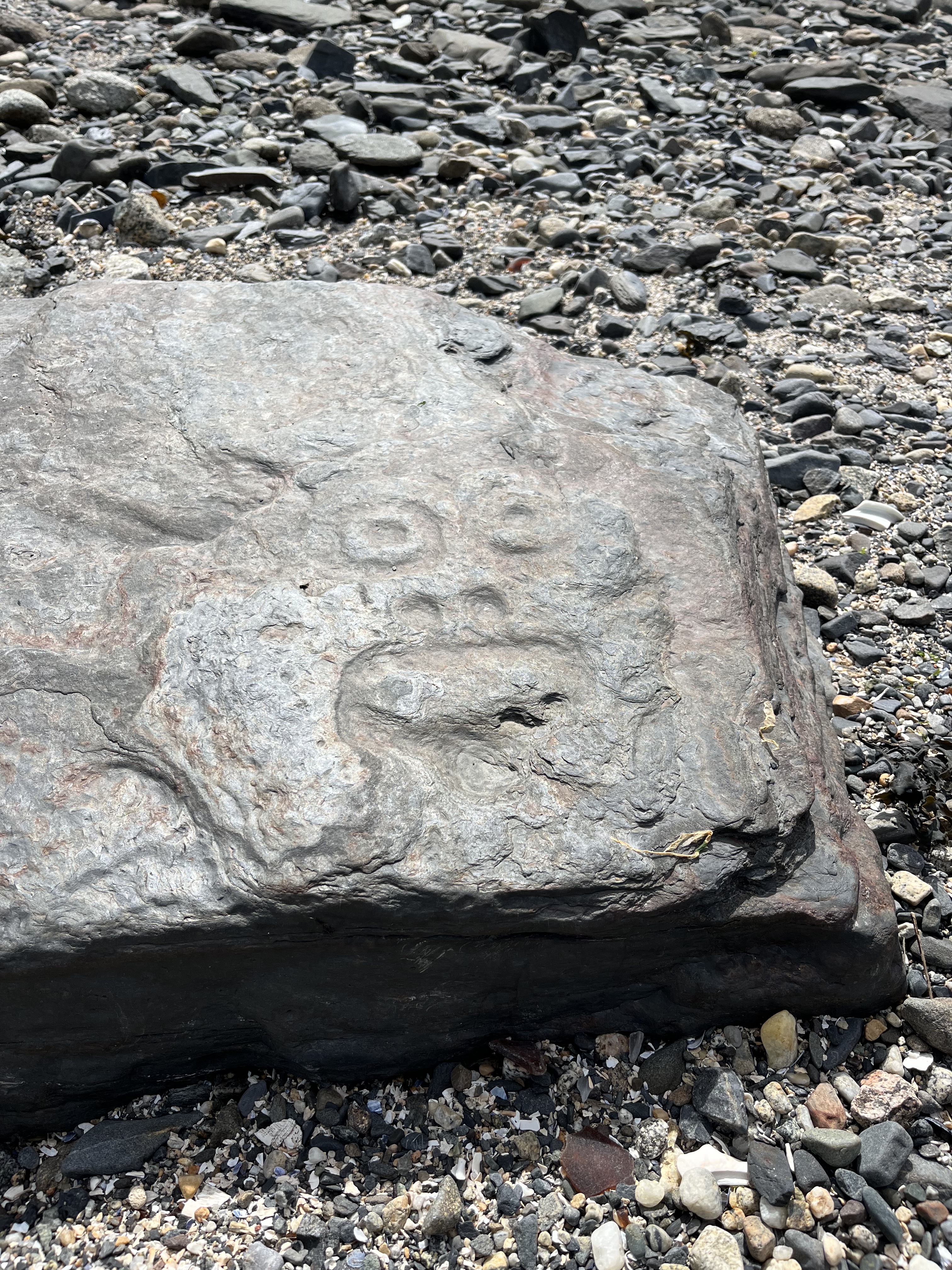
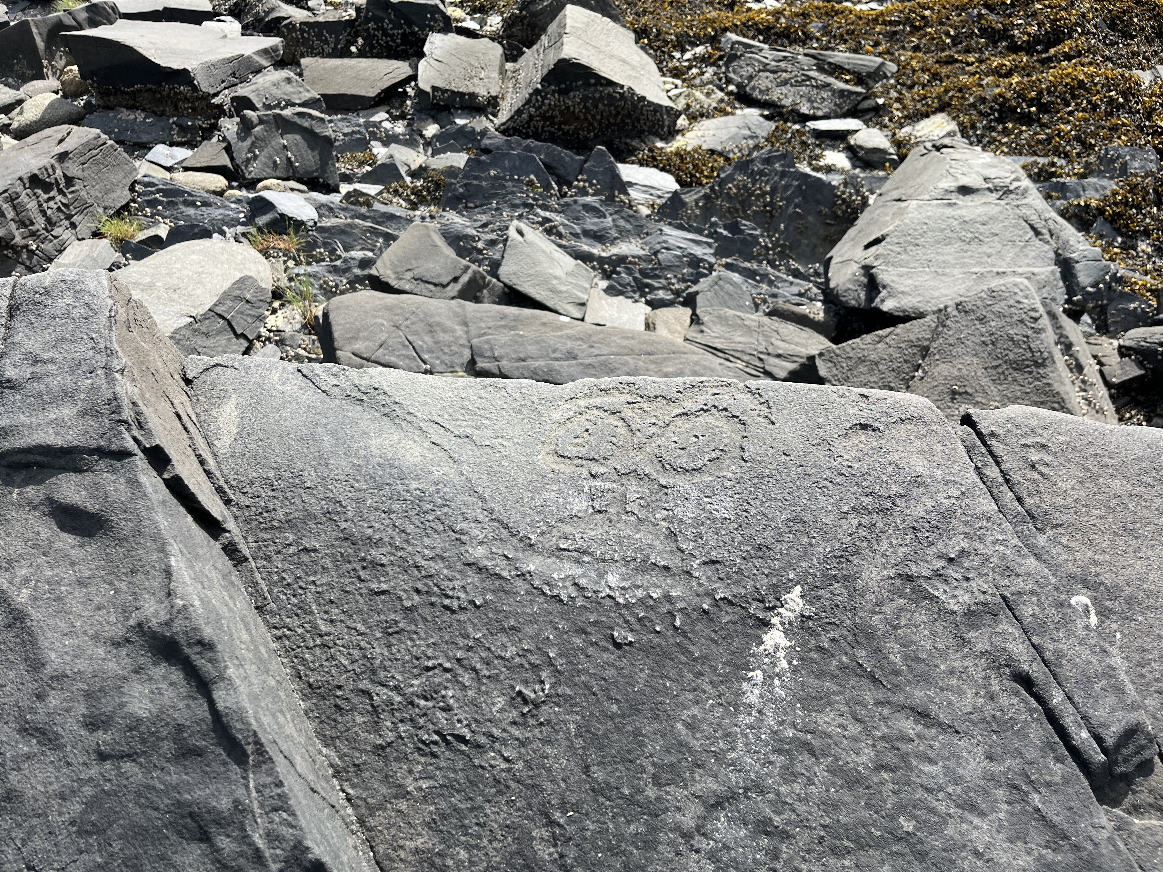
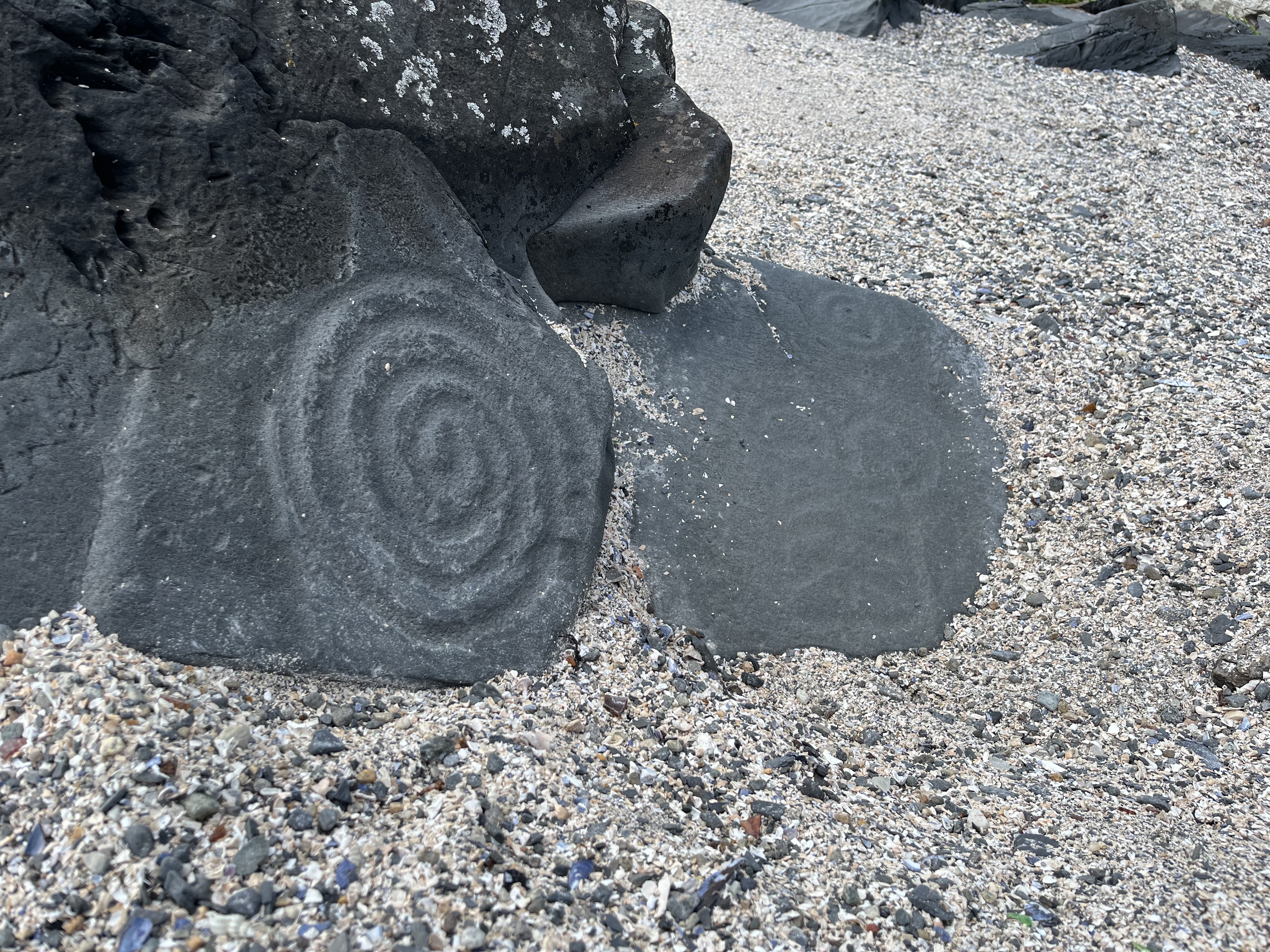
I had wanted to stay in Wrangell for a couple days as I’d been having some issues with Starlink dropping out during my working zoom meetings. I had some important meetings Tuesday, and didn’t want any motion – at anchor or underway – to disturb them. We took advantage of the time in Wrangell to see Petroglyph Beach – a few of the petroglyphs we saw there are shown below. It was amazing to be able to walk among them freely, and a bit surprising that they aren’t somehow better protected.
Wednesday was a light meeting day for me, so we were underway again, this time heading to Petersburg. We had to transit Wrangell Narrows to get there, about twenty miles of narrow channel that was regularly used by ferries, cruise ships, and tugs with tow.
The channel had an additional complexity in that the tide would ebb and flood towards a center point of the channel from both ends, so with good timing one could flood in to the center, then ebb out to the other end. We timed our transit such that we were able to take advantage of the current in this way.
Despite warnings in the guidebooks about Wrangell Narrows, we found it to be a typically passage when timed correctly. I can see how it would be challenging in places to squeeze by larger vessels, but we were fortunate not to meet any during our time through. At times it almost felt like you could just throw out your fenders and bumper-car your way down the large number of aids-to-navigation (ATONs). Our only significant hazard of any consequence was in avoiding the numerous fishermen in small vessels who were trolling in the channel.
Wrangell Narrows – ATONs everywhere!!
As we rounded the final bend in Wrangell Narrows, we could see the Petersburg marinas laid out before us. We were there just after the ebb started, so didn’t have much difficulty getting into our slip – though apparently at maximum current it can be difficult. We docked in the South Harbor among a majority of fishing boats and a handful of pleasure craft.
Tied up in the South Harbor at Petersburg
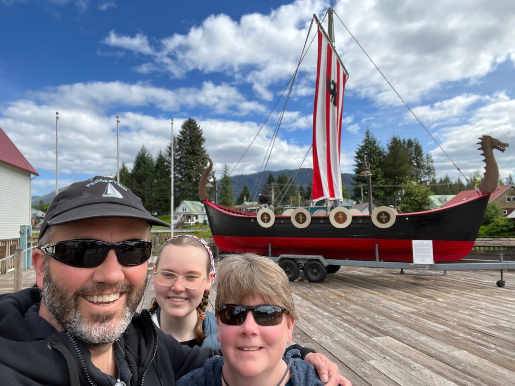
As it was a sunny afternoon, we were able to get out and see the town. We checked out some of the Norwegian heritage of the town, and took the obligatory picture at the replica longship.
Enjoying the sun in Petersburg, we visit the longship replica
Sunsets had really begun to linger as we approached the solstice. Our first evening in Petersburg glowed with a beauty that lasted into the late hours of the evening.
Sunset in Petersburg
Soon our good fortune with weather was at an end, and we saw a couple rainy days in Petersburg. I’d started changing our engine oil the evening of our arrival, but as with most of my first-time boat projects it took me much longer than anticipated. I had decided to use a drill-powered “self-priming” pump for the oil, but it wouldn’t prime, and I eventually had to pour some fresh oil into it to get it to start pulling from the oil pan. After that it wasn’t too bad, though I could only get about 4.5 of the ~ 5 quarts of oil that should have been in the engine. Presumably good enough as I can’t drain it like a car!
I was tuckered out after getting the starboard engine oil changed, and saved port for the next day. The rain put the kibosh on that, as I didn’t want to get water into the engine oil. I didn’t finish the job until Saturday morning when the rain finally subsided enough to go down in the engine compartments without drenching everything.
Hunting for fine dining in a rainy Petersburg
We had our most memorable day yet after this, going to the LeConte Glacier. I’m sure Melinda and Grace will write more about this spectacular experience with Dan and Sage at Seek Alaska.
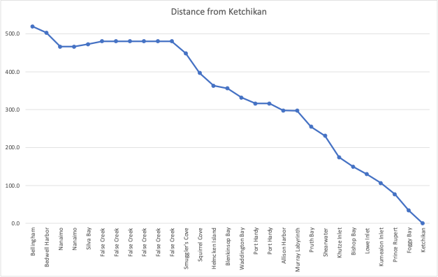
During the course of our trip to Ketchikan, I kept a log of the distance as the crow flies between each stop and Ketchikan. I then plotted this across the different stoping point each day.
We got off to a pretty rapid start, and had covered more than 10% of the distance to Ketchikan in the first two days. We then slid backwards as we went across the Strait of Georgia to Vancouver, and stayed there for almost a week.
After leaving Vancouver our progress was relatively rapid. It slowed down as we hit the Johnstone Strait, and wound our way up to the Broughtons and over to Port Hardy. Once around Cape Caution we were off to the races again, with some mile-eating days going through the inside passage.
Some other statistics:
Total days from Bellingham to Ketchikan: 28 days
Days underway from Bellingham to Ketchikan: 21 days
Average rate of closure on Ketchikan (all days): 18.5 nm/day
Average rate of closure on Ketchikan (underway): 24.7 nm/day
Average distance covered per day (underway): 36.6 nm
Total distance covered (approximate): 769.4
Gallons of diesel fuel consumed: 234.4
Fuel efficiency: 3.28 nm/gallon
Note that our progress to Ketchikan was almost completely under engine power, other than a few rare instances when we made way under sail or motor sailing. When motoring, early in the trip we would run with a single engine at times to conserve fuel, as we can get 70-80% of full speed with just a single engine. We also ran at lower engine speeds at times when we weren’t itching to get in to the next harbor.
All and all, we found that the wind was on our nose nearly all the time, especially early in the trip. I don’t have good excuses for not raising the sails more often other than trying to maximize the distance covered each day. We have been in too much of a hurry! Hopefully we can slow down a bit on the way south…