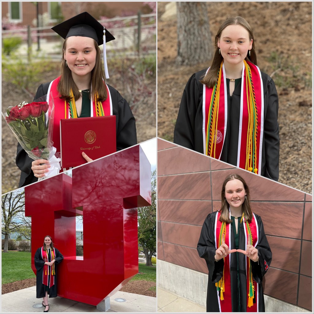
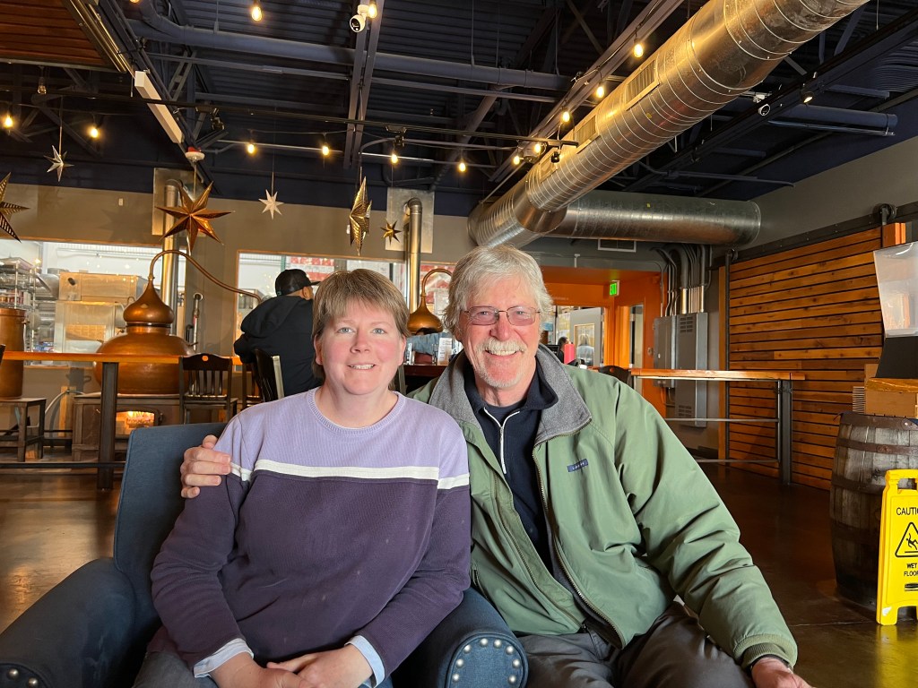
We welcomed Captain Marty O’Toole and his crew, Maureen, Mike, & Becky aboard. After a short briefing about her preferences, we left Perception in the care of this capable crew. Jim and I packed out and drove to Yakima, (the Palm Springs of Washington!) and continued on to Boise the following morning. After a couple of days in Boise celebrating my father’s birthday and a drink with the Steins to celebrate Frank’s retirement, we drove down to watch our third crewmember graduate from the University of Utah in Salt Lake City. Grace graduated Magna Cum Laude, earning her Honours Bachelor of Arts in Anthropology, as well as a BA in International Studies, a BA in Latin American Studies, and a minor in Spanish.
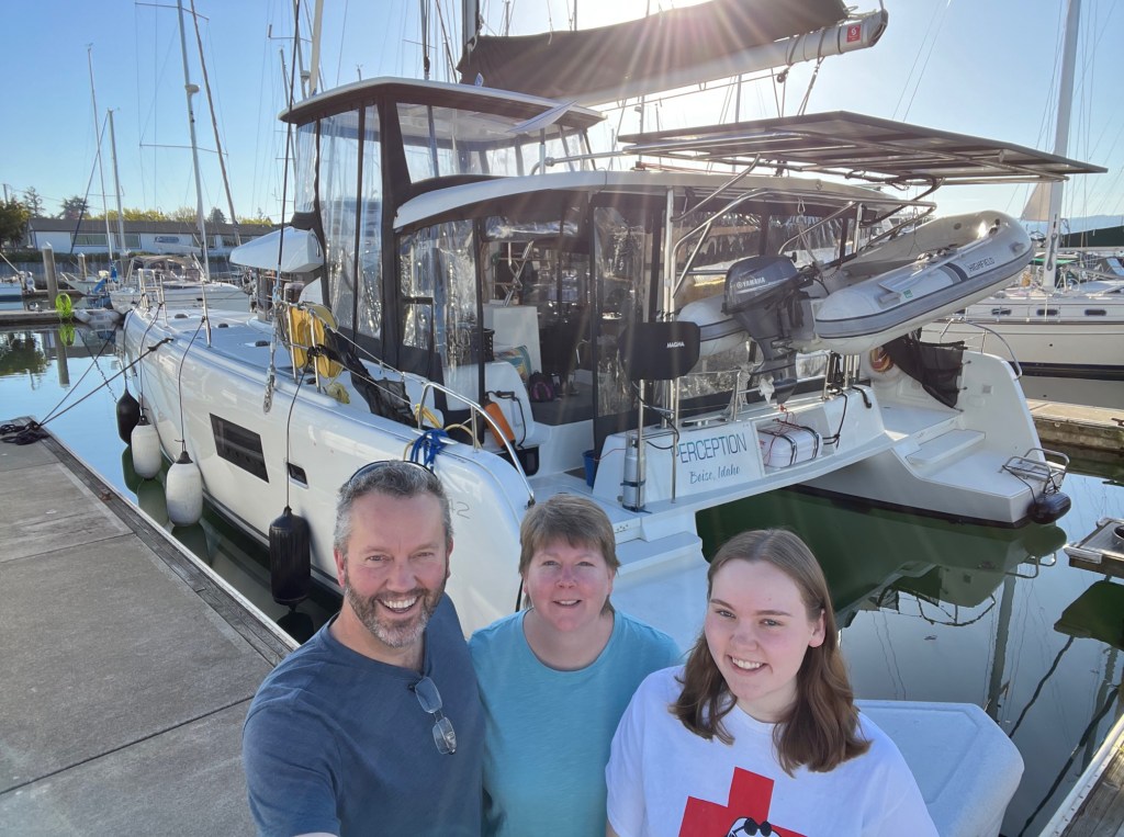
After a quick lunch to celebrate with her roommate, we all piled back in the cars and returned to Boise to celebrate with our Boise village. We saw lots of loved ones we hadn’t seen in a long time, and celebrated our departure and Grace’s graduation until the wee hours. Jim left to relieve the temporary crew just hours after the party was over; returning to make some final repairs on the boat while Melinda and Grace remained in Boise another 5 days to prepare the house for our extended absence. On Friday, May 12, we reunited back in Bellingham to begin the arduous task of provisioning. (Melinda)
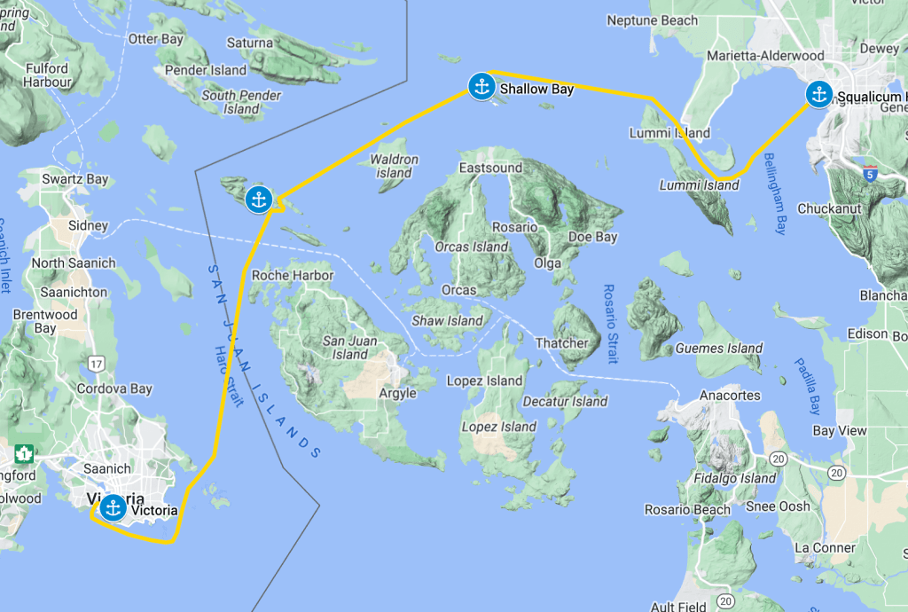
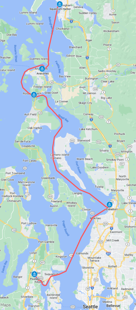
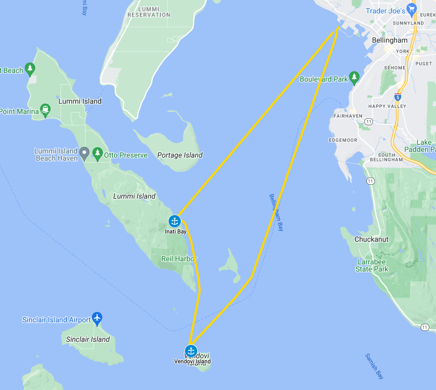
After our weekend in Victoria it was time to start heading back to Bellingham to set ourselves up for our trip back to Boise and Salt Lake City for Grace’s graduation.
Our route back to Bellingham
Skipper’s Perspective
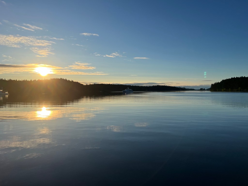
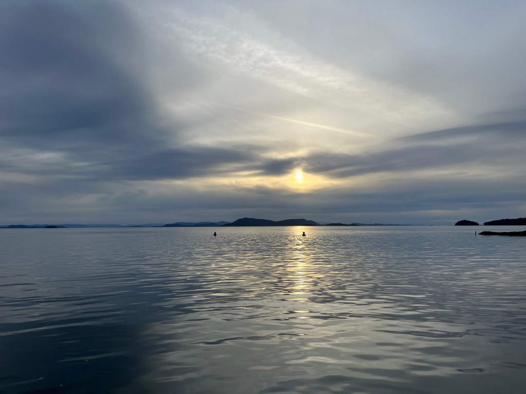
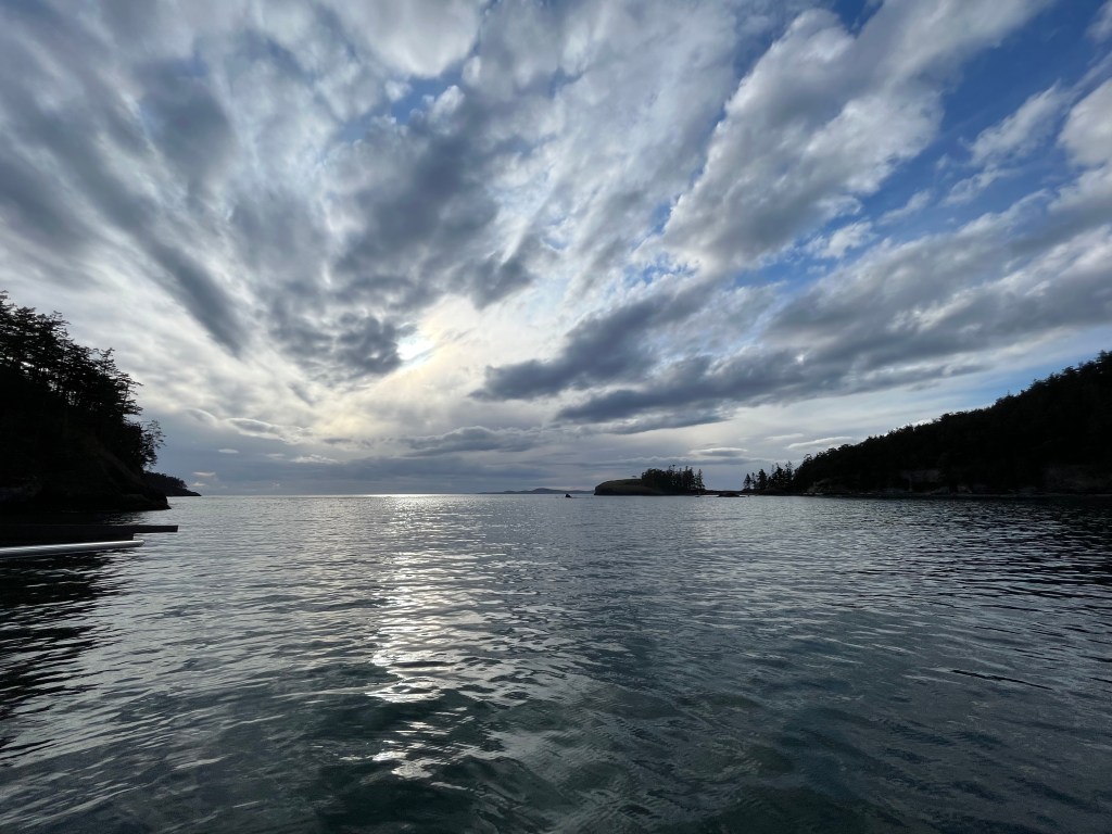
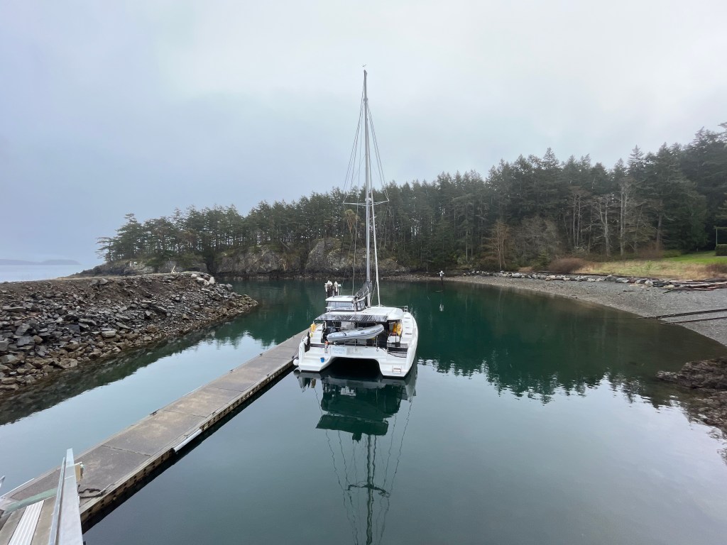
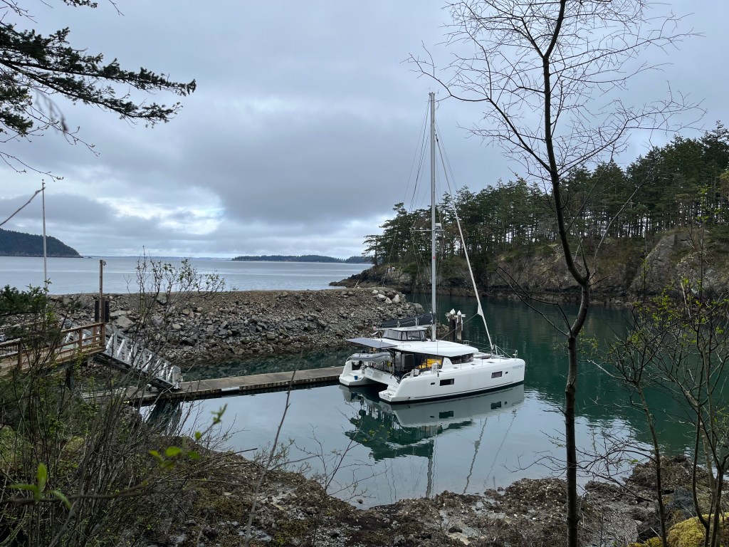
We left Sunday afternoon at 3pm, waiting for the flood tide to start up. Perception was rewarded with a speed boost from the current, reaching 11 knots at one point while passing between Ten Mile Point and the Chatham Islands. We pulled into a mostly empty Reid Harbor on Stuart Island after just a few hours of motoring.
Reid Harbor can be mostly empty in the off-season
Our experience with the US Customs and Border Patrol was a bit different this time. We have been happily using the CBP Roam application for a few years now, which has allowed us to clear in from the boat as soon as we cross the border from Canada. We’ve had responses from CBP that are as simple as an “accepted” message with a confirmation email, up to a one-way video call with an agent. This time I cleared in from the helm as we crossed the Haro Strait without informing Melinda, and received a confirmation by email. A minute later Melinda popped out of the saloon on the phone with a CBP agent. When I submitted our arrival the form had listed her as the “master of the vessel”, so they called her number with the typical questions about where we’d been and what we were bringing into the country. They also noted that my submission had last year’s CBP tag number (the new one was waiting for us in Boise), so gave us the new one. Every time is a bit different, but it sure has been nice not needing to clear in at a physical location!
Reid Harbor at sunrise
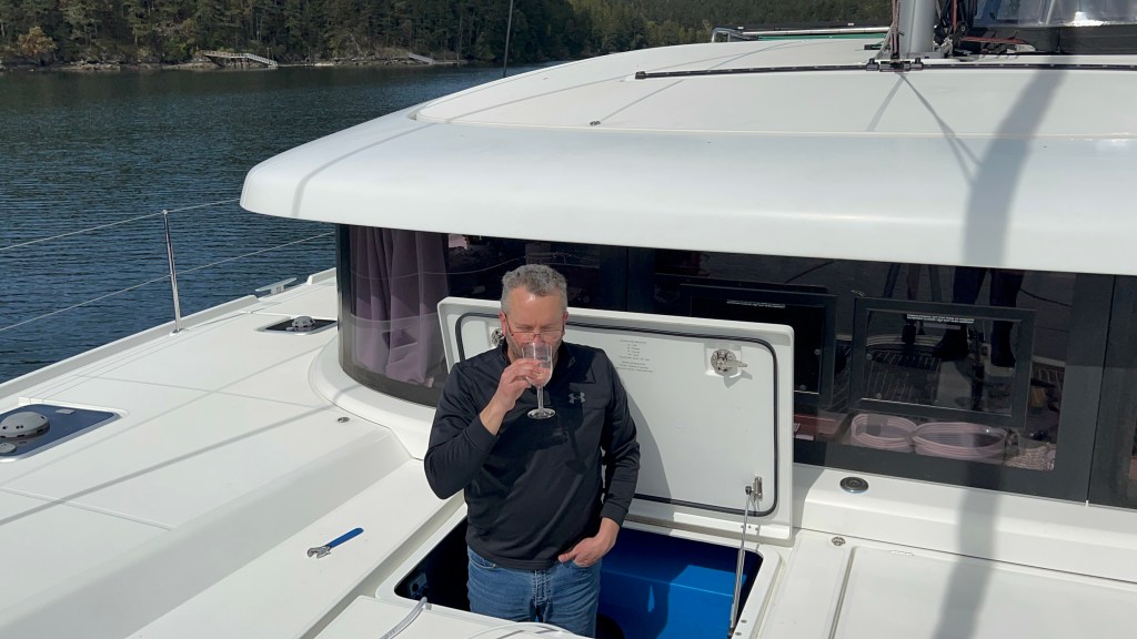
We hung out in Reid Harbor for two days with me in my work meetings and Melinda furiously organizing our spares, tools, and other boat items that we’d brought aboard this spring. We also turned on our water maker for the first time, even Melinda found the pure water to be tasteless in a good way.
My first taste from the water maker which is installed in this deck locker
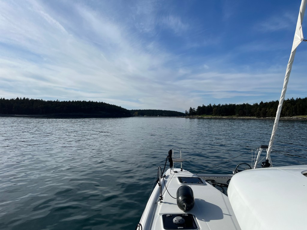
Tuesday we left Reid Harbor to get a bit closer to Bellingham for our anticipated stay there on Wednesday evening. We motored out of the harbor and turned north through John’s Pass. We’d never been through before and I’d been a bit trepidatious about it after hearing someone aground there over VHF a few years ago. We found it to be fairly wide and deep, no concerns as long as you are paying attention.
Southern entrance to John’s PassExiting John’s Pass
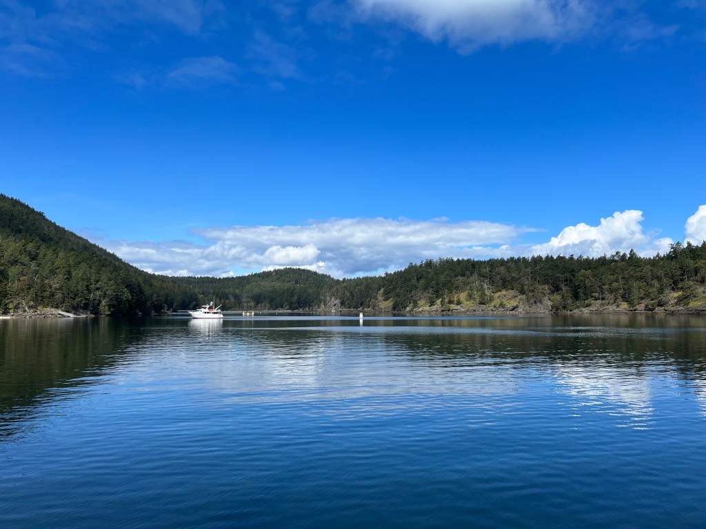
We entered Shallow Bay on Sucia Island in the late afternoon as clouds were rolling in. There were four other boats in the little bay, which surprised me given we hadn’t seen this many in the San Juans so far this year. We anchored not far inside the channel markers for the bay to leave room from the other boats anchored further in.
View west from Shallow Bay, channel markers in the foreground bracketing the narrow channel into the bay
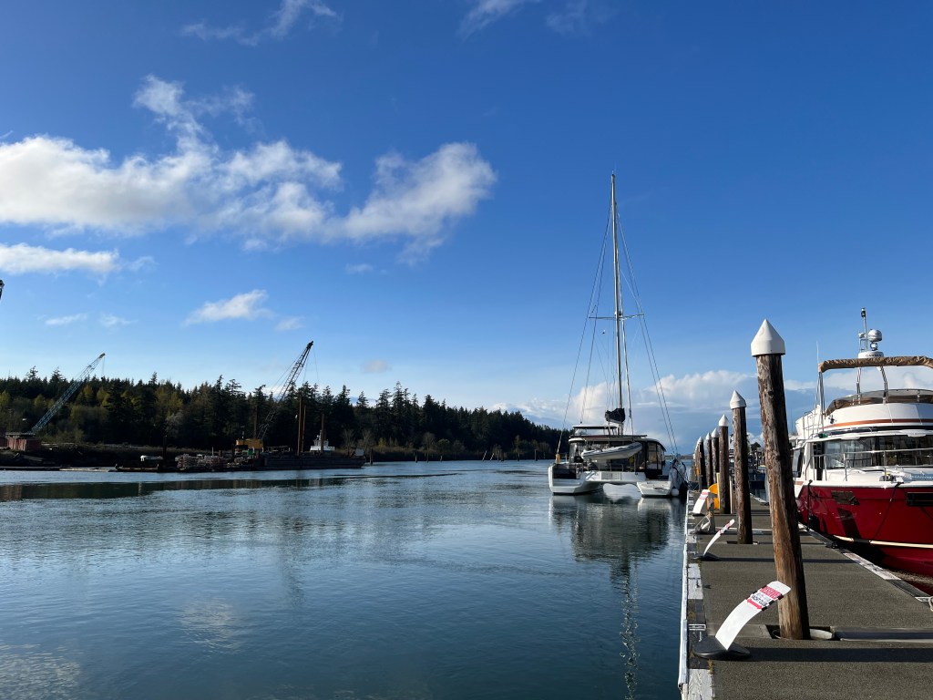
Wednesday morning Melinda motored us back into Squalicum Harbor in Bellingham and we tied up to the guest dock in front of Nikki’s Bella Marina restaurant. Not the best spot for my ongoing feud with our avian friends the gulls, as they would swoop in to the restaurant balcony above us and raid the plates left behind by departing diners. We (again) saw a gull take off with a full cup of ranch dressing clamped in its beak – but it wasn’t ranch dressing the gulls left behind on the deck – ugh!
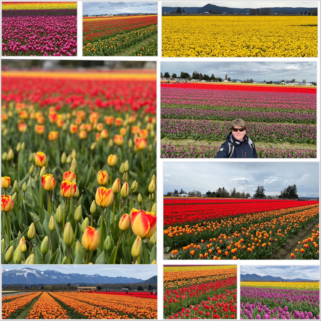
The marina in La Conner is about 7 miles away from the tulip fields in the Skagit Valley. The blooms were a couple of weeks late this season and that afforded me a perfect opportunity to view them while we waiting for the wind to die down a bit. I assembled Jim’s folding full-size commuter bike and struck out to bicycle over to RoozenGaarde. Usually everything is uphill from a marina, but that was not much of an issue for this marina. However, the wind that was keeping us from heading out again in the Swinomish Channel was also blowing on the land. I had a headwind the whole ride, and actually ended up just walking the final mile. But, the struggle was worth it as the tulips were at their peak, and the daffodils were still showing nicely as well. I was looking forward to the bike ride back, although the feeling didn’t last very long. As I started heading back towards La Conner, I quickly noticed that the wind-at-my-back boost I was hoping for had turned and was right on my nose again. As I limped back into town, I was passed by a public bus that read “Mount Vernon” as its destination. I later learned that there is a bus line that runs between La Conner and Mount Vernon that stops at an intersection nearby RoozenGaarde. If you find yourself in La Conner during bloom time with no wheels, take the bus!
La Conner Marina has a unique feature that I wish more marinas had – they have a moorage payment kiosk that is simple and easy to use. No trying to find the harbormaster office and then wait while someone uses Windows 95 to enter all the details about your boat. That is if you are lucky enough to arrive while they are open. There’s also a decent grocery store within walking distance to the docks, and lots of welcoming shops and restaurants. (Melinda)
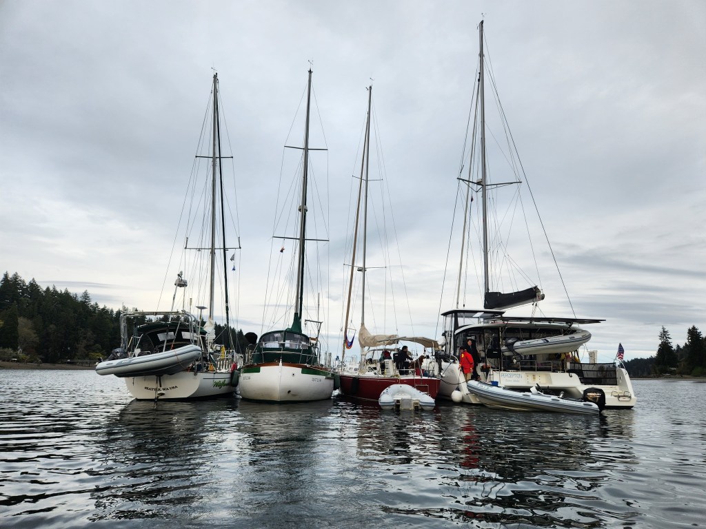
After two wonderful days in Poulsbo it was time to head to the Coho Ho Ho raft-up. The weather was still cold and rainy, so we motored down around the south end of Blakely Island. Upon entering Blakely Harbor we found that only one boat had arrived at the raft-up so far, but one other Coho boat was entering the bay just ahead of us. We idled while the first two boats tied together, then dropped our anchor and joined the raft. A fourth boat arrived a while later to complete the raft for the night.
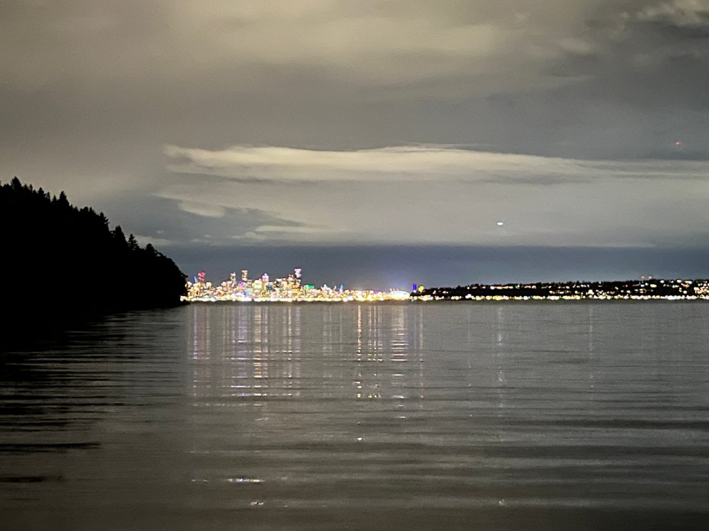
Seattle skyline from Blakely Harbor
After spending the night at the Coho Ho Ho raft-up tied to three other boats, we began our return to the San Juan Islands and familiar territory. We had never rafted before, and untangling the mess in the morning took some time. We were rotated 180 degrees from our position the night before, both Perception and one other boat had anchors down, and it was unclear which direction we had rotated. We attempted to rotate the raft back into position by pulling clockwise with Perception, but found resistance, so went back the other direction and were able to get free. Luckily we didn’t rotate more than a full circle or it would have been a complete mess to disentangle.
Coho Ho Ho raft-up in Blakely Harbor
After leaving the raft we motored up Puget Sound, into Possession Sound, up the south side of Whidbey Island, and back into Skagit bay. While we travelled a significant wind came up from the south, and we saw gusts of over 33 knots while underway. Luckily it was nearly dead behind us so we experienced the wind waves as a relatively gentle, rolling, following sea.
Our route from Poulsbo to Blakely Harbor, then up the sound to La Conner
We had decided to head to La Conner on the way back north as the tide level was reasonable for both air and water clearance in the Swinomish Channel. In hindsight turning across the wind and current to head up the channel was not a very safe action to take. I realized as we progressed up the channel that we would have almost no time to react if we encountered engine trouble, and the strong current and wind on our starboard beam would quickly push us aground outside the dredged channel. Luckily we encountered no such trouble, but I will try to carry the lesson forward.
We arrived at La Conner and landed at the sparsely populated guest dock, choosing to land against the outside as the pilot was a bit tired after the long trip. In hindsight we really should have taken the time to go inside the guest dock to stay out of the worst of the current. Where we were located we were exposed to a good deal of the current in the channel, at times feeling like we were tied in a rushing river.
We motored through Deception Pass just after daybreak and made for Everett. We often stopped in Everett on our drive to or from Bellingham, back when we were chartering boats in the summer to see our dear friends, Peg and Dave Ludwig. Peg and her kids, Kristi Meyers Lovern and Jeff Meyers lived across the street from us when I was a child and our families stayed close for the 45 years since. This was our first stop with our boat, and our first stop since Peg was lost to Alzheimer’s in January. Coming into the marina, I could picture where she would have stood to greet us, at the end of the pier with her giant smile and exuberant wave. We met up with Dave for dinner and drinks at a distillery in the marina. It was good to see him and raise a glass to our dear friend.
Peg (1947-2023) & Dave Ludwig
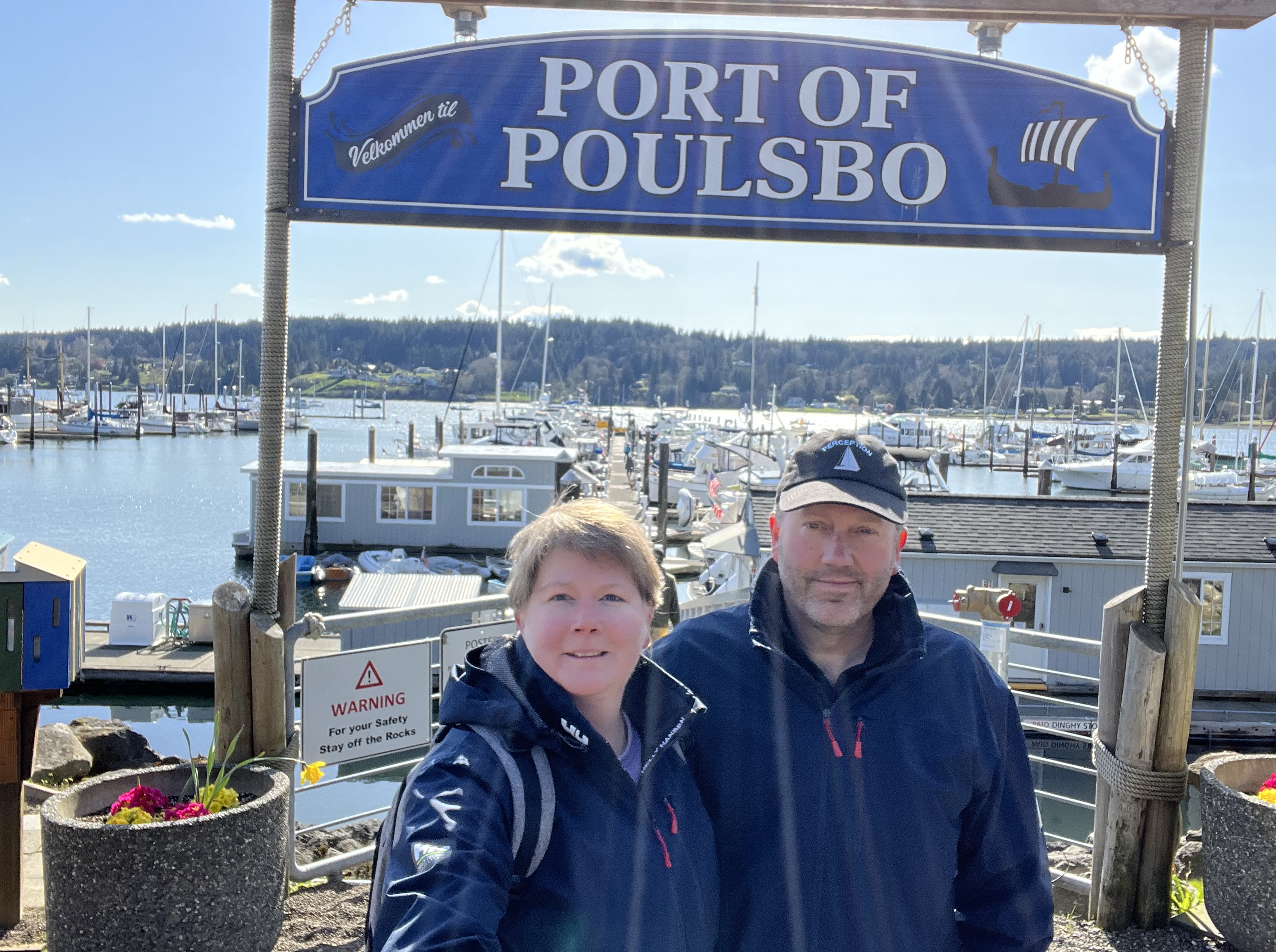
poulsbo
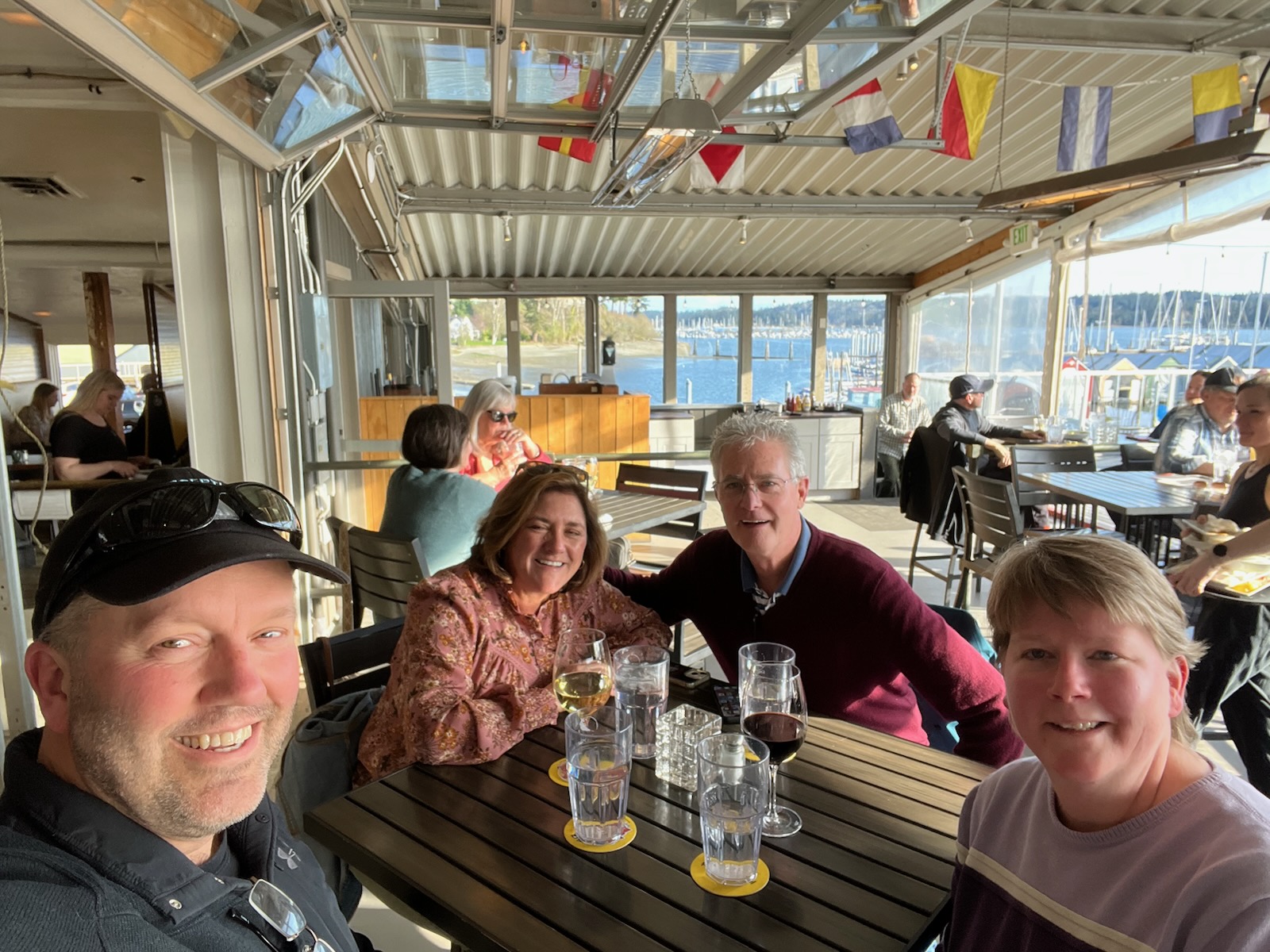
We were attracted to Liberty Bay in Poulsbo because of a sailing blog we follow called Ran Sailing. It’s creators are a couple from Sweden who sailed extensively and stopped by Poulsbo. It’s a cool town nicknamed “Little Norway” with many waterfront restaurants to choose from. We met up with Teresa and Randy Mitchell for dinner and drinks. Teresa is Marty O’Toole’s sister and Marty encouraged us to look them up while we were in Poulsbo. We had a lovely evening at a waterfront restaurant with great food, views and wonderful company. (Melinda)
Skipper’s Perspective
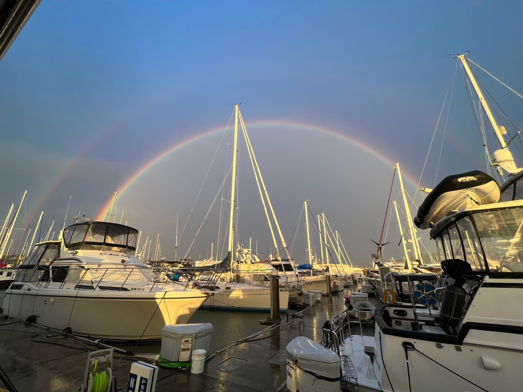
After several tries we finally left Bellingham for an extended duration, with the intent to get to Blakely Harbor for the Coho Ho Ho raft-up on the following Saturday, April 15th. We left the dock late Monday afternoon with Melinda at the helm, motoring south in Bellingham bay. We had attempted this journey the previous Friday, intending to meet up with Sarah and Max in Anacortes but were stymied by the 25+ knot winds and resulting waves on our nose. This time we were successful, spending a quiet evening in Cap Sante marina with a brief shore excursion to the Sebo’s hardware store and dinner at Coconut Kenny’s.
After the weekend storms, a rainbow is a welcome sign of better weather, at least for a while…
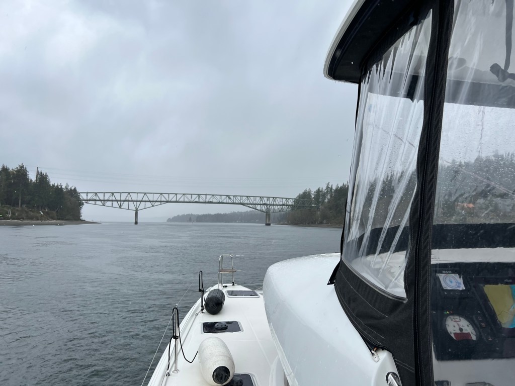
The direction for the next step of the journey was a struggle to decide. Our intent was to try the “inside passage” behind Whidbey Island as a safe weather and wave state alternative to our last trip across the Strait of Juan de Fuca. To get there we needed to either go through the Swinomish channel or Deception Pass, neither of which we’d previously done. The Swinomish looked attractive but had both an uncertain depth and overhead bridges. Deception pass had to be transited at slack tide due to the high currents.
To be clear, we carry one of the most dangerous items onboard Perception as we cruise: a schedule. My work schedule tends to dictate when we can travel, at least to get on and off docks and anchor. I’ve found that I am able to work effectively while Melinda drives the boat, but I need to have open time at the start and end of each leg. This constrains our ability to freely travel whenever the weather and tide conditions are best.
The Internet supplied ample warnings about shoaling areas in the channel, and the last dredging was five years prior. I wasn’t too concerned about this with our shallow draft, but our available window on Tuesday to get through the channel coincided with a negative tide. It was clear that no-one recommended going through the Swinomish Channel at negative tide even with a shoal-draft boat.
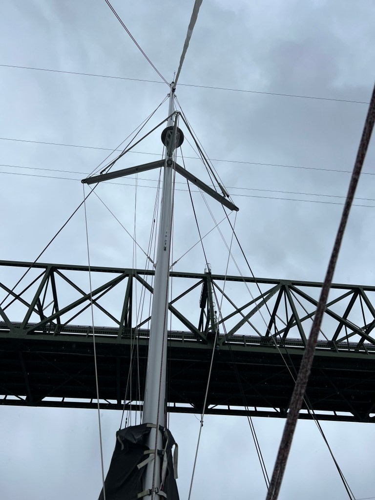
Compounding my worry was my inexperience passing under bridges with clearances above the water in the range of our mast height. The Swinomish has three such bridges: a pair of bridges for State Highway 20 in the north section, and Rainbow Bridge in the south section. All three bridges are listed with a clearance of 75′ on the charts. Furthermore there is an indication of an overhead telephone cable near the north set of bridges that have a clearance of 72′. Perception is spec’d at 68′ air draft, and I suspect we are a couple feet higher (~70′) with our VHF antenna (haven’t yet had opportunity to directly measure!) With some hunting on the charts it became clear that the bridge clearances are specified at Mean High Water (MHW). Further searching on the NOAA Tides and Currents site to find MHW for La Conner in the middle of the channel. In theory we would have at worst 2′ of clearance at MHW, and more clearance if we went through at lower tide.
Our route south from Bellingham to Poulsbo stopping at Anacortes, Bowman Bay, and Everett along the way
In the end we gave up on the idea of going south through the Swinomish due to the negative tide during our window of opportunity. That left us the option of going through Deception Pass, which also constrained us to go through at slack water. We had a reasonable window with slack tide on Wednesday morning before my meetings started, so Tuesday evening after my meetings ended we motored around the west side of Fidalgo Island and anchored for the night in Bowman Bay to set ourselves up for the pass the next morning. Luckily the weather was light – even with little wind the swell coming into the bay made for a bouncy evening. I wouldn’t want to stay there with significant swell coming in from Juan de Fuca.
View from our anchorage in Bowman Bay out towards the Strait of Juan de Fuca
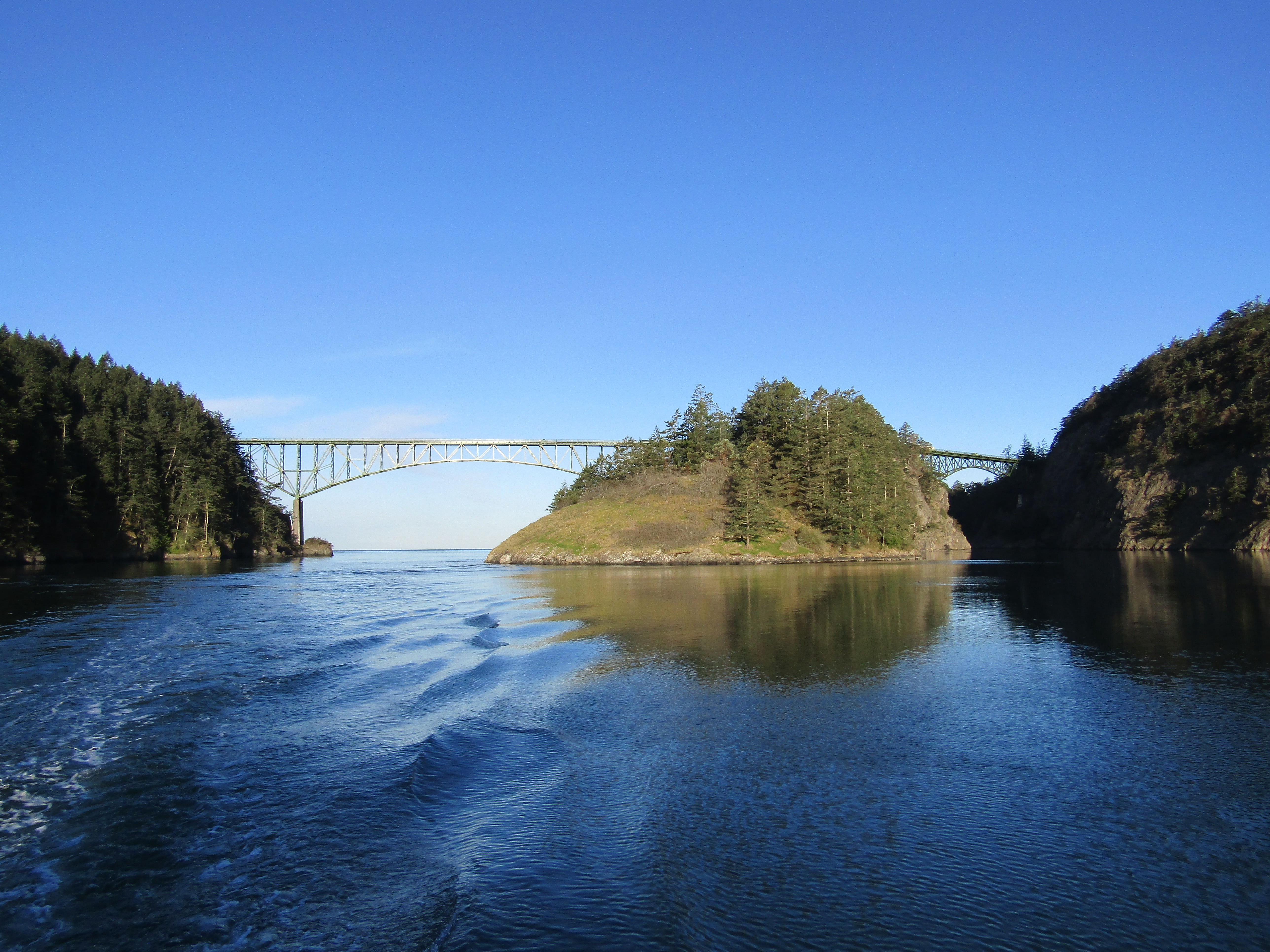
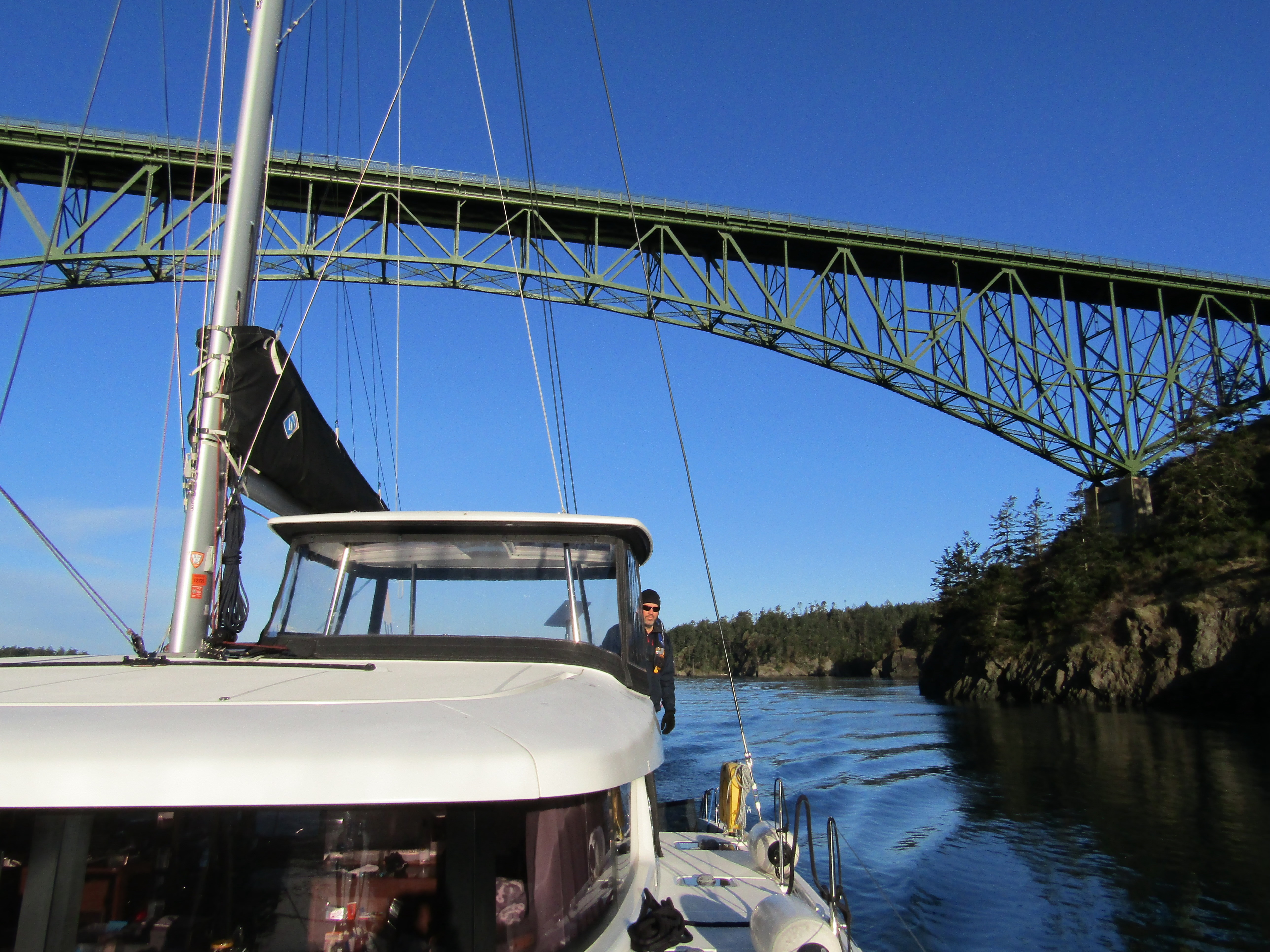
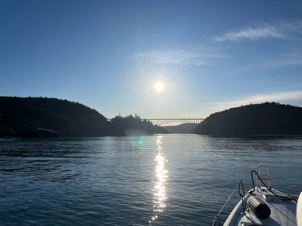
Wednesday morning bright and early we motored through Deception Pass at slack tide. The views of the bridge in the morning light were stunning, and we were soon greeted by the protected waters of Skagit Bay on the other side.
Heading into the sun and under the bridge across Deception Pass
Melinda motored us south the roughly 38 nm to Everett during the day while I worked through a number of zoom meetings. It was our first significant test of Starlink’s ability to function well while underway, and it performed amazingly. The technology does not seem to be bothered much by either the forward motion of the boat or the bouncing across waves and wakes.
The entrance to Everett Marina is inside the mouth of the Snohomish River, and however short this became our first-ever river entrance. We had to crab the boat sideways into the marina out of the ~2 knot current, but were met with relatively still water once past the outer docks. We stayed at Guest Dock 5, a long linear dock up against the shore. Only two other boats were at the dock when we arrived, but left shortly thereafter leaving us with the place to ourselves.
Perception alone at the guest dock in Everett
Even though we evaded the vertical clearance issues of the Swinomish channel, the next leg of our trip would test that in any case. Thursday at noon we left the Everett Marina, and Melinda motored us south towards Port Madison and Agate Pass.
Highway 305 spans Agate Pass on a bridge with a 75′ clearance – seems to be a popular clearance height for highway bridges in the area. We were approaching a couple hours before slack tide at the end of the ebb and had a current against us. I liked this scenario as it would let us approach the bridge slowly, gave us additional clearance margin under mean high water, and if we hit the current would push us off rather than forcing us under.
Approaching Agate PassWhew, we made it under!
Needless to say we cleared under the bridge successfully, though from below it looks very close. I do wish we had a picture of the transit from afar to gauge how much clearance we actually had!
Shortly after getting through Agate Pass we arrived in Liberty Bay and dropped our hook a ways from the Port of Poulsbo Marina. It was raining and cold, so we didn’t spend time looking for a closer spot among the boats already anchored in the bay.
We kicked off the month with a visit from our daughter, Sarah, and her boyfriend, Max. The weather did not cooperate for our broader plans, but a 12-hour window between gales allowed us safely out for a day trip. It was new territory for all of us visiting Vendovi Island Preserve for the first time. On the way back, we stopped by Inati Bay on Lummi Island and they took the dinghy out to get a closer look at the waterfall. (Melinda)
Skipper’s Perspective
Until I came across an article on the San Juan Preservation Trust this spring I hadn’t realized that Vendovi island is accessible to the public. We’ve sailed past it nearly every time we’ve been in the San Juan Islands over the years. It quickly became a must-visit on my list just to see a new spot inside our well-trodden cruising grounds. Since we had just a day of comfortable sailing weather ahead of us the weekend of April 7th, we decided to go for it.
The anchorage on the northwest corner of Vendovi is well-formed, but feels small as you enter. We were visiting at low tide, not ideal for a first view of a rocky harbor. I first went for the north side of the dock, trying to fit in-between the dock and the breakwater, feeling that the water would be deeper there. I quickly abandoned that plan for the south side as I was nervous about getting blown into the breakwater without having room to rotate. The south side looked shallow, but even at low tide we had about 10 feet of water.
Perception at Vendovi Island on the south side of the dockPerspective of the dock and ramp to shore